Lake Poinsett Nw Topo Map Florida
To zoom in, hover over the map of Lake Poinsett Nw
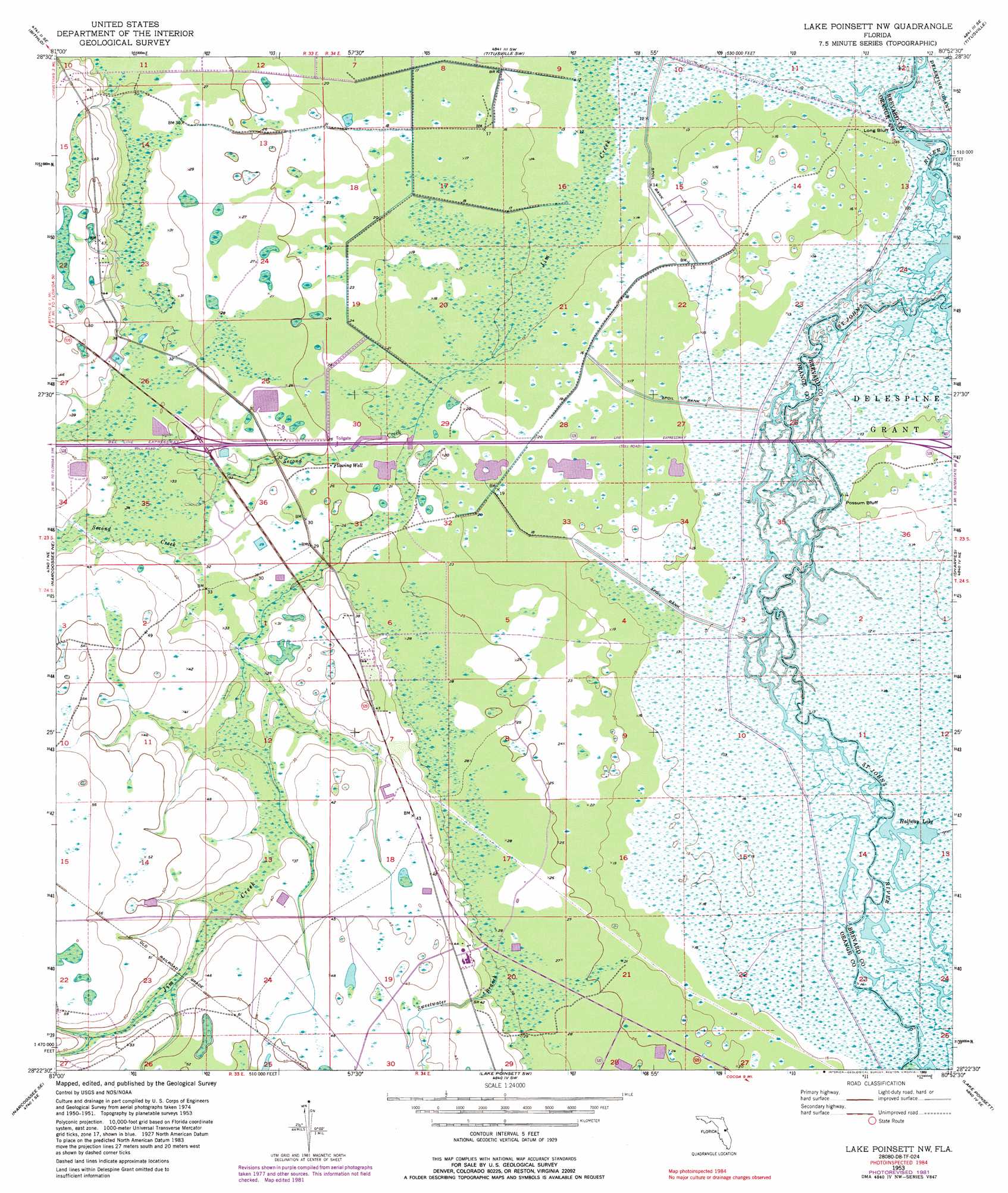
USGS Topo Quad 28080d8 - 1:24,000 scale
| Topo Map Name: | Lake Poinsett Nw |
| USGS Topo Quad ID: | 28080d8 |
| Print Size: | ca. 21 1/4" wide x 27" high |
| Southeast Coordinates: | 28.375° N latitude / 80.875° W longitude |
| Map Center Coordinates: | 28.4375° N latitude / 80.9375° W longitude |
| U.S. State: | FL |
| Filename: | O28080D8.jpg |
| Download Map JPG Image: | Lake Poinsett Nw topo map 1:24,000 scale |
| Map Type: | Topographic |
| Topo Series: | 7.5´ |
| Map Scale: | 1:24,000 |
| Source of Map Images: | United States Geological Survey (USGS) |
| Alternate Map Versions: |
Lake Poinsett NW FL 1953, updated 1955 Download PDF Buy paper map Lake Poinsett NW FL 1953, updated 1964 Download PDF Buy paper map Lake Poinsett NW FL 1953, updated 1972 Download PDF Buy paper map Lake Poinsett NW FL 1953, updated 1979 Download PDF Buy paper map Lake Poinsett NW FL 1953, updated 1981 Download PDF Buy paper map Lake Poinsett NW FL 1953, updated 1989 Download PDF Buy paper map Lake Poinsett NW FL 2012 Download PDF Buy paper map Lake Poinsett NW FL 2015 Download PDF Buy paper map |
1:24,000 Topo Quads surrounding Lake Poinsett Nw
Oviedo |
Geneva |
Aurantia |
Mims |
Wilson |
Oviedo Sw |
Bithlo |
Titusville Sw |
Titusville |
Orsino |
Narcoossee Nw |
Narcoossee Ne |
Lake Poinsett Nw |
Sharpes |
Courtenay |
Narcoossee |
Narcoossee Se |
Lake Poinsett Sw |
Lake Poinsett |
Cocoa |
Ashton |
Holopaw |
Deer Park Nw |
Deer Park Ne |
Eau Gallie |
> Back to 28080a1 at 1:100,000 scale
> Back to 28080a1 at 1:250,000 scale
> Back to U.S. Topo Maps home
Lake Poinsett Nw topo map: Gazetteer
Lake Poinsett Nw: Cliffs
Long Bluff elevation 3m 9′Possum Bluff elevation 4m 13′
Lake Poinsett Nw: Guts
Sweetwater Branch elevation 12m 39′Lake Poinsett Nw: Lakes
Halfway Lake elevation 4m 13′Lake Poinsett Nw: Parks
William Beardall Tosohatchee State Preserve elevation 3m 9′Lake Poinsett Nw: Streams
Second Creek elevation 5m 16′Lake Poinsett Nw digital topo map on disk
Buy this Lake Poinsett Nw topo map showing relief, roads, GPS coordinates and other geographical features, as a high-resolution digital map file on DVD: