Ehren Topo Map Florida
To zoom in, hover over the map of Ehren
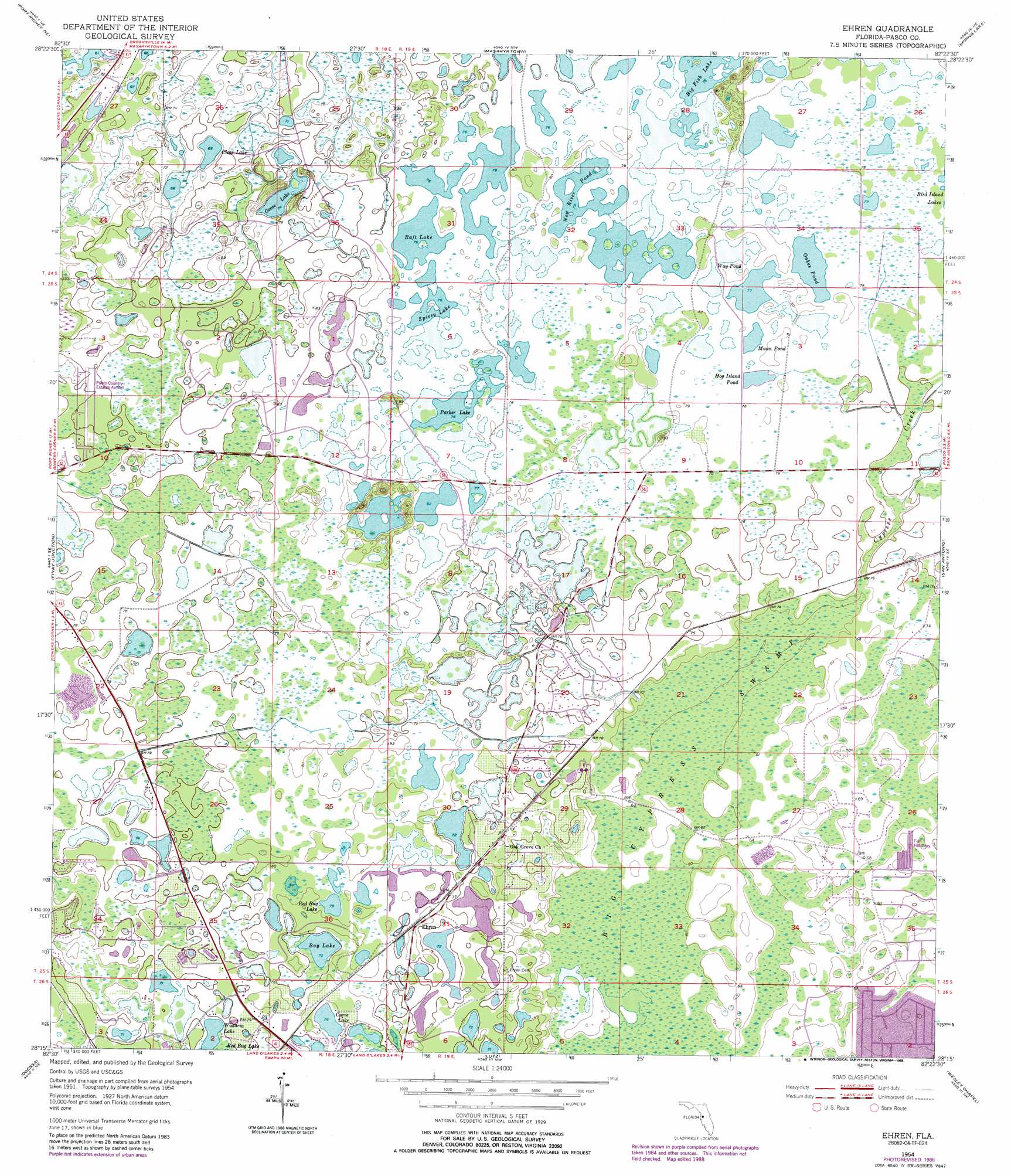
USGS Topo Quad 28082c4 - 1:24,000 scale
| Topo Map Name: | Ehren |
| USGS Topo Quad ID: | 28082c4 |
| Print Size: | ca. 21 1/4" wide x 27" high |
| Southeast Coordinates: | 28.25° N latitude / 82.375° W longitude |
| Map Center Coordinates: | 28.3125° N latitude / 82.4375° W longitude |
| U.S. State: | FL |
| Filename: | O28082C4.jpg |
| Download Map JPG Image: | Ehren topo map 1:24,000 scale |
| Map Type: | Topographic |
| Topo Series: | 7.5´ |
| Map Scale: | 1:24,000 |
| Source of Map Images: | United States Geological Survey (USGS) |
| Alternate Map Versions: |
Ehren FL 1954, updated 1955 Download PDF Buy paper map Ehren FL 1954, updated 1969 Download PDF Buy paper map Ehren FL 1954, updated 1979 Download PDF Buy paper map Ehren FL 1954, updated 1988 Download PDF Buy paper map Ehren FL 2012 Download PDF Buy paper map Ehren FL 2015 Download PDF Buy paper map |
1:24,000 Topo Quads surrounding Ehren
Bayport |
Weeki Wachee Spring |
Brooksville |
Brooksville Se |
Saint Catherine |
Aripeka |
Port Richey Ne |
Masaryktown |
Spring Lake |
Lacoochee |
Port Richey |
Fivay Junction |
Ehren |
San Antonio |
Dade City |
Elfers |
Odessa |
Lutz |
Wesley Chapel |
Zephyrhills |
Oldsmar |
Citrus Park |
Sulphur Springs |
Thonotosassa |
Plant City West |
> Back to 28082a1 at 1:100,000 scale
> Back to 28082a1 at 1:250,000 scale
> Back to U.S. Topo Maps home
Ehren topo map: Gazetteer
Ehren: Airports
Pilot Country Airport elevation 23m 75′Ehren: Lakes
Bay Lake elevation 23m 75′Clear Lake elevation 24m 78′
Curve Lake elevation 23m 75′
Goose Lake elevation 23m 75′
Hog Island Pond elevation 23m 75′
Mann Pond elevation 23m 75′
New River Pond elevation 24m 78′
Oakes Pond elevation 23m 75′
Parker Lake elevation 23m 75′
Red Bug Lake elevation 22m 72′
Red Bug Lake elevation 23m 75′
Spivey Lake elevation 23m 75′
The Rafters elevation 23m 75′
Way Pond elevation 24m 78′
Wistaria Lake elevation 22m 72′
Ehren: Populated Places
Ehren elevation 24m 78′Ehren: Streams
Cypress Creek elevation 19m 62′Ehren: Swamps
Big Cypress Swamp elevation 18m 59′Ehren digital topo map on disk
Buy this Ehren topo map showing relief, roads, GPS coordinates and other geographical features, as a high-resolution digital map file on DVD: