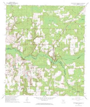
Worthington Springs Topo Map Florida
To zoom in, hover over the map of Worthington Springs
USGS Topo Quad 29082h4 - 1:24,000 scale
| Topo Map Name: | Worthington Springs |
| USGS Topo Quad ID: | 29082h4 |
| Print Size: | ca. 21 1/4" wide x 27" high |
| Southeast Coordinates: | 29.875° N latitude / 82.375° W longitude |
| Map Center Coordinates: | 29.9375° N latitude / 82.4375° W longitude |
| U.S. State: | FL |
| Filename: | O29082H4.jpg |
| Download Map JPG Image: | Worthington Springs topo map 1:24,000 scale |
| Map Type: | Topographic |
| Topo Series: | 7.5´ |
| Map Scale: | 1:24,000 |
| Source of Map Images: | United States Geological Survey (USGS) |
| Alternate Map Versions: |
Worthington Springs FL 1966, updated 1967 Download PDF Buy paper map Worthington Springs FL 2012 Download PDF Buy paper map Worthington Springs FL 2015 Download PDF Buy paper map |
1:24,000 Topo Quads surrounding Worthington Springs
> Back to 29082e1 at 1:100,000 scale
> Back to 29082a1 at 1:250,000 scale
> Back to U.S. Topo Maps home
Worthington Springs topo map: Gazetteer
Worthington Springs: Airports
Santa Fe River Ranch Airport elevation 41m 134′Worthington Springs: Parks
Chastain-Seay Park elevation 18m 59′Worthington Springs: Populated Places
Bland elevation 47m 154′Brown elevation 44m 144′
Browns Still elevation 45m 147′
Dana elevation 37m 121′
Dukes elevation 41m 134′
Miller elevation 46m 150′
Santa Fe elevation 44m 144′
Worthington Springs elevation 36m 118′
Worthington Springs: Post Offices
Worthington Springs Florida Post Office elevation 34m 111′Worthington Springs: Streams
New River elevation 15m 49′Worthington Springs: Swamps
Dekles Millpond elevation 30m 98′Fern Pond elevation 36m 118′
Worthington Springs digital topo map on disk
Buy this Worthington Springs topo map showing relief, roads, GPS coordinates and other geographical features, as a high-resolution digital map file on DVD:


