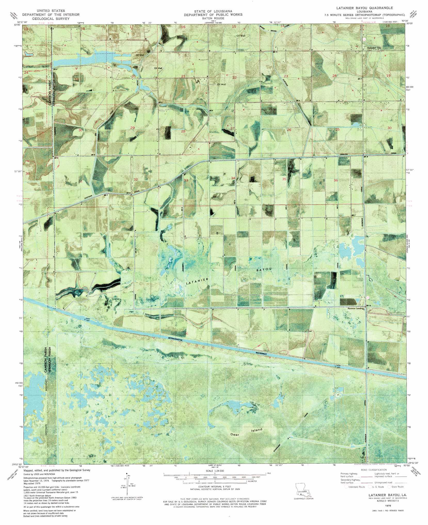
Latanier Bayou Topo Map Louisiana
To zoom in, hover over the map of Latanier Bayou
USGS Topo Quad 29092h5 - 1:24,000 scale
| Topo Map Name: | Latanier Bayou |
| USGS Topo Quad ID: | 29092h5 |
| Print Size: | ca. 21 1/4" wide x 27" high |
| Southeast Coordinates: | 29.875° N latitude / 92.5° W longitude |
| Map Center Coordinates: | 29.9375° N latitude / 92.5625° W longitude |
| U.S. State: | LA |
| Filename: | p29092h5.jpg |
| Download Map JPG Image: | Latanier Bayou topo map 1:24,000 scale |
| Map Type: | Orthophoto |
| Topo Series: | 7.5´ |
| Map Scale: | 1:24,000 |
| Source of Map Images: | United States Geological Survey (USGS) |
| Alternate Map Versions: |
Latanier Bayou LA 1979, updated 1980 Download PDF Buy paper map Latanier Bayou LA 2012 Download PDF Buy paper map Latanier Bayou LA 2015 Download PDF Buy paper map |
1:24,000 Topo Quads surrounding Latanier Bayou
Welsh South |
Jennings |
Mermentau |
Crowley West |
Crowley East |
Thornwell |
Lake Arthur |
Gueydan |
Wright |
Kaplan North |
Latania Lake |
Mallard Bay |
Latanier Bayou |
Forked Island Nw |
Kaplan South |
Catfish Lake |
Collicon Lake |
Lake Le Bleu |
Jacks Point Island |
Forked Island |
Cow Island |
Deep Lake |
Floating Turf Bayou |
Pecan Island |
Pumpkin Islands |
> Back to 29092e1 at 1:100,000 scale
> Back to 29092a1 at 1:250,000 scale
> Back to U.S. Topo Maps home
Latanier Bayou topo map: Gazetteer
Latanier Bayou: Canals
Big Four Ditch elevation 0m 0′Canal Number Eight elevation 0m 0′
Canal Number Four elevation 1m 3′
Canal Number Six elevation 1m 3′
Canal Number Ten elevation 1m 3′
Canal Number Two elevation 0m 0′
Florence Canal elevation 0m 0′
Gueydan Canal elevation 1m 3′
Spencer Canal elevation 0m 0′
Stanolind Canal elevation 1m 3′
Latanier Bayou: Islands
Deer Island elevation 1m 3′Latanier Bayou: Oilfields
Cameron Canal Gas Field elevation 1m 3′Southwest Gueydan Gas Field elevation 1m 3′
Latanier Bayou: Populated Places
Florence Landing elevation 1m 3′Latanier Bayou: Streams
Latanier Bayou elevation 0m 0′Latanier Bayou digital topo map on disk
Buy this Latanier Bayou topo map showing relief, roads, GPS coordinates and other geographical features, as a high-resolution digital map file on DVD: