Delhi Topo Map Texas
To zoom in, hover over the map of Delhi
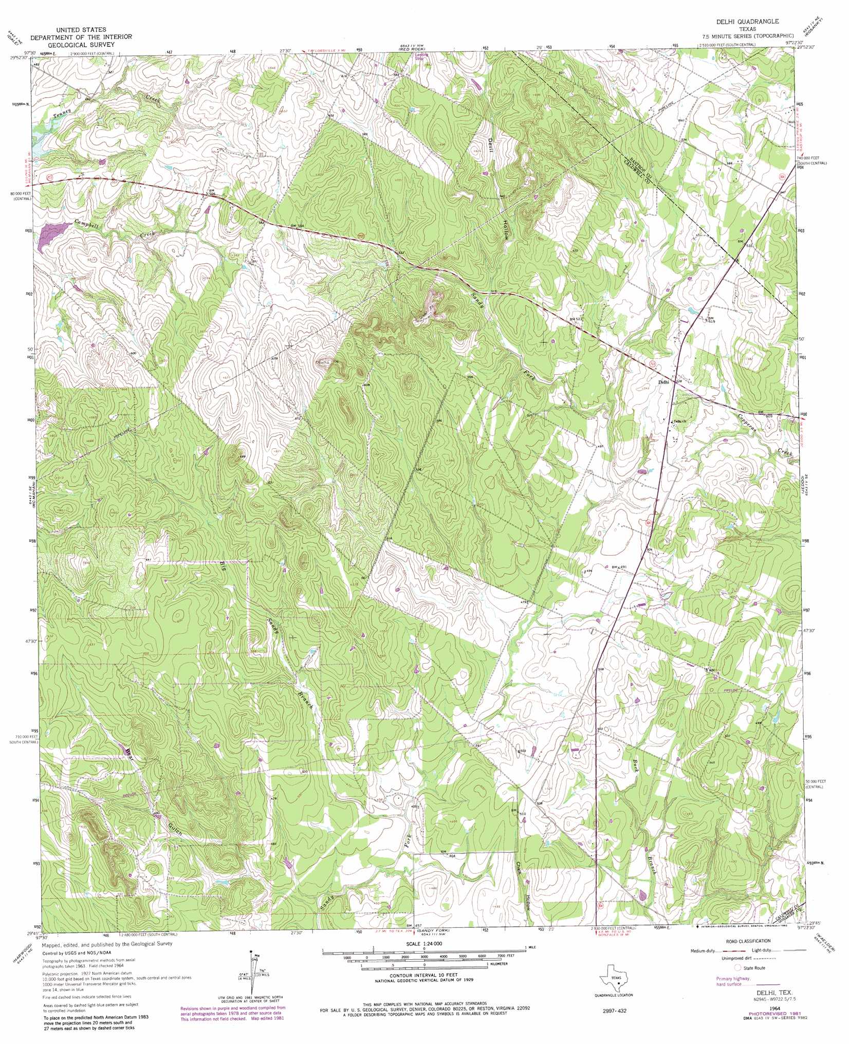
USGS Topo Quad 29097g4 - 1:24,000 scale
| Topo Map Name: | Delhi |
| USGS Topo Quad ID: | 29097g4 |
| Print Size: | ca. 21 1/4" wide x 27" high |
| Southeast Coordinates: | 29.75° N latitude / 97.375° W longitude |
| Map Center Coordinates: | 29.8125° N latitude / 97.4375° W longitude |
| U.S. State: | TX |
| Filename: | o29097g4.jpg |
| Download Map JPG Image: | Delhi topo map 1:24,000 scale |
| Map Type: | Topographic |
| Topo Series: | 7.5´ |
| Map Scale: | 1:24,000 |
| Source of Map Images: | United States Geological Survey (USGS) |
| Alternate Map Versions: |
Delhi TX 1964, updated 1966 Download PDF Buy paper map Delhi TX 1964, updated 1982 Download PDF Buy paper map Delhi TX 2010 Download PDF Buy paper map Delhi TX 2013 Download PDF Buy paper map Delhi TX 2016 Download PDF Buy paper map |
1:24,000 Topo Quads surrounding Delhi
Creedmoor |
Lytton Springs |
Bastrop Sw |
Bastrap |
Smithville |
Lockhart North |
Dale |
Red Rock |
Rosanky |
Togo |
Lockhart South |
Mcmahan |
Delhi |
Jeddo |
Cistern |
Luling |
Harwood |
Sandy Fork |
Waelder |
Flatonia Nw |
Belmont |
Ottine |
Gonzales North |
Dilworth |
Moulton |
> Back to 29097e1 at 1:100,000 scale
> Back to 29096a1 at 1:250,000 scale
> Back to U.S. Topo Maps home
Delhi topo map: Gazetteer
Delhi: Dams
Soil Conservation Service Site 29 Dam elevation 143m 469′Delhi: Populated Places
Delhi elevation 161m 528′Delhi: Reservoirs
Soil Conservation Service Site 29 Reservoir elevation 143m 469′Delhi: Streams
Big Sandy Branch elevation 131m 429′Delhi: Valleys
Bear Gulch elevation 131m 429′Devil Hollow elevation 158m 518′
Delhi digital topo map on disk
Buy this Delhi topo map showing relief, roads, GPS coordinates and other geographical features, as a high-resolution digital map file on DVD: