Durbin Topo Map Florida
To zoom in, hover over the map of Durbin
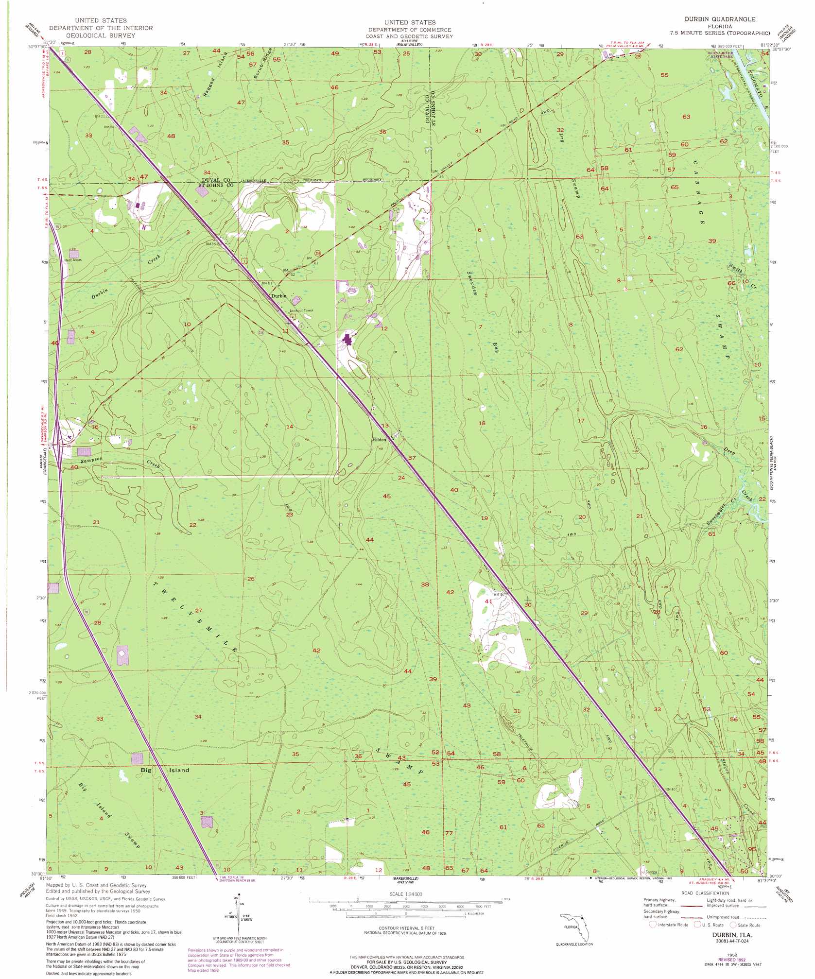
USGS Topo Quad 30081a4 - 1:24,000 scale
| Topo Map Name: | Durbin |
| USGS Topo Quad ID: | 30081a4 |
| Print Size: | ca. 21 1/4" wide x 27" high |
| Southeast Coordinates: | 30° N latitude / 81.375° W longitude |
| Map Center Coordinates: | 30.0625° N latitude / 81.4375° W longitude |
| U.S. State: | FL |
| Filename: | O30081A4.jpg |
| Download Map JPG Image: | Durbin topo map 1:24,000 scale |
| Map Type: | Topographic |
| Topo Series: | 7.5´ |
| Map Scale: | 1:24,000 |
| Source of Map Images: | United States Geological Survey (USGS) |
| Alternate Map Versions: |
Durbin FL 1952, updated 1956 Download PDF Buy paper map Durbin FL 1952, updated 1972 Download PDF Buy paper map Durbin FL 1952, updated 1992 Download PDF Buy paper map Durbin FL 2012 Download PDF Buy paper map Durbin FL 2015 Download PDF Buy paper map |
1:24,000 Topo Quads surrounding Durbin
Jacksonville |
Arlington |
Jacksonville Beach |
||
Orange Park |
Bayard |
Palm Valley |
Mickler Landing |
|
Fleming Island |
Orangedale |
Durbin |
South Ponte Vedra Beach |
|
Green Cove Springs |
Picolata |
Bakersville |
Saint Augustine |
|
Bostwick |
Riverdale |
Elkton |
Saint Augustine Beach |
> Back to 30081a1 at 1:100,000 scale
> Back to 30080a1 at 1:250,000 scale
> Back to U.S. Topo Maps home
Durbin topo map: Gazetteer
Durbin: Islands
Big Island elevation 9m 29′Durbin: Populated Places
Clarksville elevation 6m 19′Durbin elevation 18m 59′
Hilden elevation 12m 39′
Durbin: Streams
Sweetwater Creek elevation 1m 3′Durbin: Swamps
Dry Swamp elevation 6m 19′Snowden Bay elevation 10m 32′
Twelvemile Swamp elevation 11m 36′
Durbin digital topo map on disk
Buy this Durbin topo map showing relief, roads, GPS coordinates and other geographical features, as a high-resolution digital map file on DVD: