Indian Village Topo Map Louisiana
To zoom in, hover over the map of Indian Village
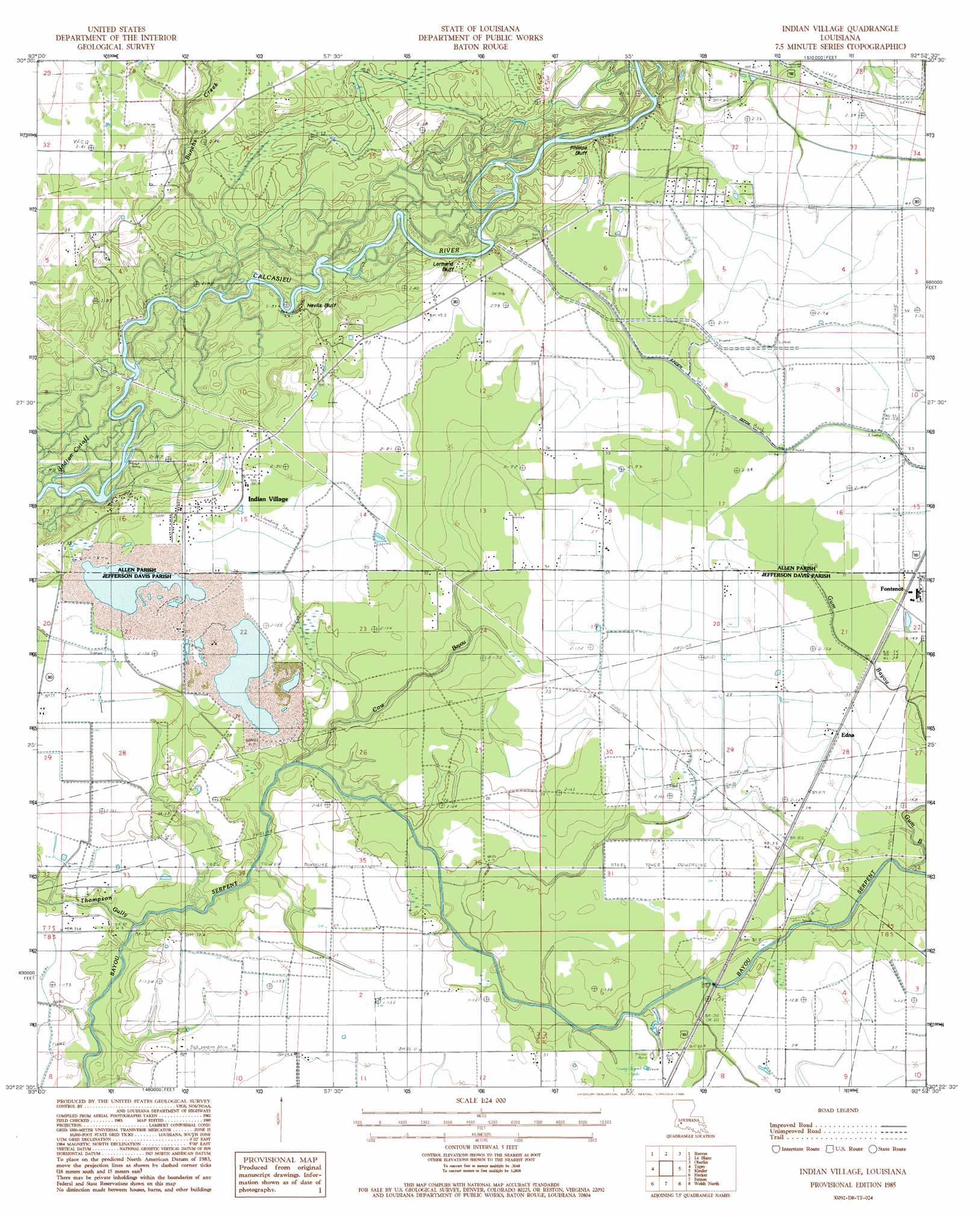
USGS Topo Quad 30092d8 - 1:24,000 scale
| Topo Map Name: | Indian Village |
| USGS Topo Quad ID: | 30092d8 |
| Print Size: | ca. 21 1/4" wide x 27" high |
| Southeast Coordinates: | 30.375° N latitude / 92.875° W longitude |
| Map Center Coordinates: | 30.4375° N latitude / 92.9375° W longitude |
| U.S. State: | LA |
| Filename: | o30092d8.jpg |
| Download Map JPG Image: | Indian Village topo map 1:24,000 scale |
| Map Type: | Topographic |
| Topo Series: | 7.5´ |
| Map Scale: | 1:24,000 |
| Source of Map Images: | United States Geological Survey (USGS) |
| Alternate Map Versions: |
Indian Village LA 1985, updated 1985 Download PDF Buy paper map Indian Village LA 2012 Download PDF Buy paper map Indian Village LA 2015 Download PDF Buy paper map |
1:24,000 Topo Quads surrounding Indian Village
Redhead Branch |
Dry Creek |
Mittie |
Pine Chapel |
Guy |
Longville |
Reeves |
Le Blanc |
Oberlin |
Soileau |
Gaytine |
Topsy |
Indian Village |
Kinder |
Elton |
Moss Bluff |
Hecker |
Fenton |
Welsh North |
Hathaway |
Lake Charles |
Iowa |
Lacassine |
Welsh South |
Jennings |
> Back to 30092a1 at 1:100,000 scale
> Back to 30092a1 at 1:250,000 scale
> Back to U.S. Topo Maps home
Indian Village topo map: Gazetteer
Indian Village: Airports
Station 823 Heliport elevation 12m 39′Indian Village: Bends
Indian Cutoff elevation 5m 16′Indian Village: Cliffs
Lormand Bluff elevation 6m 19′Nevils Bluff elevation 7m 22′
Phillips Bluff elevation 8m 26′
Indian Village: Dams
Louisiana Noname 108 Dam elevation 8m 26′Indian Village: Oilfields
North Indian Village Gas Field elevation 12m 39′Southwest Kinder Gas Field elevation 11m 36′
Indian Village: Populated Places
Edna elevation 11m 36′Fontenot elevation 12m 39′
Gravel Point elevation 9m 29′
Indian Village elevation 10m 32′
Stanley elevation 13m 42′
Indian Village: Streams
Bunchs Creek elevation 5m 16′Cow Bayou elevation 5m 16′
Gum Bayou elevation 8m 26′
Thompson Gully elevation 2m 6′
Indian Village digital topo map on disk
Buy this Indian Village topo map showing relief, roads, GPS coordinates and other geographical features, as a high-resolution digital map file on DVD: