Welcome Topo Map Texas
To zoom in, hover over the map of Welcome
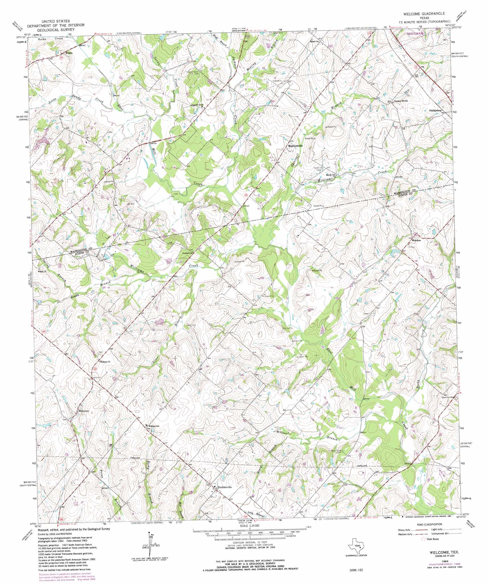
USGS Topo Quad 30096a4 - 1:24,000 scale
| Topo Map Name: | Welcome |
| USGS Topo Quad ID: | 30096a4 |
| Print Size: | ca. 21 1/4" wide x 27" high |
| Southeast Coordinates: | 30° N latitude / 96.375° W longitude |
| Map Center Coordinates: | 30.0625° N latitude / 96.4375° W longitude |
| U.S. State: | TX |
| Filename: | o30096a4.jpg |
| Download Map JPG Image: | Welcome topo map 1:24,000 scale |
| Map Type: | Topographic |
| Topo Series: | 7.5´ |
| Map Scale: | 1:24,000 |
| Source of Map Images: | United States Geological Survey (USGS) |
| Alternate Map Versions: |
Welcome TX 1963, updated 1965 Download PDF Buy paper map Welcome TX 1963, updated 1980 Download PDF Buy paper map Welcome TX 1963, updated 1989 Download PDF Buy paper map Welcome TX 2010 Download PDF Buy paper map Welcome TX 2013 Download PDF Buy paper map Welcome TX 2016 Download PDF Buy paper map |
1:24,000 Topo Quads surrounding Welcome
Flag Pond |
Somerville |
Gay Hill |
Independence |
Washington |
Carmine |
Burton |
Brenham |
Chappell Hill |
Daniels |
Round Top |
Greenvine |
Welcome |
Kenney |
Buckhorn |
Fayetteville |
Industry |
New Ulm |
Bellville |
Burleigh |
Ellinger |
Frelsburg |
Bernardo |
Cat Spring |
Sealy |
> Back to 30096a1 at 1:100,000 scale
> Back to 30096a1 at 1:250,000 scale
> Back to U.S. Topo Maps home
Welcome topo map: Gazetteer
Welcome: Dams
Tonn Lake Dam elevation 95m 311′Welcome: Oilfields
Brenham Oil Field elevation 80m 262′Welcome: Populated Places
Bleiblerville elevation 113m 370′Klump elevation 96m 314′
Muellersville elevation 90m 295′
Wehdem elevation 101m 331′
Welcome elevation 100m 328′
Welcome: Reservoirs
Tonn Lake elevation 95m 311′Welcome: Streams
Beaty Branch elevation 73m 239′Boggy Branch elevation 76m 249′
Jackson Creek elevation 70m 229′
Lime Branch elevation 73m 239′
Little Sandy Creek elevation 75m 246′
Meeting Branch elevation 75m 246′
Millseat Branch elevation 61m 200′
Rocky Creek elevation 79m 259′
Rocky Creek elevation 61m 200′
Sandy Creek elevation 73m 239′
Shirttail Branch elevation 68m 223′
Spring Branch elevation 88m 288′
Williams Creek elevation 67m 219′
Williams Creek elevation 68m 223′
Wood Branch elevation 79m 259′
Welcome digital topo map on disk
Buy this Welcome topo map showing relief, roads, GPS coordinates and other geographical features, as a high-resolution digital map file on DVD: