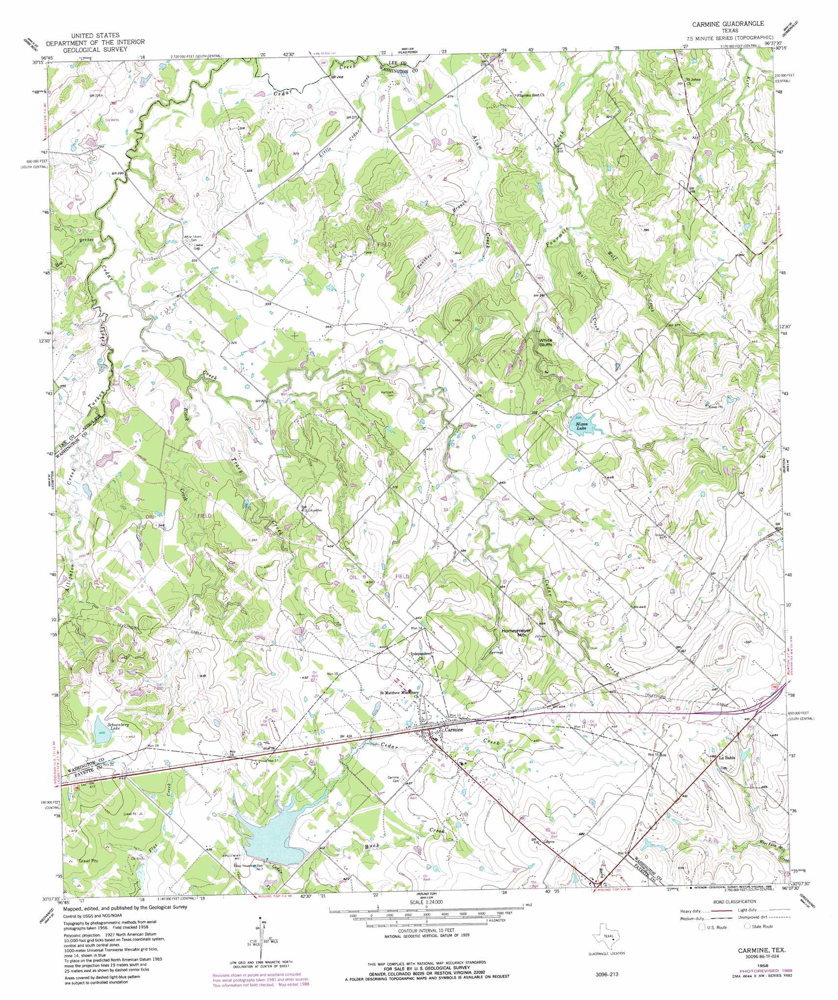
Carmine Topo Map Texas
To zoom in, hover over the map of Carmine
USGS Topo Quad 30096b6 - 1:24,000 scale
| Topo Map Name: | Carmine |
| USGS Topo Quad ID: | 30096b6 |
| Print Size: | ca. 21 1/4" wide x 27" high |
| Southeast Coordinates: | 30.125° N latitude / 96.625° W longitude |
| Map Center Coordinates: | 30.1875° N latitude / 96.6875° W longitude |
| U.S. State: | TX |
| Filename: | o30096b6.jpg |
| Download Map JPG Image: | Carmine topo map 1:24,000 scale |
| Map Type: | Topographic |
| Topo Series: | 7.5´ |
| Map Scale: | 1:24,000 |
| Source of Map Images: | United States Geological Survey (USGS) |
| Alternate Map Versions: |
Carmine TX 1958, updated 1959 Download PDF Buy paper map Carmine TX 1958, updated 1989 Download PDF Buy paper map Carmine TX 2010 Download PDF Buy paper map Carmine TX 2013 Download PDF Buy paper map Carmine TX 2016 Download PDF Buy paper map |
1:24,000 Topo Quads surrounding Carmine
Tanglewood |
Deanville |
Frenstat |
Lyons |
Snook |
Lincoln |
Dime Box |
Flag Pond |
Somerville |
Gay Hill |
Giddings |
Ledbetter |
Carmine |
Burton |
Brenham |
Warda |
Nechanitz |
Round Top |
Greenvine |
Welcome |
La Grange West |
La Grange East |
Fayetteville |
Industry |
New Ulm |
> Back to 30096a1 at 1:100,000 scale
> Back to 30096a1 at 1:250,000 scale
> Back to U.S. Topo Maps home
Carmine topo map: Gazetteer
Carmine: Cliffs
White Bluffs elevation 107m 351′Carmine: Dams
Els Lake Dam elevation 94m 308′Flood Prevention Dam Number 7 elevation 119m 390′
Moye Lake Dam elevation 98m 321′
Nixon Lake Dam elevation 122m 400′
Soil Conservation Service Site 7 Dam elevation 125m 410′
Carmine: Lakes
Nixon Lake elevation 121m 396′Schoenberg Lake elevation 138m 452′
Carmine: Populated Places
Carmine elevation 132m 433′La Bahia elevation 145m 475′
Carmine: Reservoirs
Els Lake elevation 94m 308′Moye Lake elevation 98m 321′
Nixon Lake elevation 122m 400′
Soil Conservation Service Site 7 Reservoir elevation 125m 410′
Carmine: Streams
Alligator Creek elevation 92m 301′Black Creek elevation 91m 298′
Bull Creek elevation 98m 321′
Hog Branch elevation 88m 288′
Little Cedar Creek elevation 83m 272′
Panther Branch elevation 89m 291′
Tracy Creek elevation 92m 301′
Turkey Creek elevation 90m 295′
Wolf Creek elevation 99m 324′
Carmine: Summits
Homeymeyer Mountain elevation 139m 456′Carmine digital topo map on disk
Buy this Carmine topo map showing relief, roads, GPS coordinates and other geographical features, as a high-resolution digital map file on DVD: