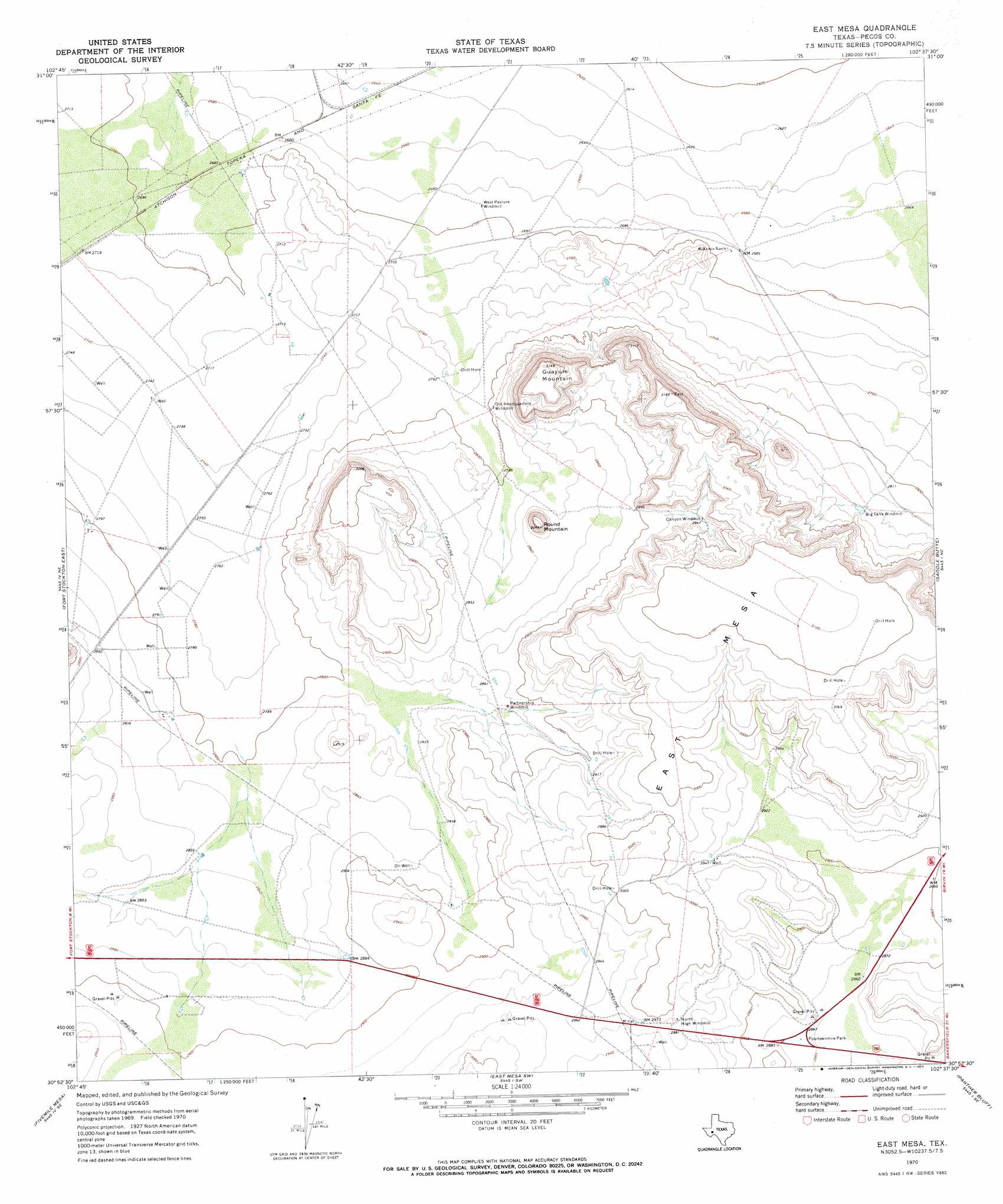
East Mesa Topo Map Texas
To zoom in, hover over the map of East Mesa
USGS Topo Quad 30102h6 - 1:24,000 scale
| Topo Map Name: | East Mesa |
| USGS Topo Quad ID: | 30102h6 |
| Print Size: | ca. 21 1/4" wide x 27" high |
| Southeast Coordinates: | 30.875° N latitude / 102.625° W longitude |
| Map Center Coordinates: | 30.9375° N latitude / 102.6875° W longitude |
| U.S. State: | TX |
| Filename: | o30102h6.jpg |
| Download Map JPG Image: | East Mesa topo map 1:24,000 scale |
| Map Type: | Topographic |
| Topo Series: | 7.5´ |
| Map Scale: | 1:24,000 |
| Source of Map Images: | United States Geological Survey (USGS) |
| Alternate Map Versions: |
East Mesa TX 1970, updated 1973 Download PDF Buy paper map East Mesa TX 2010 Download PDF Buy paper map East Mesa TX 2012 Download PDF Buy paper map East Mesa TX 2016 Download PDF Buy paper map |
1:24,000 Topo Quads surrounding East Mesa
Diamond Y Spring Nw |
Diamond Y Spring Ne |
Buena Vista |
Buena Vista Ne |
Girvin Nw |
Diamond Y Spring |
Diamond Y Spring Se |
Buena Vista Sw |
Owego |
Girvin |
Fort Stockton West |
Fort Stockton East |
East Mesa |
Saddle Butte |
Bootleg Canyon |
Twelvemile Mesa |
Fivemile Mesa |
East Mesa Sw |
Panther Bluff |
Skyscraper Peak |
Sierra Madera Nw |
Sierra Madera Ne |
Rock House Draw Nw |
Rock House Draw Ne |
Hackberry Draw Nw |
> Back to 30102e1 at 1:100,000 scale
> Back to 30102a1 at 1:250,000 scale
> Back to U.S. Topo Maps home
East Mesa topo map: Gazetteer
East Mesa: Parks
Fourteenmile Park elevation 874m 2867′East Mesa: Summits
East Mesa elevation 953m 3126′Guayule Mountain elevation 957m 3139′
Round Mountain elevation 919m 3015′
East Mesa digital topo map on disk
Buy this East Mesa topo map showing relief, roads, GPS coordinates and other geographical features, as a high-resolution digital map file on DVD: