Belding Topo Map Texas
To zoom in, hover over the map of Belding
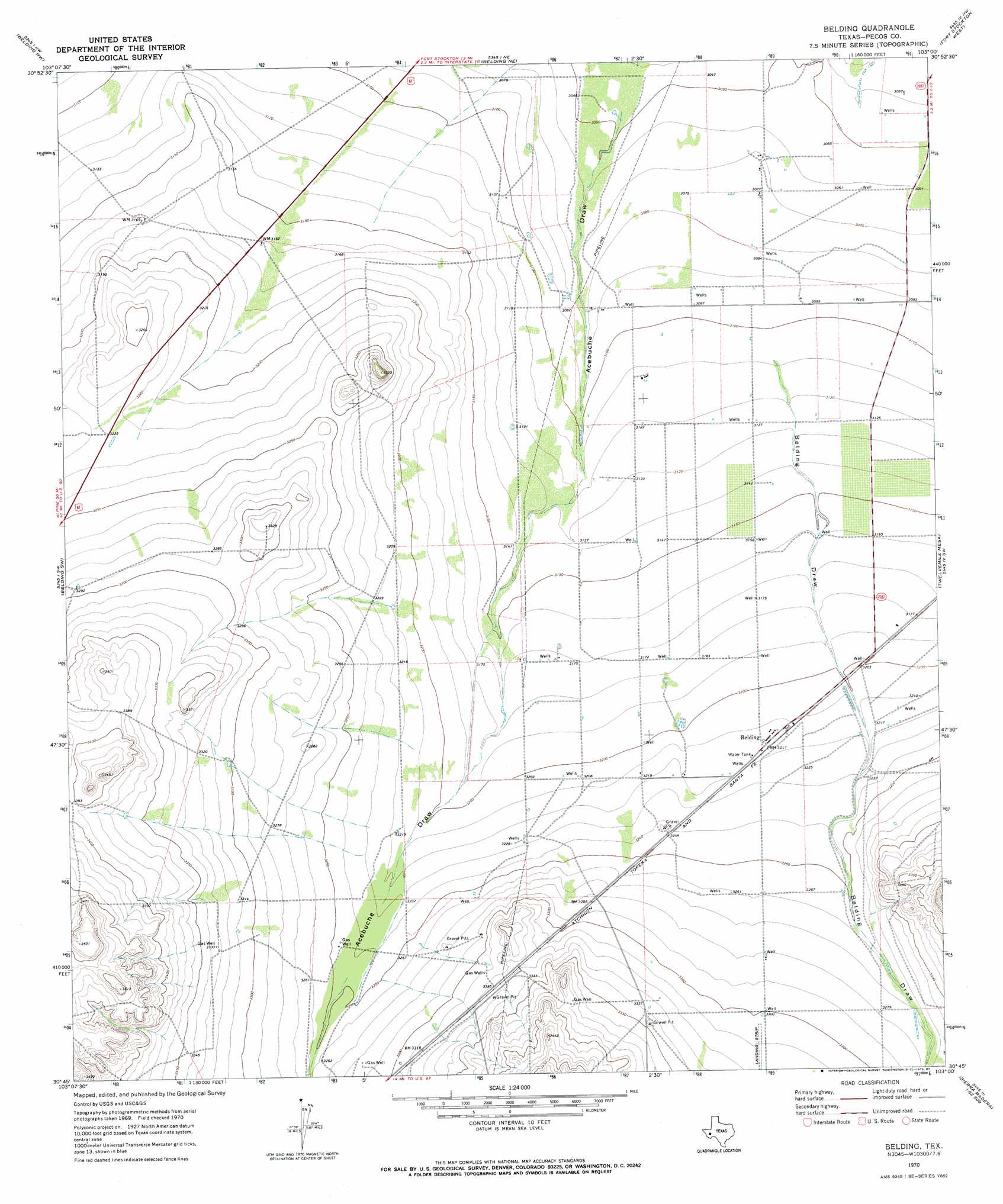
USGS Topo Quad 30103g1 - 1:24,000 scale
| Topo Map Name: | Belding |
| USGS Topo Quad ID: | 30103g1 |
| Print Size: | ca. 21 1/4" wide x 27" high |
| Southeast Coordinates: | 30.75° N latitude / 103° W longitude |
| Map Center Coordinates: | 30.8125° N latitude / 103.0625° W longitude |
| U.S. State: | TX |
| Filename: | o30103g1.jpg |
| Download Map JPG Image: | Belding topo map 1:24,000 scale |
| Map Type: | Topographic |
| Topo Series: | 7.5´ |
| Map Scale: | 1:24,000 |
| Source of Map Images: | United States Geological Survey (USGS) |
| Alternate Map Versions: |
Belding TX 1970, updated 1987 Download PDF Buy paper map Belding TX 2010 Download PDF Buy paper map Belding TX 2012 Download PDF Buy paper map Belding TX 2016 Download PDF Buy paper map |
1:24,000 Topo Quads surrounding Belding
Barstow 3 Se |
Coyanosa Sw |
Coyanosa Se |
Diamond Y Spring |
Diamond Y Spring Se |
Tucker Hill |
Belding Nw |
Belding Ne |
Fort Stockton West |
Fort Stockton East |
Deep Well Ranch Se |
Belding Sw |
Belding |
Twelvemile Mesa |
Fivemile Mesa |
Hovey Ne |
Chancellor |
Cave Mesa Ne |
Sierra Madera Nw |
Sierra Madera Ne |
Hovey |
Cave Mesa |
Cave Mesa Se |
Sierra Madera |
Sierra Madera Se |
> Back to 30103e1 at 1:100,000 scale
> Back to 30102a1 at 1:250,000 scale
> Back to U.S. Topo Maps home
Belding topo map: Gazetteer
Belding: Populated Places
Belding elevation 980m 3215′Belding: Valleys
Belding Draw elevation 948m 3110′Belding digital topo map on disk
Buy this Belding topo map showing relief, roads, GPS coordinates and other geographical features, as a high-resolution digital map file on DVD: