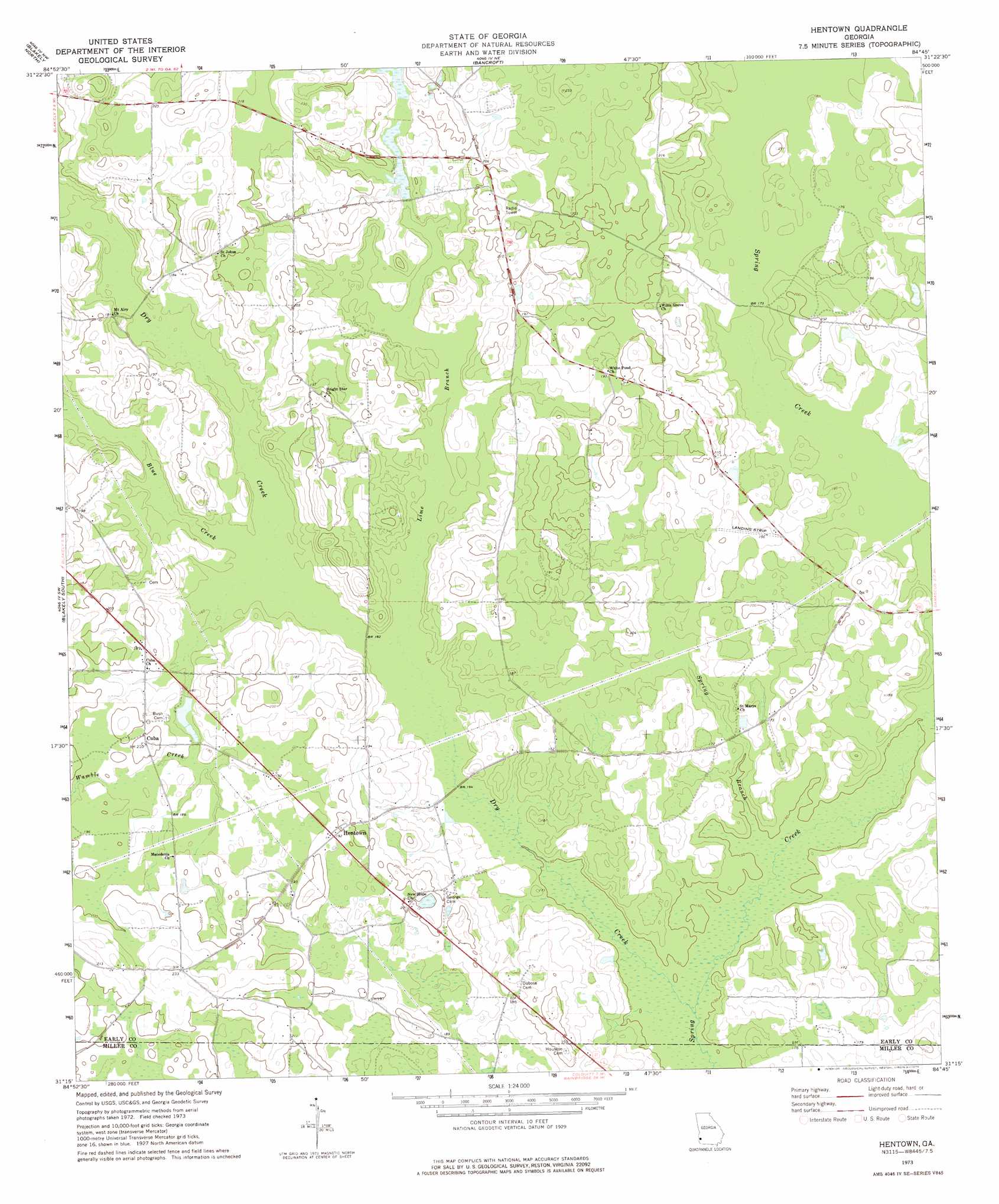
Hentown Topo Map Georgia
To zoom in, hover over the map of Hentown
USGS Topo Quad 31084c7 - 1:24,000 scale
| Topo Map Name: | Hentown |
| USGS Topo Quad ID: | 31084c7 |
| Print Size: | ca. 21 1/4" wide x 27" high |
| Southeast Coordinates: | 31.25° N latitude / 84.75° W longitude |
| Map Center Coordinates: | 31.3125° N latitude / 84.8125° W longitude |
| U.S. State: | GA |
| Filename: | o31084c7.jpg |
| Download Map JPG Image: | Hentown topo map 1:24,000 scale |
| Map Type: | Topographic |
| Topo Series: | 7.5´ |
| Map Scale: | 1:24,000 |
| Source of Map Images: | United States Geological Survey (USGS) |
| Alternate Map Versions: |
Hentown GA 1973, updated 1975 Download PDF Buy paper map Hentown GA 2011 Download PDF Buy paper map Hentown GA 2014 Download PDF Buy paper map |
1:24,000 Topo Quads surrounding Hentown
Fort Gaines |
Zetto |
Bluffton |
Edison |
Morgan |
Columbia Ne |
Blakely North |
Bancroft |
Arlington |
Leary |
Columbia |
Blakely South |
Hentown |
Damascus |
Bethany |
Gordon |
Lucile |
Donalsonville Ne |
Colquitt |
Cooktown |
Saffold |
Donalsonville West |
Donalsonville East |
Boykin |
Steadhams Store |
> Back to 31084a1 at 1:100,000 scale
> Back to 31084a1 at 1:250,000 scale
> Back to U.S. Topo Maps home
Hentown topo map: Gazetteer
Hentown: Bridges
Five Bridge elevation 52m 170′Hentown: Dams
Maddox Lake Dam elevation 55m 180′Hentown: Populated Places
Cuba elevation 63m 206′Hentown elevation 59m 193′
New Hope elevation 61m 200′
Hentown: Reservoirs
Maddox Lake elevation 55m 180′Hentown: Streams
Blue Creek elevation 48m 157′Dry Creek elevation 44m 144′
Lime Branch elevation 48m 157′
Spring Branch elevation 45m 147′
Wamble Creek elevation 48m 157′
Hentown digital topo map on disk
Buy this Hentown topo map showing relief, roads, GPS coordinates and other geographical features, as a high-resolution digital map file on DVD:
Gulf Coast (LA, MS, AL, FL) & Southwestern Georgia
Buy digital topo maps: Gulf Coast (LA, MS, AL, FL) & Southwestern Georgia
 & Southwestern Georgia map DVD")