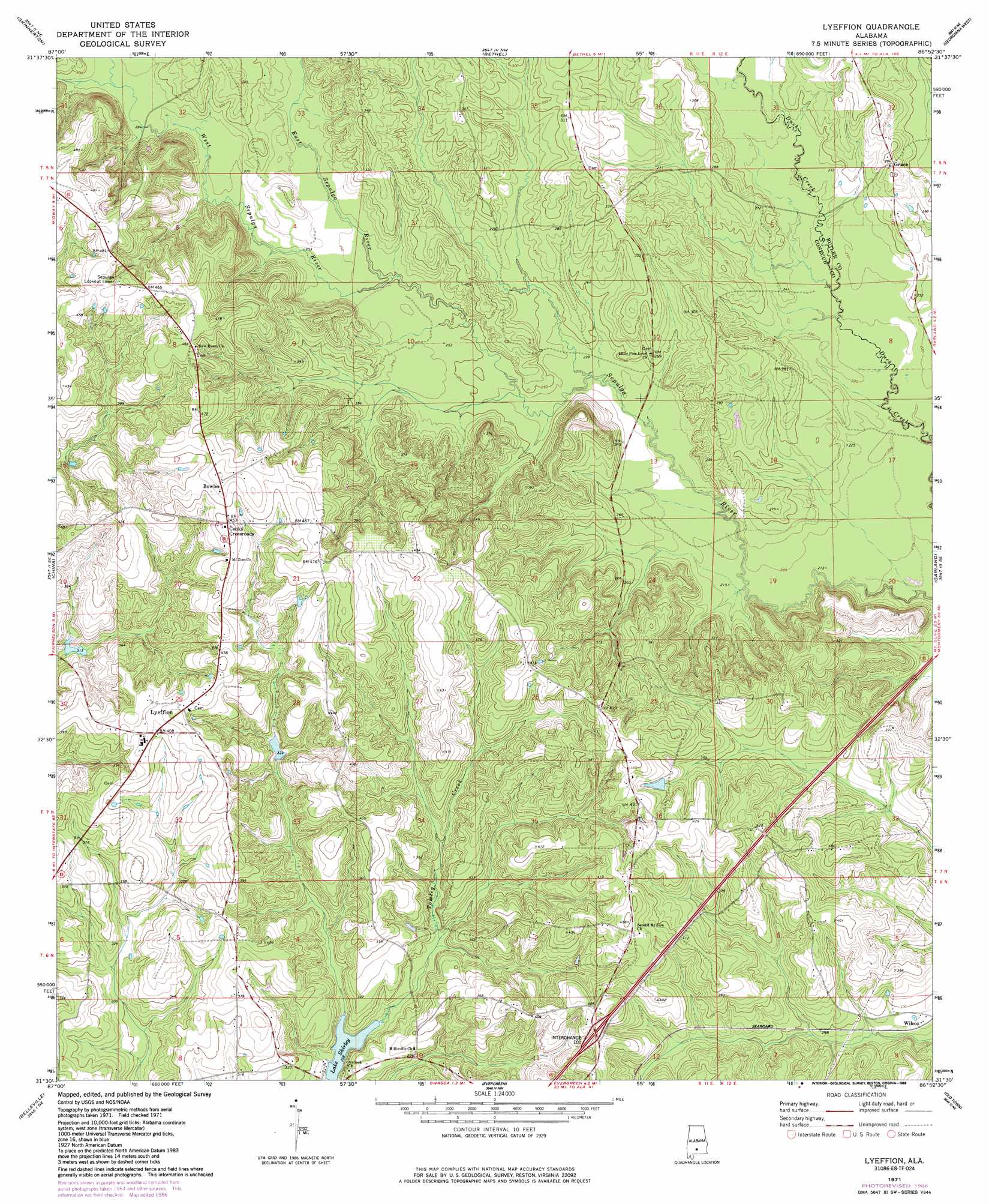
Lyeffion Topo Map Alabama
To zoom in, hover over the map of Lyeffion
USGS Topo Quad 31086e8 - 1:24,000 scale
| Topo Map Name: | Lyeffion |
| USGS Topo Quad ID: | 31086e8 |
| Print Size: | ca. 21 1/4" wide x 27" high |
| Southeast Coordinates: | 31.5° N latitude / 86.875° W longitude |
| Map Center Coordinates: | 31.5625° N latitude / 86.9375° W longitude |
| U.S. State: | AL |
| Filename: | o31086e8.jpg |
| Download Map JPG Image: | Lyeffion topo map 1:24,000 scale |
| Map Type: | Topographic |
| Topo Series: | 7.5´ |
| Map Scale: | 1:24,000 |
| Source of Map Images: | United States Geological Survey (USGS) |
| Alternate Map Versions: |
Lyeffion AL 1971, updated 1971 Download PDF Buy paper map Lyeffion AL 1971, updated 1986 Download PDF Buy paper map Lyeffion AL 2011 Download PDF Buy paper map Lyeffion AL 2014 Download PDF Buy paper map |
1:24,000 Topo Quads surrounding Lyeffion
Nadawah |
Mcwilliams |
Pine Apple South |
Forest Home |
Greenville West |
Beatrice |
Skinnerton |
Bethel |
Georgiana West |
Georgiana East |
Burnt Corn |
China |
Lyeffion |
Garland |
Mckenzie |
Repton |
Belleville |
Evergreen |
Old Town |
Brooks |
Range |
Castleberry |
Nymph |
Brooklyn |
Loango |
> Back to 31086e1 at 1:100,000 scale
> Back to 31086a1 at 1:250,000 scale
> Back to U.S. Topo Maps home
Lyeffion topo map: Gazetteer
Lyeffion: Crossings
Exit 101 elevation 121m 396′Lyeffion: Dams
Conecuh County Lake elevation 81m 265′Lyeffion: Parks
Hank Williams Memorial Park elevation 76m 249′Lyeffion: Populated Places
Bowles elevation 145m 475′Cooks Crossroads elevation 139m 456′
Grace elevation 89m 291′
Lyeffion elevation 125m 410′
Wilcox elevation 88m 288′
Lyeffion: Streams
East Sepulga River elevation 76m 249′Tomley Creek elevation 82m 269′
West Sepulga River elevation 76m 249′
Lyeffion digital topo map on disk
Buy this Lyeffion topo map showing relief, roads, GPS coordinates and other geographical features, as a high-resolution digital map file on DVD:
Gulf Coast (LA, MS, AL, FL) & Southwestern Georgia
Buy digital topo maps: Gulf Coast (LA, MS, AL, FL) & Southwestern Georgia
 & Southwestern Georgia map DVD")