Brooks Topo Map Alabama
To zoom in, hover over the map of Brooks
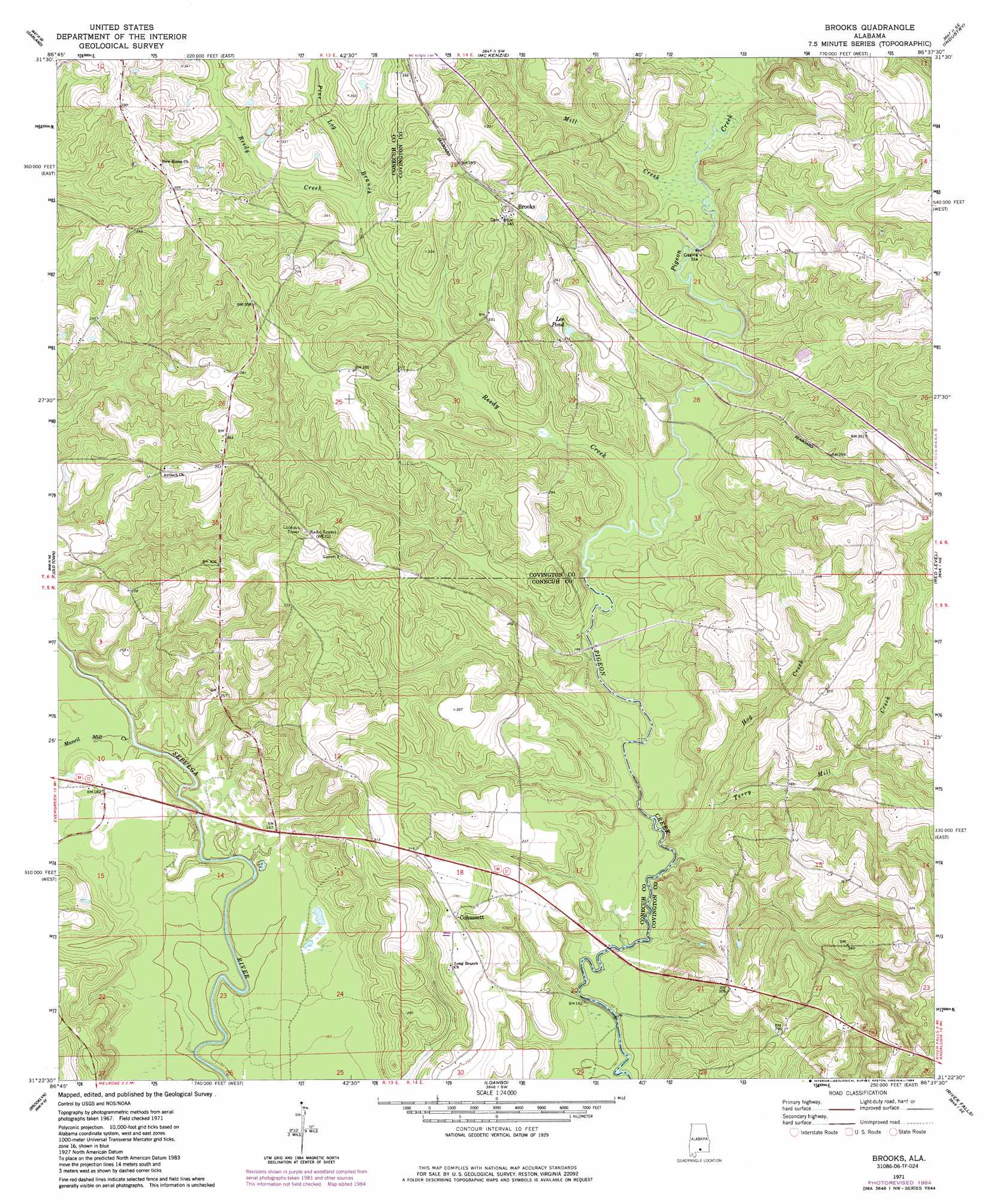
USGS Topo Quad 31086d6 - 1:24,000 scale
| Topo Map Name: | Brooks |
| USGS Topo Quad ID: | 31086d6 |
| Print Size: | ca. 21 1/4" wide x 27" high |
| Southeast Coordinates: | 31.375° N latitude / 86.625° W longitude |
| Map Center Coordinates: | 31.4375° N latitude / 86.6875° W longitude |
| U.S. State: | AL |
| Filename: | o31086d6.jpg |
| Download Map JPG Image: | Brooks topo map 1:24,000 scale |
| Map Type: | Topographic |
| Topo Series: | 7.5´ |
| Map Scale: | 1:24,000 |
| Source of Map Images: | United States Geological Survey (USGS) |
| Alternate Map Versions: |
Brooks AL 1971, updated 1972 Download PDF Buy paper map Brooks AL 1971, updated 1984 Download PDF Buy paper map Brooks AL 2011 Download PDF Buy paper map Brooks AL 2014 Download PDF Buy paper map |
1:24,000 Topo Quads surrounding Brooks
Bethel |
Georgiana West |
Georgiana East |
Pigeon Creek |
Moodys Crossroads |
Lyeffion |
Garland |
Mckenzie |
Industry |
Leon |
Evergreen |
Old Town |
Brooks |
Red Level |
Gantt |
Nymph |
Brooklyn |
Loango |
River Falls |
Andalusia |
Shipps Creek |
Damascus |
Dixie |
Carolina |
Libertyville |
> Back to 31086a1 at 1:100,000 scale
> Back to 31086a1 at 1:250,000 scale
> Back to U.S. Topo Maps home
Brooks topo map: Gazetteer
Brooks: Bars
Bold Sluice Shoal elevation 47m 154′Brooks: Bridges
Motts Bridge (historical) elevation 59m 193′Brooks: Dams
Fergerson Lake Dam elevation 49m 160′Brooks: Populated Places
Brooks elevation 104m 341′Cohassett elevation 82m 269′
Brooks: Reservoirs
Lee Pond elevation 88m 288′Brooks: Streams
Hog Creek elevation 48m 157′Mancil Mill Creek elevation 42m 137′
Mill Creek elevation 57m 187′
Pine Log Branch elevation 78m 255′
Reedy Creek elevation 51m 167′
Terry Mill Creek elevation 46m 150′
Brooks digital topo map on disk
Buy this Brooks topo map showing relief, roads, GPS coordinates and other geographical features, as a high-resolution digital map file on DVD:
Gulf Coast (LA, MS, AL, FL) & Southwestern Georgia
Buy digital topo maps: Gulf Coast (LA, MS, AL, FL) & Southwestern Georgia
 & Southwestern Georgia map DVD")