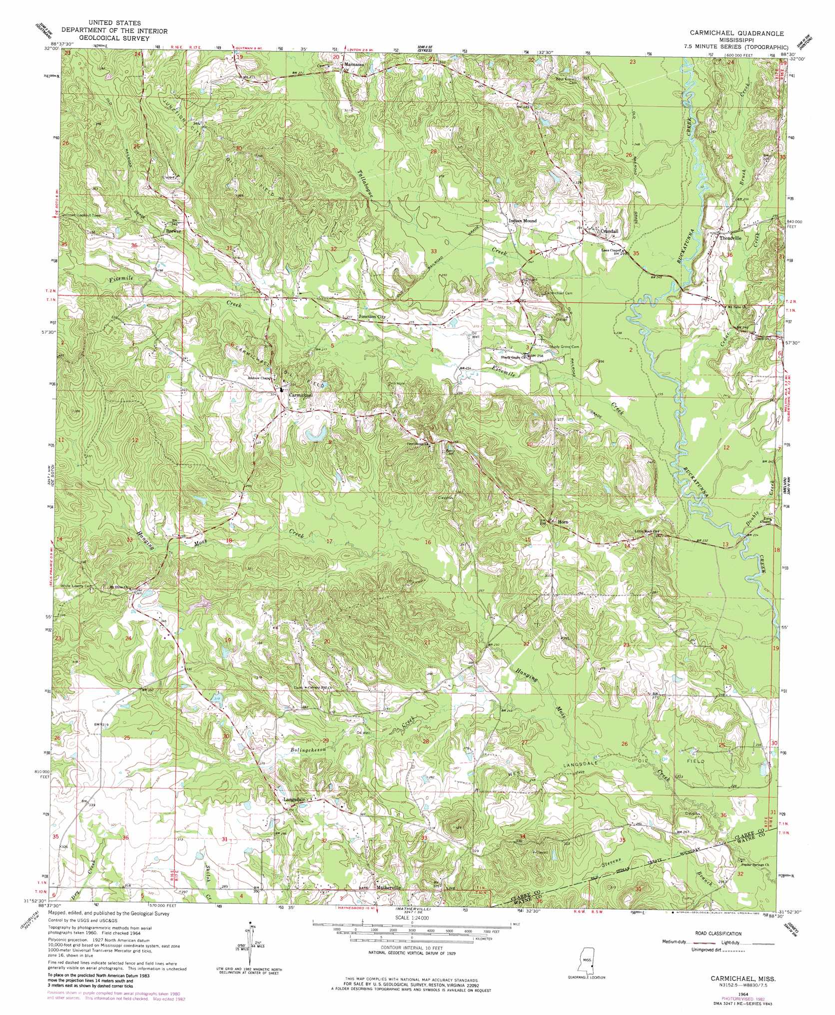
Carmichael Topo Map Mississippi
To zoom in, hover over the map of Carmichael
USGS Topo Quad 31088h5 - 1:24,000 scale
| Topo Map Name: | Carmichael |
| USGS Topo Quad ID: | 31088h5 |
| Print Size: | ca. 21 1/4" wide x 27" high |
| Southeast Coordinates: | 31.875° N latitude / 88.5° W longitude |
| Map Center Coordinates: | 31.9375° N latitude / 88.5625° W longitude |
| U.S. State: | MS |
| Filename: | o31088h5.jpg |
| Download Map JPG Image: | Carmichael topo map 1:24,000 scale |
| Map Type: | Topographic |
| Topo Series: | 7.5´ |
| Map Scale: | 1:24,000 |
| Source of Map Images: | United States Geological Survey (USGS) |
| Alternate Map Versions: |
Carmichael MS 1964, updated 1965 Download PDF Buy paper map Carmichael MS 1964, updated 1982 Download PDF Buy paper map Carmichael MS 2012 Download PDF Buy paper map Carmichael MS 2015 Download PDF Buy paper map |
1:24,000 Topo Quads surrounding Carmichael
Stonewall |
Sable |
Snell |
Yantley |
Lisman |
Wautubbee |
Quittman |
Sykes |
Hinton |
Land |
Hale |
De Soto |
Carmichael |
Melvin |
Toxey |
Eucutta |
Shubuta |
Matherville |
Isney |
Silas |
Whistler |
Waynesboro |
Denham |
Aquilla |
Millry North |
> Back to 31088e1 at 1:100,000 scale
> Back to 31088a1 at 1:250,000 scale
> Back to U.S. Topo Maps home
Carmichael topo map: Gazetteer
Carmichael: Bridges
Evans Bridge elevation 67m 219′Theads Bridge elevation 74m 242′
Carmichael: Dams
Beckman Lake Dam elevation 104m 341′Claude Mauley Lake Dam elevation 106m 347′
Carmichael: Oilfields
Carmichael Oil Field elevation 90m 295′Junction City Oil Field elevation 112m 367′
West Langsdale Oil Field elevation 68m 223′
Carmichael: Populated Places
Brewer elevation 104m 341′Carmichael elevation 101m 331′
Crandall elevation 81m 265′
Horn elevation 91m 298′
Junction City elevation 83m 272′
Langsdale elevation 94m 308′
Mannassa elevation 98m 321′
Matherville elevation 93m 305′
Threadville elevation 82m 269′
Carmichael: Streams
Bolingchessa Creek elevation 70m 229′Brush Creek elevation 74m 242′
Cedar Creek elevation 69m 226′
Double Creek elevation 66m 216′
Fivemile Creek elevation 68m 223′
Tallabogue Creek elevation 68m 223′
Carmichael digital topo map on disk
Buy this Carmichael topo map showing relief, roads, GPS coordinates and other geographical features, as a high-resolution digital map file on DVD:
Gulf Coast (LA, MS, AL, FL) & Southwestern Georgia
Buy digital topo maps: Gulf Coast (LA, MS, AL, FL) & Southwestern Georgia
 & Southwestern Georgia map DVD")