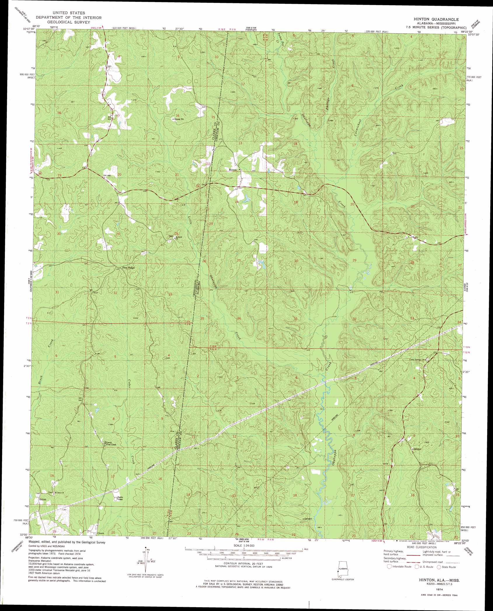
Hinton Topo Map Alabama
To zoom in, hover over the map of Hinton
USGS Topo Quad 32088a4 - 1:24,000 scale
| Topo Map Name: | Hinton |
| USGS Topo Quad ID: | 32088a4 |
| Print Size: | ca. 21 1/4" wide x 27" high |
| Southeast Coordinates: | 32° N latitude / 88.375° W longitude |
| Map Center Coordinates: | 32.0625° N latitude / 88.4375° W longitude |
| U.S. States: | AL, MS |
| Filename: | o32088a4.jpg |
| Download Map JPG Image: | Hinton topo map 1:24,000 scale |
| Map Type: | Topographic |
| Topo Series: | 7.5´ |
| Map Scale: | 1:24,000 |
| Source of Map Images: | United States Geological Survey (USGS) |
| Alternate Map Versions: |
Hinton AL 1974, updated 1978 Download PDF Buy paper map Hinton AL 2011 Download PDF Buy paper map Hinton AL 2014 Download PDF Buy paper map |
1:24,000 Topo Quads surrounding Hinton
Meridian South |
Vimville |
Whynot |
Ward |
Gaston |
Sable |
Snell |
Yantley |
Lisman |
Jachin |
Quittman |
Sykes |
Hinton |
Land |
Butler |
De Soto |
Carmichael |
Melvin |
Toxey |
Ararat |
Shubuta |
Matherville |
Isney |
Silas |
Coffeeville Lock And Dam |
> Back to 32088a1 at 1:100,000 scale
> Back to 32088a1 at 1:250,000 scale
> Back to U.S. Topo Maps home
Hinton topo map: Gazetteer
Hinton: Bridges
Haney Bridge elevation 74m 242′Scott Bridge (historical) elevation 67m 219′
Hinton: Populated Places
Hinton elevation 141m 462′Pine Ridge elevation 133m 436′
Shiloh elevation 109m 357′
Hinton: Streams
Bull Branch elevation 67m 219′Carmichael Creek elevation 75m 246′
Harvey Branch elevation 67m 219′
Hurricane Creek elevation 70m 229′
Little Okatuppa Creek elevation 60m 196′
Phillips Creek elevation 78m 255′
Turkey Pen Creek elevation 87m 285′
Turkey Pen Creek elevation 87m 285′
Hinton digital topo map on disk
Buy this Hinton topo map showing relief, roads, GPS coordinates and other geographical features, as a high-resolution digital map file on DVD:
Gulf Coast (LA, MS, AL, FL) & Southwestern Georgia
Buy digital topo maps: Gulf Coast (LA, MS, AL, FL) & Southwestern Georgia
 & Southwestern Georgia map DVD")