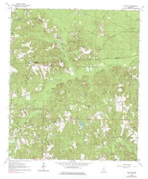
Eucutta Topo Map Mississippi
To zoom in, hover over the map of Eucutta
USGS Topo Quad 31088g7 - 1:24,000 scale
| Topo Map Name: | Eucutta |
| USGS Topo Quad ID: | 31088g7 |
| Print Size: | ca. 21 1/4" wide x 27" high |
| Southeast Coordinates: | 31.75° N latitude / 88.75° W longitude |
| Map Center Coordinates: | 31.8125° N latitude / 88.8125° W longitude |
| U.S. State: | MS |
| Filename: | o31088g7.jpg |
| Download Map JPG Image: | Eucutta topo map 1:24,000 scale |
| Map Type: | Topographic |
| Topo Series: | 7.5´ |
| Map Scale: | 1:24,000 |
| Source of Map Images: | United States Geological Survey (USGS) |
| Alternate Map Versions: |
Eucutta MS 1964, updated 1965 Download PDF Buy paper map Eucutta MS 1964, updated 1976 Download PDF Buy paper map Eucutta MS 2012 Download PDF Buy paper map Eucutta MS 2015 Download PDF Buy paper map |
1:24,000 Topo Quads surrounding Eucutta
> Back to 31088e1 at 1:100,000 scale
> Back to 31088a1 at 1:250,000 scale
> Back to U.S. Topo Maps home
Eucutta topo map: Gazetteer
Eucutta: Dams
Bounds Lake Dam elevation 96m 314′Masonite Nursery Reservoir Dam elevation 86m 282′
Woodward Pond Dam elevation 97m 318′
Eucutta: Oilfields
Eucutta Oil Field elevation 101m 331′Goodwater Oil Field elevation 95m 311′
Wolf Creek Oil Field elevation 110m 360′
Eucutta: Populated Places
Eucutta elevation 88m 288′Eucutta: Streams
Beaverdam Creek elevation 77m 252′Bogue Flower elevation 68m 223′
Dry Fork elevation 71m 232′
Horse Branch elevation 83m 272′
Jackie Branch elevation 71m 232′
Little Eucutta Creek elevation 74m 242′
Mill Creek elevation 77m 252′
Mill Creek elevation 73m 239′
Pine Orchard Branch elevation 73m 239′
Sugar Hill Creek elevation 73m 239′
Tampa Creek elevation 81m 265′
Wagon Branch elevation 81m 265′
Wolf Creek elevation 64m 209′
Eucutta digital topo map on disk
Buy this Eucutta topo map showing relief, roads, GPS coordinates and other geographical features, as a high-resolution digital map file on DVD:
Gulf Coast (LA, MS, AL, FL) & Southwestern Georgia
Buy digital topo maps: Gulf Coast (LA, MS, AL, FL) & Southwestern Georgia


