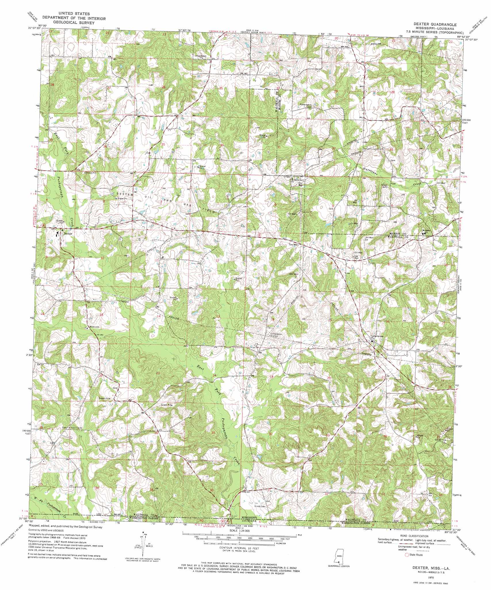
Dexter Topo Map Mississippi
To zoom in, hover over the map of Dexter
USGS Topo Quad 31089a8 - 1:24,000 scale
| Topo Map Name: | Dexter |
| USGS Topo Quad ID: | 31089a8 |
| Print Size: | ca. 21 1/4" wide x 27" high |
| Southeast Coordinates: | 31° N latitude / 89.875° W longitude |
| Map Center Coordinates: | 31.0625° N latitude / 89.9375° W longitude |
| U.S. States: | MS, LA |
| Filename: | o31089a8.jpg |
| Download Map JPG Image: | Dexter topo map 1:24,000 scale |
| Map Type: | Topographic |
| Topo Series: | 7.5´ |
| Map Scale: | 1:24,000 |
| Source of Map Images: | United States Geological Survey (USGS) |
| Alternate Map Versions: |
Dexter MS 1970, updated 1972 Download PDF Buy paper map Dexter MS 2012 Download PDF Buy paper map Dexter MS 2015 Download PDF Buy paper map |
1:24,000 Topo Quads surrounding Dexter
Jayess |
Darbun |
Morgantown |
Columbia North |
Improve |
Mesa |
Kokomo |
Sandy Hook Nw |
Columbia South |
Pinebur |
Tylertown |
Tylertown Se |
Dexter |
Sandy Hook |
Baxterville Sw |
Clifton |
Pine |
State Line |
Angie |
Fords Creek |
Franklinton |
Sheridan |
Bogalusa West |
Bogalusa East |
White Sand |
> Back to 31089a1 at 1:100,000 scale
> Back to 31088a1 at 1:250,000 scale
> Back to U.S. Topo Maps home
Dexter topo map: Gazetteer
Dexter: Dams
Andersons Canal Structure Two Dam elevation 85m 278′Dexter: Oilfields
Dexter Oil and Gas Field elevation 112m 367′East Dexter Oil Field elevation 77m 252′
Dexter: Populated Places
Dexter elevation 95m 311′Dexter digital topo map on disk
Buy this Dexter topo map showing relief, roads, GPS coordinates and other geographical features, as a high-resolution digital map file on DVD:
Gulf Coast (LA, MS, AL, FL) & Southwestern Georgia
Buy digital topo maps: Gulf Coast (LA, MS, AL, FL) & Southwestern Georgia
 & Southwestern Georgia map DVD")