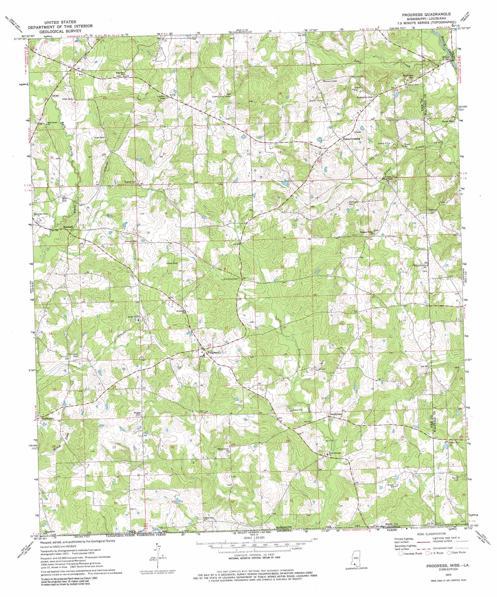
Progress Topo Map Mississippi
To zoom in, hover over the map of Progress
USGS Topo Quad 31090a3 - 1:24,000 scale
| Topo Map Name: | Progress |
| USGS Topo Quad ID: | 31090a3 |
| Print Size: | ca. 21 1/4" wide x 27" high |
| Southeast Coordinates: | 31° N latitude / 90.25° W longitude |
| Map Center Coordinates: | 31.0625° N latitude / 90.3125° W longitude |
| U.S. States: | MS, LA |
| Filename: | o31090a3.jpg |
| Download Map JPG Image: | Progress topo map 1:24,000 scale |
| Map Type: | Topographic |
| Topo Series: | 7.5´ |
| Map Scale: | 1:24,000 |
| Source of Map Images: | United States Geological Survey (USGS) |
| Alternate Map Versions: |
Progress MS 1972, updated 1975 Download PDF Buy paper map Progress MS 1972, updated 1990 Download PDF Buy paper map Progress MS 2012 Download PDF Buy paper map Progress MS 2015 Download PDF Buy paper map |
1:24,000 Topo Quads surrounding Progress
Auburn |
Mccomb North |
Pricedale |
Jayess |
Darbun |
Lake Tangipahoa |
Mccomb South |
Holmesville |
Mesa |
Kokomo |
Terrys Creek |
Osyka |
Progress |
Tylertown |
Tylertown Se |
Kentwood |
Spring Creek |
Sunny Hill |
Clifton |
Pine |
Roseland |
Bolivar |
Wilmer |
Franklinton |
Sheridan |
> Back to 31090a1 at 1:100,000 scale
> Back to 31090a1 at 1:250,000 scale
> Back to U.S. Topo Maps home
Progress topo map: Gazetteer
Progress: Bridges
Walker Bridge elevation 67m 219′Progress: Dams
Hall Lake Dam elevation 103m 337′Progress: Populated Places
Dykes Crossing elevation 110m 360′Emerald elevation 104m 341′
Gladhurst elevation 105m 344′
Progress elevation 113m 370′
Simmonsville elevation 103m 337′
Smithburg elevation 90m 295′
Progress: Streams
Love Creek elevation 67m 219′Sweetwater Creek elevation 67m 219′
Progress digital topo map on disk
Buy this Progress topo map showing relief, roads, GPS coordinates and other geographical features, as a high-resolution digital map file on DVD: