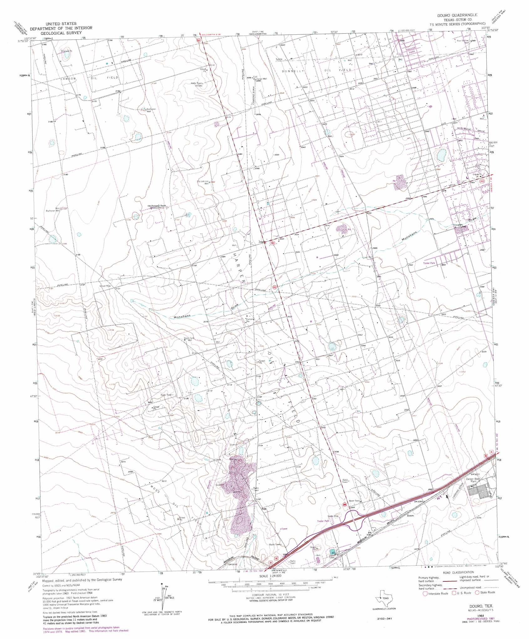
Douro Topo Map Texas
To zoom in, hover over the map of Douro
USGS Topo Quad 31102g5 - 1:24,000 scale
| Topo Map Name: | Douro |
| USGS Topo Quad ID: | 31102g5 |
| Print Size: | ca. 21 1/4" wide x 27" high |
| Southeast Coordinates: | 31.75° N latitude / 102.5° W longitude |
| Map Center Coordinates: | 31.8125° N latitude / 102.5625° W longitude |
| U.S. State: | TX |
| Filename: | o31102g5.jpg |
| Download Map JPG Image: | Douro topo map 1:24,000 scale |
| Map Type: | Topographic |
| Topo Series: | 7.5´ |
| Map Scale: | 1:24,000 |
| Source of Map Images: | United States Geological Survey (USGS) |
| Alternate Map Versions: |
Douro TX 1964, updated 1967 Download PDF Buy paper map Douro TX 1964, updated 1975 Download PDF Buy paper map Douro TX 1964, updated 1981 Download PDF Buy paper map Douro TX 2010 Download PDF Buy paper map Douro TX 2012 Download PDF Buy paper map Douro TX 2016 Download PDF Buy paper map |
1:24,000 Topo Quads surrounding Douro
Bedford Ranch |
Coyote Corner |
North Cowden |
Gardendale |
Hackberry Lake |
Notrees |
Turnbaugh Corner |
Goldsmith |
Odessa Nw |
Odessa Ne |
Amburgey Ranch |
Red Lakes |
Douro |
Odessa Sw |
Odessa Se |
Cowden Place |
Metz |
Penwell |
Clark Brothers Ranch |
South Cowden Ranch |
Monahans Se |
Penwell Sw |
Penwell Se |
Doodle Bug Well |
Perkins Lake |
> Back to 31102e1 at 1:100,000 scale
> Back to 31102a1 at 1:250,000 scale
> Back to U.S. Topo Maps home
Douro topo map: Gazetteer
Douro: Oilfields
Harper Oil Field elevation 932m 3057′Moss Oil Field elevation 915m 3001′
Douro: Parks
Westlake Park elevation 909m 2982′Douro: Populated Places
Douro elevation 940m 3083′West Odessa elevation 910m 2985′
Douro: Wells
Buchanan Well elevation 959m 3146′East Buchanan Well elevation 935m 3067′
Four Section Well elevation 912m 2992′
Old Johnson Well elevation 943m 3093′
West Buchanan Well elevation 966m 3169′
Douro digital topo map on disk
Buy this Douro topo map showing relief, roads, GPS coordinates and other geographical features, as a high-resolution digital map file on DVD: