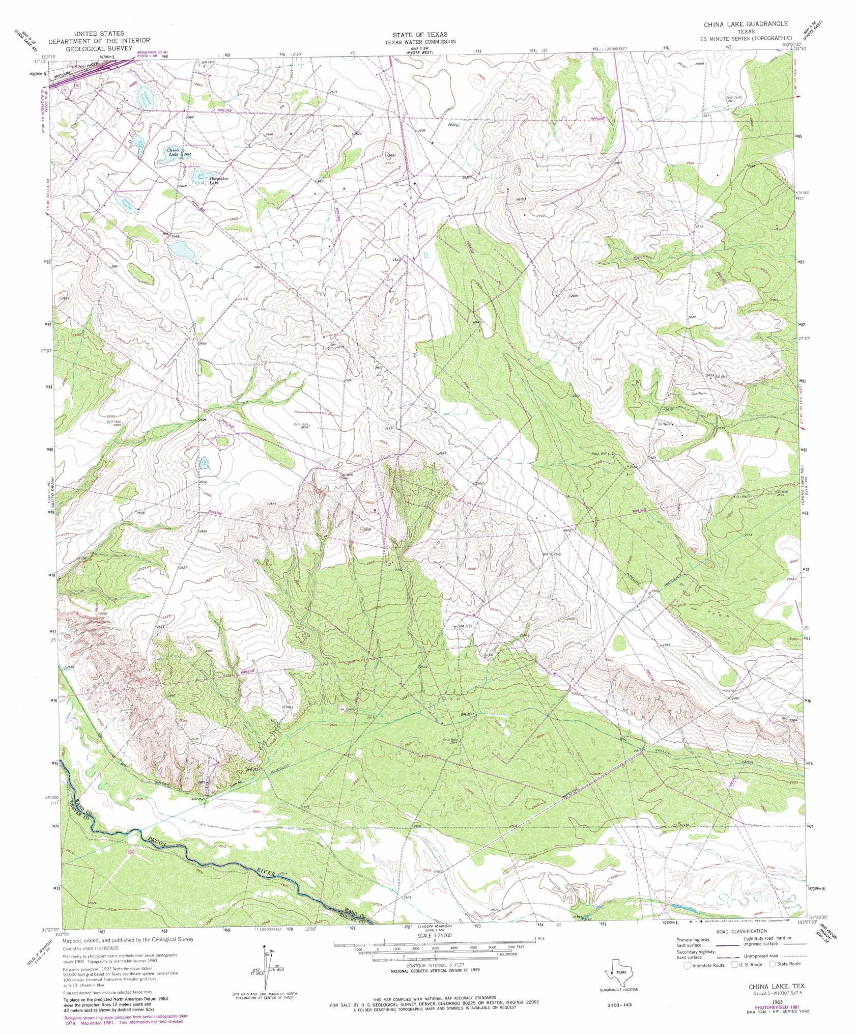
China Lake Topo Map Texas
To zoom in, hover over the map of China Lake
USGS Topo Quad 31103d2 - 1:24,000 scale
| Topo Map Name: | China Lake |
| USGS Topo Quad ID: | 31103d2 |
| Print Size: | ca. 21 1/4" wide x 27" high |
| Southeast Coordinates: | 31.375° N latitude / 103.125° W longitude |
| Map Center Coordinates: | 31.4375° N latitude / 103.1875° W longitude |
| U.S. State: | TX |
| Filename: | o31103d2.jpg |
| Download Map JPG Image: | China Lake topo map 1:24,000 scale |
| Map Type: | Topographic |
| Topo Series: | 7.5´ |
| Map Scale: | 1:24,000 |
| Source of Map Images: | United States Geological Survey (USGS) |
| Alternate Map Versions: |
China Lake TX 1963, updated 1965 Download PDF Buy paper map China Lake TX 1963, updated 1981 Download PDF Buy paper map China Lake TX 2010 Download PDF Buy paper map China Lake TX 2012 Download PDF Buy paper map China Lake TX 2016 Download PDF Buy paper map |
1:24,000 Topo Quads surrounding China Lake
Soda Lake Nw |
Soda Lake Ne |
Wink South |
Pyote Ne |
China Ranch |
Soda Lake |
Soda Lake Se |
Pyote West |
Pyote East |
Monahans |
Pecos East |
Quito Draw |
China Lake |
China Lake Ne |
7 L Ranch |
Toyah Lake |
Old X Ranch |
Ligon Ranch |
Rio Pecos Ranch |
Grandfalls Sw |
Barstow 3 Nw |
Barstow 3 Ne |
Coyanosa Nw |
Coyanosa |
Diamond Y Spring Nw |
> Back to 31103a1 at 1:100,000 scale
> Back to 31102a1 at 1:250,000 scale
> Back to U.S. Topo Maps home
China Lake topo map: Gazetteer
China Lake: Canals
Big Valley Canal elevation 766m 2513′China Lake: Lakes
China Lake elevation 807m 2647′Horseshoe Lake elevation 805m 2641′
China Lake: Wells
Black Well elevation 793m 2601′China Lake digital topo map on disk
Buy this China Lake topo map showing relief, roads, GPS coordinates and other geographical features, as a high-resolution digital map file on DVD: