Tank Mountain Topo Map New Mexico
To zoom in, hover over the map of Tank Mountain
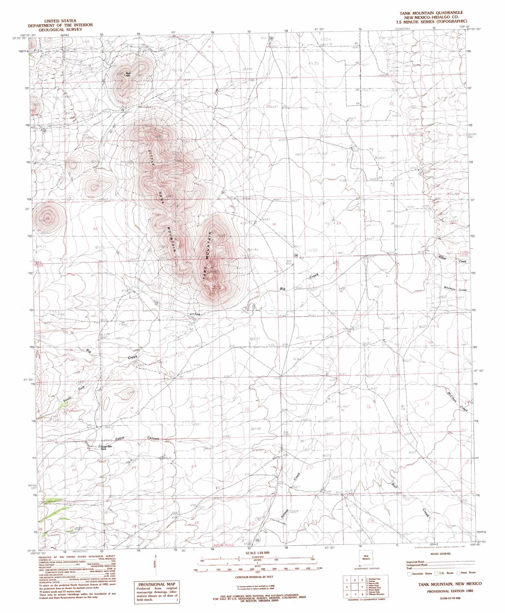
USGS Topo Quad 31108g7 - 1:24,000 scale
| Topo Map Name: | Tank Mountain |
| USGS Topo Quad ID: | 31108g7 |
| Print Size: | ca. 21 1/4" wide x 27" high |
| Southeast Coordinates: | 31.75° N latitude / 108.75° W longitude |
| Map Center Coordinates: | 31.8125° N latitude / 108.8125° W longitude |
| U.S. State: | NM |
| Filename: | o31108g7.jpg |
| Download Map JPG Image: | Tank Mountain topo map 1:24,000 scale |
| Map Type: | Topographic |
| Topo Series: | 7.5´ |
| Map Scale: | 1:24,000 |
| Source of Map Images: | United States Geological Survey (USGS) |
| Alternate Map Versions: |
Tank Mountain NM 1982, updated 1982 Download PDF Buy paper map Tank Mountain NM 2010 Download PDF Buy paper map Tank Mountain NM 2013 Download PDF Buy paper map Tank Mountain NM 2017 Download PDF Buy paper map |
1:24,000 Topo Quads surrounding Tank Mountain
San Simon Cienega |
Cotton City |
Table Top Mountain |
South Pyramid Peak |
Coyote Peak |
Portal Ne |
Antelope Pass |
Animas |
Beacon Hill |
Playas Lake North |
Rodeo |
Indian Peak |
Tank Mountain |
Whitmire Pass |
Playas Lake South |
Skull Canyon |
Mount Baldy |
Animas Peak Ne |
Gillespie Mountain |
Walnut Wells Ne |
Skeleton Canyon |
Clanton Draw |
Animas Peak |
Center Peak |
Horse Mountain |
> Back to 31108e1 at 1:100,000 scale
> Back to 31108a1 at 1:250,000 scale
> Back to U.S. Topo Maps home
Tank Mountain topo map: Gazetteer
Tank Mountain: Populated Places
Gibson Place elevation 1427m 4681′Jim Robinson elevation 1426m 4678′
Tank Mountain: Reservoirs
X T Tank elevation 1449m 4753′Tank Mountain: Streams
Animas Creek elevation 1421m 4662′Big Creek elevation 1418m 4652′
McClean Creek elevation 1407m 4616′
South Fork Big Creek elevation 1465m 4806′
Whitmire Creek elevation 1402m 4599′
Willow Creek elevation 1401m 4596′
Tank Mountain: Summits
Little Tank Mountain elevation 1691m 5547′Red Hill elevation 1550m 5085′
Tank Mountain elevation 1660m 5446′
Tank Mountain: Valleys
Cabin Canyon elevation 1425m 4675′Tank Mountain: Wells
10145 Water Well elevation 1391m 4563′10146 Water Well elevation 1402m 4599′
10157 Water Well elevation 1403m 4603′
Tank Mountain digital topo map on disk
Buy this Tank Mountain topo map showing relief, roads, GPS coordinates and other geographical features, as a high-resolution digital map file on DVD: