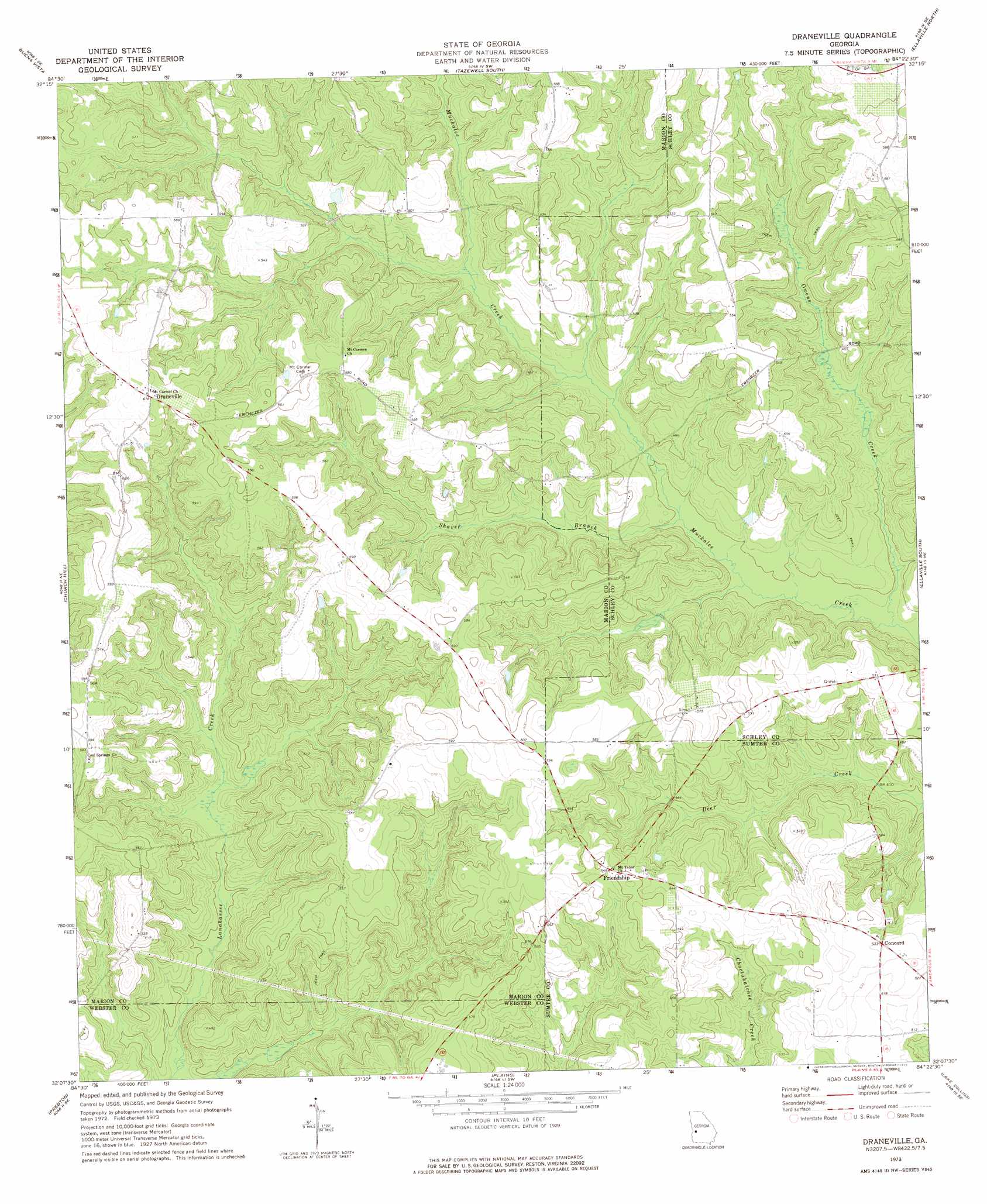
Draneville Topo Map Georgia
To zoom in, hover over the map of Draneville
USGS Topo Quad 32084b4 - 1:24,000 scale
| Topo Map Name: | Draneville |
| USGS Topo Quad ID: | 32084b4 |
| Print Size: | ca. 21 1/4" wide x 27" high |
| Southeast Coordinates: | 32.125° N latitude / 84.375° W longitude |
| Map Center Coordinates: | 32.1875° N latitude / 84.4375° W longitude |
| U.S. State: | GA |
| Filename: | o32084b4.jpg |
| Download Map JPG Image: | Draneville topo map 1:24,000 scale |
| Map Type: | Topographic |
| Topo Series: | 7.5´ |
| Map Scale: | 1:24,000 |
| Source of Map Images: | United States Geological Survey (USGS) |
| Alternate Map Versions: |
Draneville GA 1973, updated 1975 Download PDF Buy paper map Draneville GA 2011 Download PDF Buy paper map Draneville GA 2014 Download PDF Buy paper map |
1:24,000 Topo Quads surrounding Draneville
Buena Vista Nw |
Buena Vista Ne |
Tazewell North |
Rupert |
Ideal North |
Glen Alta |
Buena Vista |
Tazewell South |
Ellaville North |
Ideal South |
Brooklyn |
Church Hill |
Draneville |
Ellaville South |
Andersonville |
Richland |
Preston |
Plains |
Lake Collins |
Americus |
Benevolence |
Parrott |
Bottsford |
Smithville West |
Smithville East |
> Back to 32084a1 at 1:100,000 scale
> Back to 32084a1 at 1:250,000 scale
> Back to U.S. Topo Maps home
Draneville topo map: Gazetteer
Draneville: Bridges
Ira Kelly Bridge elevation 125m 410′Draneville: Dams
David Gwest Lake Dam elevation 130m 426′Draneville: Populated Places
Concord elevation 162m 531′Draneville elevation 188m 616′
Friendship elevation 166m 544′
Draneville: Reservoirs
David Gwest Lake elevation 130m 426′Draneville: Streams
Owens Creek elevation 117m 383′Shaver Branch elevation 121m 396′
Draneville digital topo map on disk
Buy this Draneville topo map showing relief, roads, GPS coordinates and other geographical features, as a high-resolution digital map file on DVD:
Gulf Coast (LA, MS, AL, FL) & Southwestern Georgia
Buy digital topo maps: Gulf Coast (LA, MS, AL, FL) & Southwestern Georgia
 & Southwestern Georgia map DVD")