Brooklyn Topo Map Georgia
To zoom in, hover over the map of Brooklyn
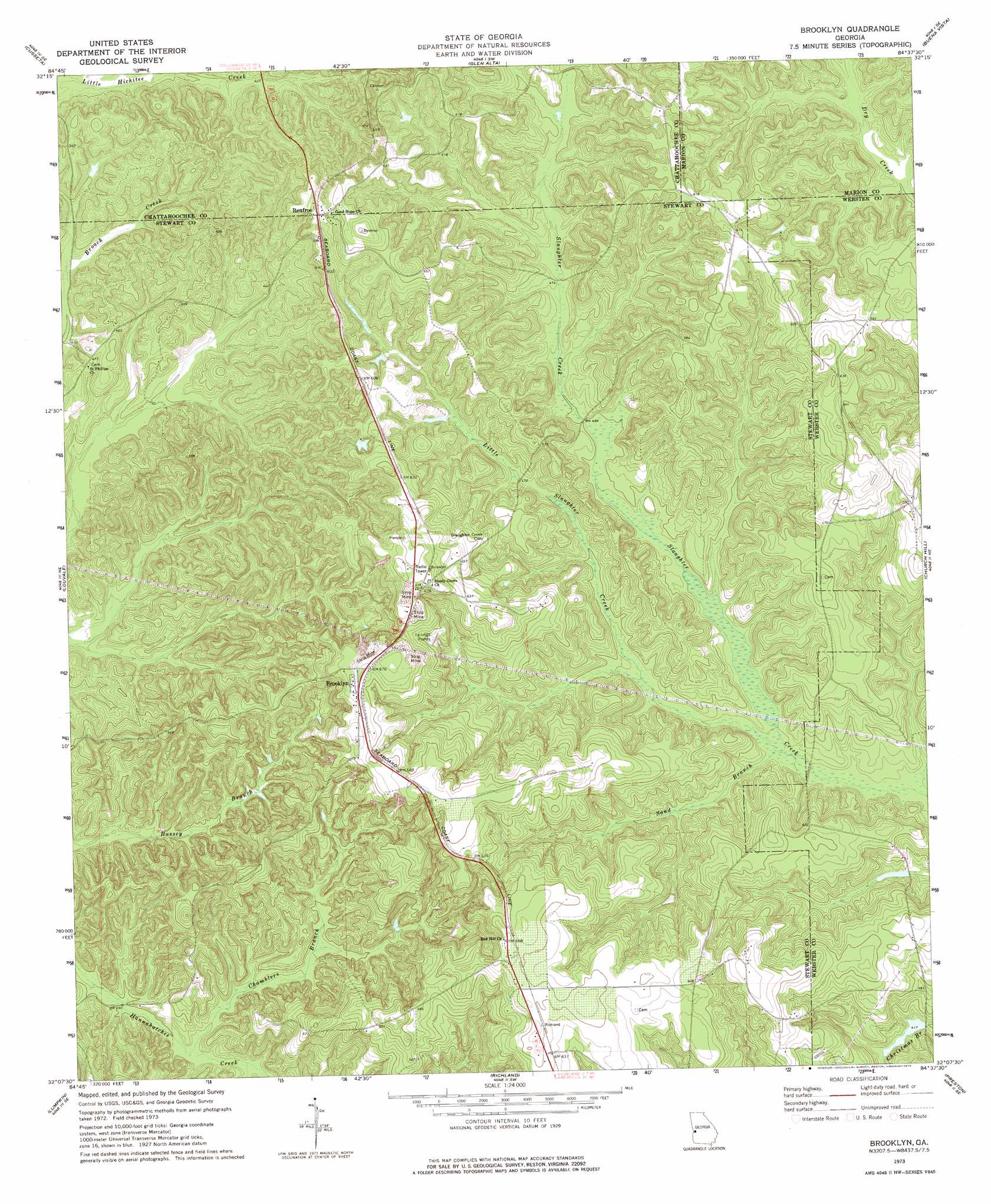
USGS Topo Quad 32084b6 - 1:24,000 scale
| Topo Map Name: | Brooklyn |
| USGS Topo Quad ID: | 32084b6 |
| Print Size: | ca. 21 1/4" wide x 27" high |
| Southeast Coordinates: | 32.125° N latitude / 84.625° W longitude |
| Map Center Coordinates: | 32.1875° N latitude / 84.6875° W longitude |
| U.S. State: | GA |
| Filename: | o32084b6.jpg |
| Download Map JPG Image: | Brooklyn topo map 1:24,000 scale |
| Map Type: | Topographic |
| Topo Series: | 7.5´ |
| Map Scale: | 1:24,000 |
| Source of Map Images: | United States Geological Survey (USGS) |
| Alternate Map Versions: |
Brooklyn GA 1973, updated 1975 Download PDF Buy paper map Brooklyn GA 2011 Download PDF Buy paper map Brooklyn GA 2014 Download PDF Buy paper map |
1:24,000 Topo Quads surrounding Brooklyn
Columbus |
Ochillee |
Buena Vista Nw |
Buena Vista Ne |
Tazewell North |
Fort Benning |
Cusseta |
Glen Alta |
Buena Vista |
Tazewell South |
Union |
Louvale |
Brooklyn |
Church Hill |
Draneville |
Lumpkin Sw |
Lumpkin |
Richland |
Preston |
Plains |
Sanford |
County Line |
Benevolence |
Parrott |
Bottsford |
> Back to 32084a1 at 1:100,000 scale
> Back to 32084a1 at 1:250,000 scale
> Back to U.S. Topo Maps home
Brooklyn topo map: Gazetteer
Brooklyn: Dams
Christmas Branch Dam elevation 127m 416′Van Cleve Lake Dam elevation 136m 446′
Brooklyn: Populated Places
Brooklyn elevation 207m 679′Renfroe elevation 184m 603′
Shady Grove elevation 208m 682′
Slaughter Creek (historical) elevation 175m 574′
Brooklyn: Reservoirs
Christmas Branch Lake elevation 127m 416′Van Cleve Lake elevation 136m 446′
Brooklyn: Streams
Chamblers Branch elevation 108m 354′Little Slaughter Creek elevation 126m 413′
Sand Branch elevation 126m 413′
Brooklyn digital topo map on disk
Buy this Brooklyn topo map showing relief, roads, GPS coordinates and other geographical features, as a high-resolution digital map file on DVD:
Gulf Coast (LA, MS, AL, FL) & Southwestern Georgia
Buy digital topo maps: Gulf Coast (LA, MS, AL, FL) & Southwestern Georgia
 & Southwestern Georgia map DVD")