Union Springs Topo Map Alabama
To zoom in, hover over the map of Union Springs
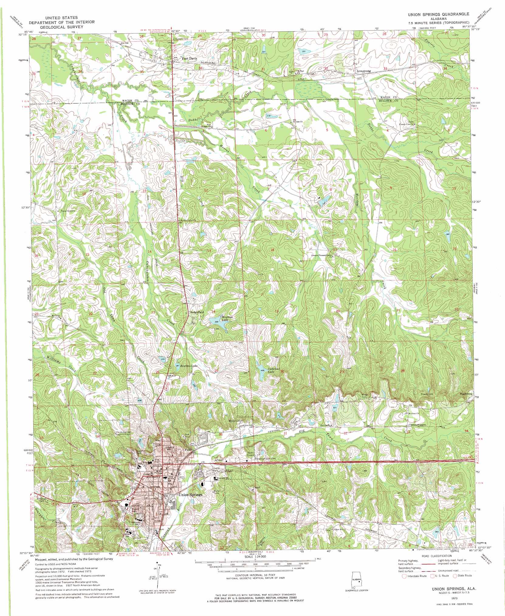
USGS Topo Quad 32085b6 - 1:24,000 scale
| Topo Map Name: | Union Springs |
| USGS Topo Quad ID: | 32085b6 |
| Print Size: | ca. 21 1/4" wide x 27" high |
| Southeast Coordinates: | 32.125° N latitude / 85.625° W longitude |
| Map Center Coordinates: | 32.1875° N latitude / 85.6875° W longitude |
| U.S. State: | AL |
| Filename: | o32085b6.jpg |
| Download Map JPG Image: | Union Springs topo map 1:24,000 scale |
| Map Type: | Topographic |
| Topo Series: | 7.5´ |
| Map Scale: | 1:24,000 |
| Source of Map Images: | United States Geological Survey (USGS) |
| Alternate Map Versions: |
Union Springs AL 1973, updated 1976 Download PDF Buy paper map Union Springs AL 2011 Download PDF Buy paper map Union Springs AL 2014 Download PDF Buy paper map |
1:24,000 Topo Quads surrounding Union Springs
Shorter |
La Place |
Tuskegee |
Little Texas |
Society Hill |
Chesson |
Hardaway |
Davisville |
Warriorstand |
Creek Stand |
Fitzpatrick |
Thompson |
Union Springs |
Roba |
Hurtsboro |
China Grove |
Almeria |
Aberfoil |
Midway |
Comer |
Needmore |
Saco |
Perote |
Mount Andrew |
Clayton North |
> Back to 32085a1 at 1:100,000 scale
> Back to 32084a1 at 1:250,000 scale
> Back to U.S. Topo Maps home
Union Springs topo map: Gazetteer
Union Springs: Dams
Hoff Pond Dam elevation 174m 570′Maytag Lake Number 1 Dam elevation 109m 357′
Old Town Creek Watershed Dam Number 32 elevation 105m 344′
Old Town Creek Watershed Dam Number 37 elevation 101m 331′
Schorr Lake Dam elevation 104m 341′
Sorrell Dam elevation 124m 406′
Union Springs: Parks
Bullock County Courthouse Historic District elevation 163m 534′Union Springs: Populated Places
Armstrong elevation 101m 331′Chunnenuggee elevation 168m 551′
Fort Davis elevation 95m 311′
Sedgefield elevation 117m 383′
Union Springs elevation 159m 521′
Union Springs: Post Offices
Armstrong Post Office elevation 102m 334′Fort Davis Post Office elevation 98m 321′
Union Springs Post Office elevation 159m 521′
Union Springs: Reservoirs
Bentons Lake elevation 108m 354′Cochrans Lake elevation 123m 403′
Hoff Pond elevation 174m 570′
Maytag Lake Number 1 elevation 109m 357′
Maytags Lake elevation 109m 357′
Old Town Creek Watershed Lake Number Thirty-seven elevation 101m 331′
Old Town Creek Watershed Lake Number Thirty-two elevation 105m 344′
Schorr Lake elevation 104m 341′
Union Springs: Streams
Dobbs Creek elevation 87m 285′Dry Creek elevation 91m 298′
Moores Creek elevation 88m 288′
Moseley Creek elevation 97m 318′
Union Springs digital topo map on disk
Buy this Union Springs topo map showing relief, roads, GPS coordinates and other geographical features, as a high-resolution digital map file on DVD:
Gulf Coast (LA, MS, AL, FL) & Southwestern Georgia
Buy digital topo maps: Gulf Coast (LA, MS, AL, FL) & Southwestern Georgia
 & Southwestern Georgia map DVD")