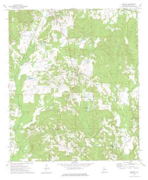
Aberfoil Topo Map Alabama
To zoom in, hover over the map of Aberfoil
USGS Topo Quad 32085a6 - 1:24,000 scale
| Topo Map Name: | Aberfoil |
| USGS Topo Quad ID: | 32085a6 |
| Print Size: | ca. 21 1/4" wide x 27" high |
| Southeast Coordinates: | 32° N latitude / 85.625° W longitude |
| Map Center Coordinates: | 32.0625° N latitude / 85.6875° W longitude |
| U.S. State: | AL |
| Filename: | o32085a6.jpg |
| Download Map JPG Image: | Aberfoil topo map 1:24,000 scale |
| Map Type: | Topographic |
| Topo Series: | 7.5´ |
| Map Scale: | 1:24,000 |
| Source of Map Images: | United States Geological Survey (USGS) |
| Alternate Map Versions: |
Aberfoil AL 1973, updated 1976 Download PDF Buy paper map Aberfoil AL 2011 Download PDF Buy paper map Aberfoil AL 2014 Download PDF Buy paper map |
1:24,000 Topo Quads surrounding Aberfoil
> Back to 32085a1 at 1:100,000 scale
> Back to 32084a1 at 1:250,000 scale
> Back to U.S. Topo Maps home
Aberfoil topo map: Gazetteer
Aberfoil: Dams
C F Green Lake Dam elevation 138m 452′Colley Pond Dam elevation 149m 488′
Gibson Dam elevation 137m 449′
Hobbie Lee Dam elevation 136m 446′
O H Williams Lake Dam elevation 152m 498′
Smuteye Pond Dam elevation 130m 426′
Varner Dam elevation 149m 488′
White Oak Number One Dam elevation 143m 469′
White Oak Number Two Dam elevation 145m 475′
Aberfoil: Lakes
Cypress Pond (historical) elevation 123m 403′Gibson Lake elevation 137m 449′
Aberfoil: Populated Places
Aberfoil elevation 172m 564′Inverness elevation 130m 426′
Ox Level elevation 148m 485′
Scottland elevation 168m 551′
Stavo elevation 140m 459′
Tito elevation 134m 439′
Aberfoil: Post Offices
Indian Creek Post Office (historical) elevation 144m 472′Aberfoil: Reservoirs
C F Green Lake elevation 138m 452′Colley Lake elevation 149m 488′
Green Lakes elevation 140m 459′
Hobbie Lee Lake elevation 138m 452′
O H Williams Lake elevation 152m 498′
Smuteye Lake elevation 132m 433′
Varner Lake elevation 149m 488′
White Oak Lake Number One elevation 143m 469′
White Oak Lake Number Two elevation 145m 475′
White Oak Lakes elevation 143m 469′
Aberfoil: Streams
Little Conecuh River elevation 130m 426′Aberfoil digital topo map on disk
Buy this Aberfoil topo map showing relief, roads, GPS coordinates and other geographical features, as a high-resolution digital map file on DVD:
Gulf Coast (LA, MS, AL, FL) & Southwestern Georgia
Buy digital topo maps: Gulf Coast (LA, MS, AL, FL) & Southwestern Georgia


