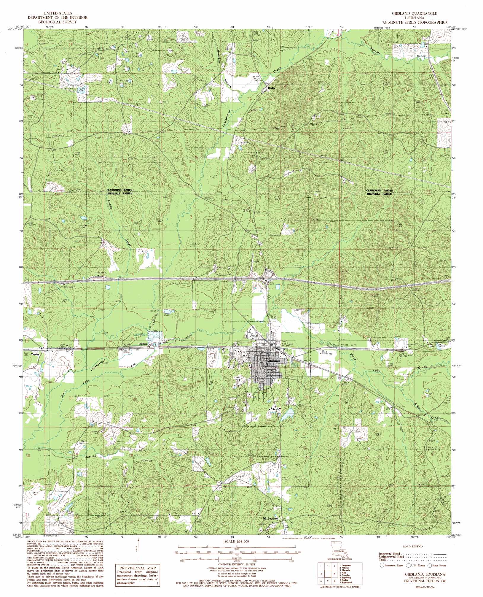
Gibsland Topo Map Louisiana
To zoom in, hover over the map of Gibsland
USGS Topo Quad 32093e1 - 1:24,000 scale
| Topo Map Name: | Gibsland |
| USGS Topo Quad ID: | 32093e1 |
| Print Size: | ca. 21 1/4" wide x 27" high |
| Southeast Coordinates: | 32.5° N latitude / 93° W longitude |
| Map Center Coordinates: | 32.5625° N latitude / 93.0625° W longitude |
| U.S. State: | LA |
| Filename: | o32093e1.jpg |
| Download Map JPG Image: | Gibsland topo map 1:24,000 scale |
| Map Type: | Topographic |
| Topo Series: | 7.5´ |
| Map Scale: | 1:24,000 |
| Source of Map Images: | United States Geological Survey (USGS) |
| Alternate Map Versions: |
Gibsland LA 1986, updated 1986 Download PDF Buy paper map Gibsland LA 2012 Download PDF Buy paper map Gibsland LA 2015 Download PDF Buy paper map |
1:24,000 Topo Quads surrounding Gibsland
Leton |
Blackburn |
Homer |
Arizona |
Lisbon |
Minden North |
Langston |
Athens |
Marsalis |
Lake Foursome |
Minden South |
Ada |
Gibsland |
Arcadia |
Simsboro |
Heflin |
Fryeburg |
Sailes |
Bryceland |
Wilson Creek |
Ringgold |
Jamestown |
Sparta |
Bienville |
Mount Olive |
> Back to 32093e1 at 1:100,000 scale
> Back to 32092a1 at 1:250,000 scale
> Back to U.S. Topo Maps home
Gibsland topo map: Gazetteer
Gibsland: Crossings
Interchange 61 elevation 76m 249′Gibsland: Populated Places
Darley elevation 73m 239′Gibsland elevation 82m 269′
Mount Lebanon elevation 103m 337′
Phillips elevation 63m 206′
Taylor elevation 68m 223′
Gibsland: Post Offices
Gibsland Post Office elevation 76m 249′Taylor Post Office elevation 68m 223′
Gibsland: Streams
Baker Creek elevation 72m 236′Black Lake Creek elevation 59m 193′
Caney Creek elevation 59m 193′
Frazier Creek elevation 73m 239′
Hurried Branch elevation 58m 190′
Moccasin Branch elevation 69m 226′
Gibsland digital topo map on disk
Buy this Gibsland topo map showing relief, roads, GPS coordinates and other geographical features, as a high-resolution digital map file on DVD: