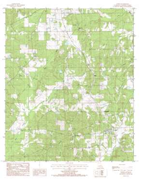
Athens Topo Map Louisiana
To zoom in, hover over the map of Athens
USGS Topo Quad 32093f1 - 1:24,000 scale
| Topo Map Name: | Athens |
| USGS Topo Quad ID: | 32093f1 |
| Print Size: | ca. 21 1/4" wide x 27" high |
| Southeast Coordinates: | 32.625° N latitude / 93° W longitude |
| Map Center Coordinates: | 32.6875° N latitude / 93.0625° W longitude |
| U.S. State: | LA |
| Filename: | o32093f1.jpg |
| Download Map JPG Image: | Athens topo map 1:24,000 scale |
| Map Type: | Topographic |
| Topo Series: | 7.5´ |
| Map Scale: | 1:24,000 |
| Source of Map Images: | United States Geological Survey (USGS) |
| Alternate Map Versions: |
Athens LA 1986, updated 1986 Download PDF Buy paper map Athens LA 2012 Download PDF Buy paper map Athens LA 2015 Download PDF Buy paper map |
1:24,000 Topo Quads surrounding Athens
> Back to 32093e1 at 1:100,000 scale
> Back to 32092a1 at 1:250,000 scale
> Back to U.S. Topo Maps home
Athens topo map: Gazetteer
Athens: Lakes
Spring Lake elevation 93m 305′Athens: Oilfields
Athens Gas Field elevation 104m 341′Leatherman Creek Oil and Gas Field elevation 88m 288′
Athens: Populated Places
Athens elevation 92m 301′Mulnix elevation 129m 423′
Old Athens elevation 138m 452′
Russellville elevation 115m 377′
Spring Lake elevation 99m 324′
Athens: Post Offices
Athens Post Office elevation 94m 308′Athens: Streams
Brush Creek elevation 77m 252′Choctaw Creek elevation 79m 259′
Clear Creek elevation 82m 269′
Frincher Creek elevation 76m 249′
Lick Creek elevation 77m 252′
Sandy Creek elevation 60m 196′
Walker Creek elevation 81m 265′
Athens digital topo map on disk
Buy this Athens topo map showing relief, roads, GPS coordinates and other geographical features, as a high-resolution digital map file on DVD:


