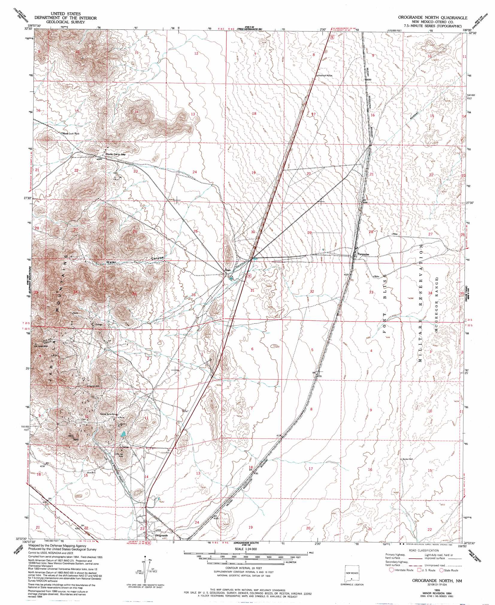
Orogrande North Topo Map New Mexico
To zoom in, hover over the map of Orogrande North
USGS Topo Quad 32106d1 - 1:24,000 scale
| Topo Map Name: | Orogrande North |
| USGS Topo Quad ID: | 32106d1 |
| Print Size: | ca. 21 1/4" wide x 27" high |
| Southeast Coordinates: | 32.375° N latitude / 106° W longitude |
| Map Center Coordinates: | 32.4375° N latitude / 106.0625° W longitude |
| U.S. State: | NM |
| Filename: | o32106d1.jpg |
| Download Map JPG Image: | Orogrande North topo map 1:24,000 scale |
| Map Type: | Topographic |
| Topo Series: | 7.5´ |
| Map Scale: | 1:24,000 |
| Source of Map Images: | United States Geological Survey (USGS) |
| Alternate Map Versions: |
Orogrande North NM 1947, updated 1948 Download PDF Buy paper map Orogrande North NM 1955, updated 1962 Download PDF Buy paper map Orogrande North NM 1955, updated 1985 Download PDF Buy paper map Orogrande North NM 1955, updated 1994 Download PDF Buy paper map Orogrande North NM 2010 Download PDF Buy paper map Orogrande North NM 2013 Download PDF Buy paper map Orogrande North NM 2017 Download PDF Buy paper map |
1:24,000 Topo Quads surrounding Orogrande North
Lake Lucero Ne |
Foster Lake |
Tres Hermanos |
Deadman Canyon |
Bug Scuffle Canyon |
Lake Lucero Se |
Tres Hermanos Sw |
Tres Hermanos Se |
Pipeline Canyon |
Culp Canyon |
White Sands Ne |
Elephant Mountain |
Orogrande North |
Wilde Tank |
Otero Mesa North |
White Sands Se |
Elwood |
Orogrande South |
Mack Tanks |
Otero Mesa South |
Newman Ne |
Desert |
Desert Ne |
Owl Tank Canyon West |
Owl Tank Canyon East |
> Back to 32106a1 at 1:100,000 scale
> Back to 32106a1 at 1:250,000 scale
> Back to U.S. Topo Maps home
Orogrande North topo map: Gazetteer
Orogrande North: Gaps
Monte Carlo Gap elevation 1314m 4311′Orogrande North: Mines
Alice Mine elevation 1307m 4288′Garnet Mine elevation 1422m 4665′
Iron Queen Mine elevation 1525m 5003′
Little Joe Mine elevation 1351m 4432′
Mannie Baird Mine elevation 1353m 4438′
Orogrande North: Populated Places
Turquoise elevation 1256m 4120′Orogrande North: Ranges
Jarilla Mountains elevation 1433m 4701′Orogrande North: Reservoirs
Hard Luck Tank elevation 1282m 4206′Orogrande North: Valleys
Water Canyon elevation 1280m 4199′Orogrande North: Wells
Benton Well elevation 1242m 4074′Orogrande North digital topo map on disk
Buy this Orogrande North topo map showing relief, roads, GPS coordinates and other geographical features, as a high-resolution digital map file on DVD: