Holly Ridge Topo Map Mississippi
To zoom in, hover over the map of Holly Ridge
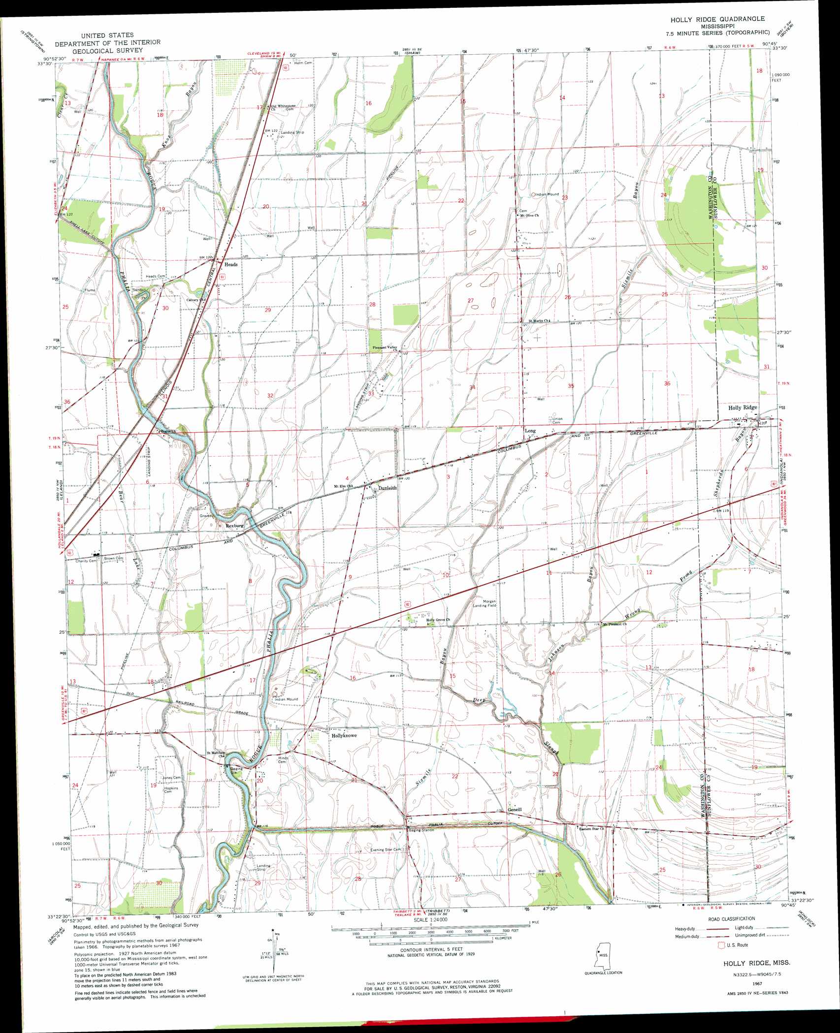
USGS Topo Quad 33090d7 - 1:24,000 scale
| Topo Map Name: | Holly Ridge |
| USGS Topo Quad ID: | 33090d7 |
| Print Size: | ca. 21 1/4" wide x 27" high |
| Southeast Coordinates: | 33.375° N latitude / 90.75° W longitude |
| Map Center Coordinates: | 33.4375° N latitude / 90.8125° W longitude |
| U.S. State: | MS |
| Filename: | o33090d7.jpg |
| Download Map JPG Image: | Holly Ridge topo map 1:24,000 scale |
| Map Type: | Topographic |
| Topo Series: | 7.5´ |
| Map Scale: | 1:24,000 |
| Source of Map Images: | United States Geological Survey (USGS) |
| Alternate Map Versions: |
Holly Ridge MS 1967, updated 1968 Download PDF Buy paper map Holly Ridge MS 1967, updated 1982 Download PDF Buy paper map Holly Ridge MS 2012 Download PDF Buy paper map Holly Ridge MS 2015 Download PDF Buy paper map |
1:24,000 Topo Quads surrounding Holly Ridge
Benoit |
Lobdell |
Skene |
Cleveland |
Ruleville |
Scott |
Stringtown |
Shaw |
Boyer |
Sunflower |
Greenville |
Leland |
Holly Ridge |
Indianola |
Moorhead |
Wayside |
Arcola |
Tribbett |
Kinlock |
Inverness |
Avon |
Swan Lake Nw |
Hollandale |
Midnight Nw |
Bellewood |
> Back to 33090a1 at 1:100,000 scale
> Back to 33090a1 at 1:250,000 scale
> Back to U.S. Topo Maps home
Holly Ridge topo map: Gazetteer
Holly Ridge: Canals
Bogue Phalia Cutoff elevation 29m 95′Holly Ridge: Populated Places
Dunleith elevation 34m 111′Geneill elevation 35m 114′
Heads elevation 37m 121′
Holly Ridge elevation 35m 114′
Hollyknowe elevation 36m 118′
Ingrams elevation 36m 118′
Long elevation 36m 118′
Rexburg elevation 37m 121′
Holly Ridge: Streams
Deep Slough elevation 29m 95′Johnson Bayou elevation 29m 95′
Knox Bayou elevation 32m 104′
Wrong Prong elevation 32m 104′
Holly Ridge digital topo map on disk
Buy this Holly Ridge topo map showing relief, roads, GPS coordinates and other geographical features, as a high-resolution digital map file on DVD: