New Union Topo Map Arkansas
To zoom in, hover over the map of New Union
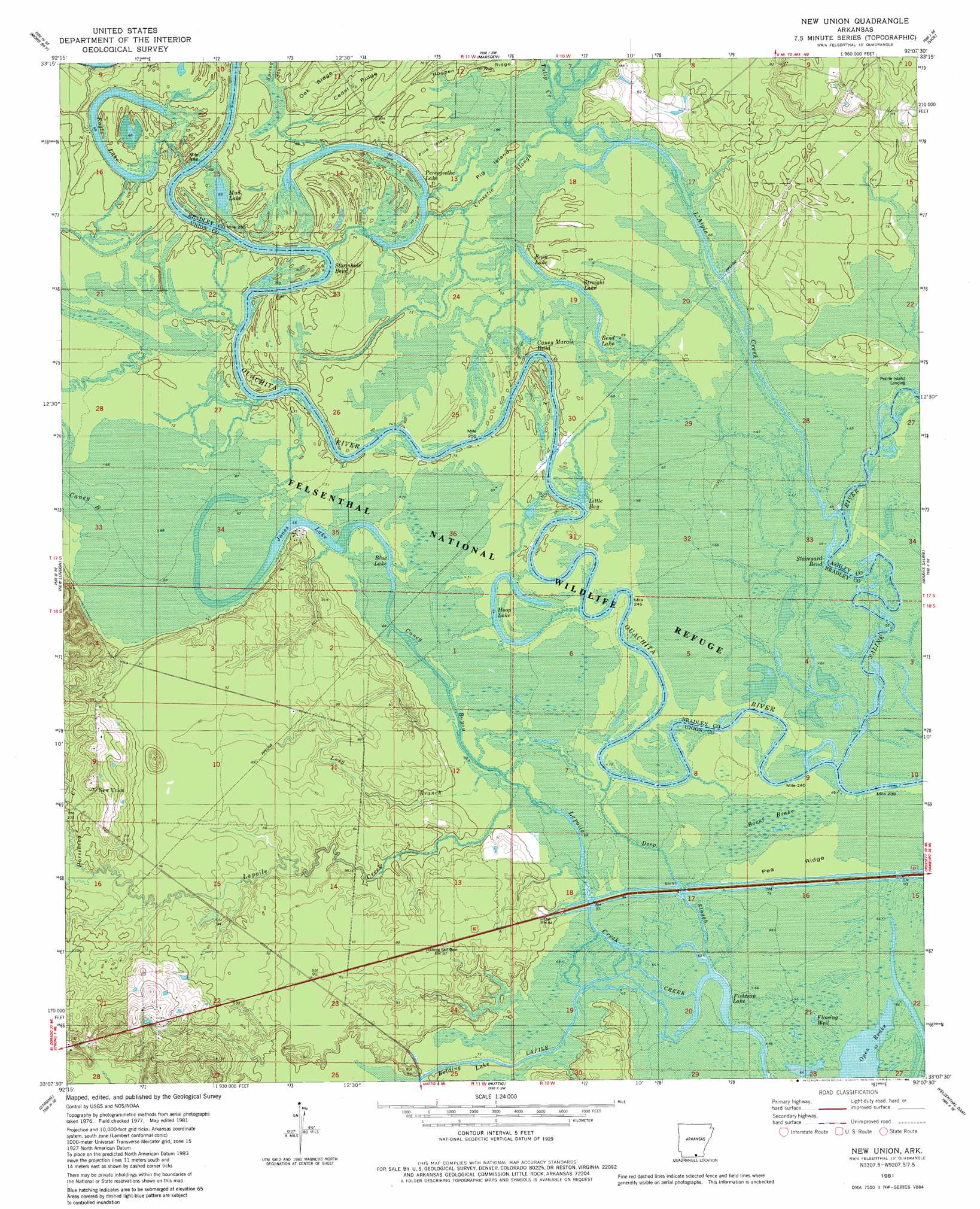
USGS Topo Quad 33092b2 - 1:24,000 scale
| Topo Map Name: | New Union |
| USGS Topo Quad ID: | 33092b2 |
| Print Size: | ca. 21 1/4" wide x 27" high |
| Southeast Coordinates: | 33.125° N latitude / 92.125° W longitude |
| Map Center Coordinates: | 33.1875° N latitude / 92.1875° W longitude |
| U.S. State: | AR |
| Filename: | o33092b2.jpg |
| Download Map JPG Image: | New Union topo map 1:24,000 scale |
| Map Type: | Topographic |
| Topo Series: | 7.5´ |
| Map Scale: | 1:24,000 |
| Source of Map Images: | United States Geological Survey (USGS) |
| Alternate Map Versions: |
New Union AR 1981, updated 1981 Download PDF Buy paper map New Union AR 1981, updated 1984 Download PDF Buy paper map New Union AR 2011 Download PDF Buy paper map New Union AR 2014 Download PDF Buy paper map |
1:24,000 Topo Quads surrounding New Union
Artesian |
Jersey |
Hermitage |
Sumpter |
Longview |
Harrell Brake |
Moro Bay |
Marsden |
Vick |
Milo |
Urbana |
New London |
New Union |
Marais Saline |
Crossett North |
Gardner |
Strong |
Huttig |
Felsenthal Dam |
Crossett South |
Truxno |
Marion West |
Marion East |
Fish Lake |
Beckman |
> Back to 33092a1 at 1:100,000 scale
> Back to 33092a1 at 1:250,000 scale
> Back to U.S. Topo Maps home
New Union topo map: Gazetteer
New Union: Bays
Little Bay elevation 21m 68′New Union: Bends
Caney Marais Bend elevation 21m 68′Staveyard Bend elevation 20m 65′
Stormhole Bend elevation 25m 82′
New Union: Guts
Crosstie Slough elevation 23m 75′Deep Slough elevation 20m 65′
New Union: Islands
Pig Island elevation 22m 72′Pine Island elevation 23m 75′
New Union: Lakes
Bend Lake elevation 20m 65′Blue Lake elevation 23m 75′
Bolding Lake elevation 23m 75′
Buck Lake elevation 22m 72′
Eagle Lake elevation 22m 72′
Eagle Lake elevation 21m 68′
Fishtrap Lake elevation 16m 52′
Frank Lake elevation 21m 68′
Hoop Lake elevation 22m 72′
Jones Lake elevation 22m 72′
Middle Lake elevation 22m 72′
Mud Lake elevation 21m 68′
Pereogeethe Lake elevation 24m 78′
Straight Lake elevation 22m 72′
New Union: Parks
Felsenthal National Wildlife Refuge elevation 21m 68′New Union: Populated Places
New Union elevation 39m 127′New Union: Ridges
Cedar Ridge elevation 26m 85′Hogpen Ridge elevation 25m 82′
Oak Ridge elevation 27m 88′
Pea Ridge elevation 20m 65′
New Union: Streams
Caney Bayou elevation 22m 72′Horsehead Creek elevation 31m 101′
Lagle Creek elevation 20m 65′
L'Aigle Creek elevation 22m 72′
Lapoile Creek elevation 22m 72′
Long Branch elevation 22m 72′
Saline River elevation 19m 62′
Tulip Creek elevation 22m 72′
New Union: Swamps
Boeut Brake elevation 20m 65′New Union digital topo map on disk
Buy this New Union topo map showing relief, roads, GPS coordinates and other geographical features, as a high-resolution digital map file on DVD: