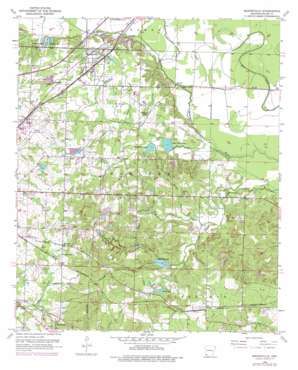
Mandeville Topo Map Arkansas
To zoom in, hover over the map of Mandeville
USGS Topo Quad 33093d8 - 1:24,000 scale
| Topo Map Name: | Mandeville |
| USGS Topo Quad ID: | 33093d8 |
| Print Size: | ca. 21 1/4" wide x 27" high |
| Southeast Coordinates: | 33.375° N latitude / 93.875° W longitude |
| Map Center Coordinates: | 33.4375° N latitude / 93.9375° W longitude |
| U.S. State: | AR |
| Filename: | o33093d8.jpg |
| Download Map JPG Image: | Mandeville topo map 1:24,000 scale |
| Map Type: | Topographic |
| Topo Series: | 7.5´ |
| Map Scale: | 1:24,000 |
| Source of Map Images: | United States Geological Survey (USGS) |
| Alternate Map Versions: |
Mandeville AR 1952, updated 1953 Download PDF Buy paper map Mandeville AR 1952, updated 1971 Download PDF Buy paper map Mandeville AR 1952, updated 1976 Download PDF Buy paper map Mandeville AR 2011 Download PDF Buy paper map Mandeville AR 2014 Download PDF Buy paper map |
1:24,000 Topo Quads surrounding Mandeville
> Back to 33093a1 at 1:100,000 scale
> Back to 33092a1 at 1:250,000 scale
> Back to U.S. Topo Maps home
Mandeville topo map: Gazetteer
Mandeville: Airports
Macks Airport elevation 100m 328′Texarkana Regional Airport elevation 114m 374′
Mandeville: Dams
Boyce Lake Dam elevation 97m 318′Buford Lake Dam elevation 95m 311′
Coca Cola Lake Dam elevation 91m 298′
Cox Lake Dam elevation 89m 291′
Gill Lake Dam elevation 91m 298′
Old Bitty Lake Dam elevation 110m 360′
Robinson Lake Dam elevation 90m 295′
Smith Lake Dam elevation 109m 357′
Upper Moore Lake Dam elevation 82m 269′
Williams Lake Dam elevation 86m 282′
Wooten Lake Dam elevation 115m 377′
Mandeville: Populated Places
Genoa elevation 111m 364′Gertrude elevation 114m 374′
Lakewood Estates elevation 117m 383′
Mandeville elevation 100m 328′
Mount Pleasant elevation 112m 367′
Rondo elevation 107m 351′
Wona (historical) elevation 125m 410′
Mandeville: Post Offices
Genoa Post Office elevation 114m 374′Mandeville: Reservoirs
Boyce Lake elevation 97m 318′Buford Lake elevation 95m 311′
Coca Cola Lake elevation 91m 298′
Cox Lake elevation 89m 291′
Gill Lake elevation 91m 298′
Lower Moore Lake elevation 78m 255′
Old Bitty Lake elevation 110m 360′
Robinson Lake elevation 90m 295′
Smith Lake elevation 109m 357′
Upper Moore Lake elevation 82m 269′
Wadley Lake elevation 85m 278′
Williams Lake elevation 86m 282′
Wooten Lake elevation 115m 377′
Mandeville: Streams
Comer Branch elevation 81m 265′Forky Deer Creek elevation 82m 269′
Morgan Branch elevation 85m 278′
Tennessee Branch elevation 86m 282′
Turkey Creek elevation 77m 252′
Mandeville digital topo map on disk
Buy this Mandeville topo map showing relief, roads, GPS coordinates and other geographical features, as a high-resolution digital map file on DVD:


