Southwest Lake Kemp Topo Map Texas
To zoom in, hover over the map of Southwest Lake Kemp
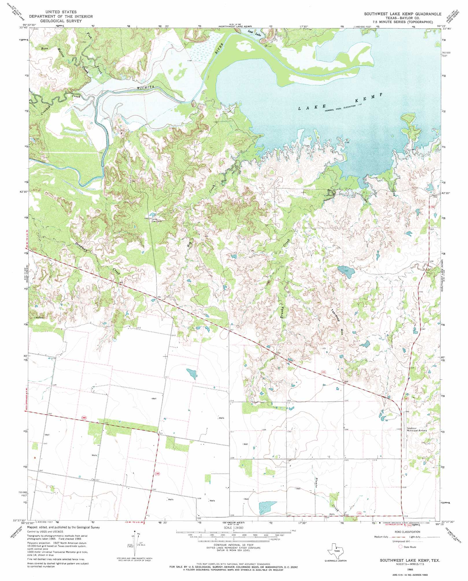
USGS Topo Quad 33099f3 - 1:24,000 scale
| Topo Map Name: | Southwest Lake Kemp |
| USGS Topo Quad ID: | 33099f3 |
| Print Size: | ca. 21 1/4" wide x 27" high |
| Southeast Coordinates: | 33.625° N latitude / 99.25° W longitude |
| Map Center Coordinates: | 33.6875° N latitude / 99.3125° W longitude |
| U.S. State: | TX |
| Filename: | o33099f3.jpg |
| Download Map JPG Image: | Southwest Lake Kemp topo map 1:24,000 scale |
| Map Type: | Topographic |
| Topo Series: | 7.5´ |
| Map Scale: | 1:24,000 |
| Source of Map Images: | United States Geological Survey (USGS) |
| Alternate Map Versions: |
Southwest Lake Kemp TX 1966, updated 1969 Download PDF Buy paper map Southwest Lake Kemp TX 2010 Download PDF Buy paper map Southwest Lake Kemp TX 2013 Download PDF Buy paper map Southwest Lake Kemp TX 2016 Download PDF Buy paper map |
1:24,000 Topo Quads surrounding Southwest Lake Kemp
Thalia |
Santa Rosa Lake Nw |
Santa Rosa Lake |
Grayback |
Lake Electra |
Colwell Creek |
Santa Rosa Lake Sw |
Northwest Lake Kemp |
Northeast Lake Kemp |
Franklin Bend |
Vera |
Soap Creek |
Southwest Lake Kemp |
Southeast Lake Kemp |
Fulda |
Hefner |
Bomarton |
Seymour West |
Seymour East |
Cope Branch |
Munday East |
Antelope Creek Nw |
Antelope Creek Ne |
Rock Canyon |
Westover |
> Back to 33099e1 at 1:100,000 scale
> Back to 33098a1 at 1:250,000 scale
> Back to U.S. Topo Maps home
Southwest Lake Kemp topo map: Gazetteer
Southwest Lake Kemp: Airports
Seymour Municipal Airport elevation 409m 1341′Southwest Lake Kemp: Lakes
Lost Lake elevation 351m 1151′Southwest Lake Kemp: Streams
Brushy Creek elevation 349m 1145′Crooked Creek elevation 350m 1148′
Fish Creek elevation 348m 1141′
Hog Creek elevation 348m 1141′
Rose Hollow Creek elevation 351m 1151′
Southwest Lake Kemp: Summits
Tabletop Mountain elevation 415m 1361′Southwest Lake Kemp digital topo map on disk
Buy this Southwest Lake Kemp topo map showing relief, roads, GPS coordinates and other geographical features, as a high-resolution digital map file on DVD: