Kenna Sw Topo Map New Mexico
To zoom in, hover over the map of Kenna Sw
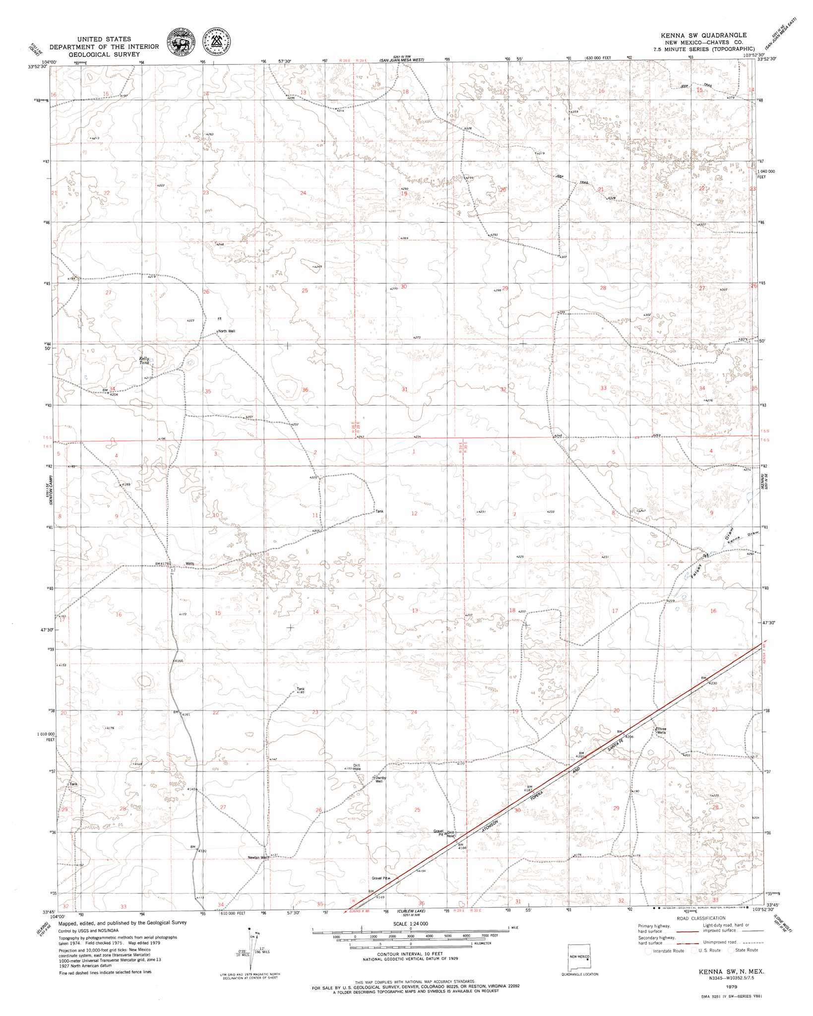
USGS Topo Quad 33103g8 - 1:24,000 scale
| Topo Map Name: | Kenna Sw |
| USGS Topo Quad ID: | 33103g8 |
| Print Size: | ca. 21 1/4" wide x 27" high |
| Southeast Coordinates: | 33.75° N latitude / 103.875° W longitude |
| Map Center Coordinates: | 33.8125° N latitude / 103.9375° W longitude |
| U.S. State: | NM |
| Filename: | o33103g8.jpg |
| Download Map JPG Image: | Kenna Sw topo map 1:24,000 scale |
| Map Type: | Topographic |
| Topo Series: | 7.5´ |
| Map Scale: | 1:24,000 |
| Source of Map Images: | United States Geological Survey (USGS) |
| Alternate Map Versions: |
Kenna SW NM 1979, updated 1979 Download PDF Buy paper map Kenna SW NM 2010 Download PDF Buy paper map Kenna SW NM 2013 Download PDF Buy paper map Kenna SW NM 2017 Download PDF Buy paper map |
1:24,000 Topo Quads surrounding Kenna Sw
Cooley Lake |
Howell Ranch |
Rippee Ranch |
Gammil Well Se |
Lewiston Lake |
Hernandez Lake |
Olive |
San Juan Mesa West |
San Juan Mesa East |
Elida |
Haystack Butte |
Denton Camp |
Kenna Sw |
Kenna |
Schram Lake |
Haystack Mountain |
Elkins |
Curlew Lake |
Lone Wolf |
Button Mesa North |
Campbell |
Sardine Lake |
Presler Lake |
Curlew Lake Se |
Button Mesa South |
> Back to 33103e1 at 1:100,000 scale
> Back to 33102a1 at 1:250,000 scale
> Back to U.S. Topo Maps home
Kenna Sw topo map: Gazetteer
Kenna Sw: Reservoirs
Kelly Tank elevation 1279m 4196′Kenna Sw: Valleys
Falsey Draw elevation 1291m 4235′Kenna Draw elevation 1298m 4258′
Kenna Sw: Wells
Newlan Well elevation 1260m 4133′North Well elevation 1289m 4229′
Ownby Well elevation 1267m 4156′
Three Wells elevation 1284m 4212′
Kenna Sw digital topo map on disk
Buy this Kenna Sw topo map showing relief, roads, GPS coordinates and other geographical features, as a high-resolution digital map file on DVD: