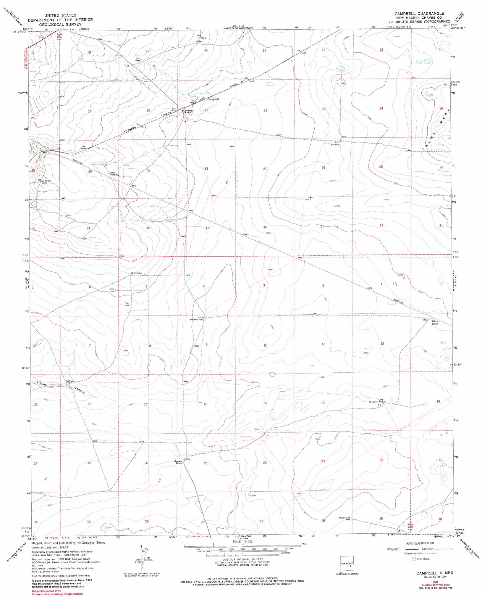
Campbell Topo Map New Mexico
To zoom in, hover over the map of Campbell
USGS Topo Quad 33104e2 - 1:24,000 scale
| Topo Map Name: | Campbell |
| USGS Topo Quad ID: | 33104e2 |
| Print Size: | ca. 21 1/4" wide x 27" high |
| Southeast Coordinates: | 33.5° N latitude / 104.125° W longitude |
| Map Center Coordinates: | 33.5625° N latitude / 104.1875° W longitude |
| U.S. State: | NM |
| Filename: | o33104e2.jpg |
| Download Map JPG Image: | Campbell topo map 1:24,000 scale |
| Map Type: | Topographic |
| Topo Series: | 7.5´ |
| Map Scale: | 1:24,000 |
| Source of Map Images: | United States Geological Survey (USGS) |
| Alternate Map Versions: |
Campbell NM 1967, updated 1971 Download PDF Buy paper map Campbell NM 1967, updated 1985 Download PDF Buy paper map Campbell NM 2010 Download PDF Buy paper map Campbell NM 2013 Download PDF Buy paper map Campbell NM 2017 Download PDF Buy paper map |
1:24,000 Topo Quads surrounding Campbell
Shannon Draw |
Cottonwood Draw |
Haystack Butte |
Denton Camp |
Kenna Sw |
Coyote Draw |
Eightmile Draw |
Haystack Mountain |
Elkins |
Curlew Lake |
Melena |
Acme |
Campbell |
Sardine Lake |
Presler Lake |
Bitter Lake |
Comanche Spring |
L E Ranch |
Sardine Mountain |
Oasis |
South Spring |
Bottomless Lakes |
Wade Ranch |
Malstrom Ranch |
Culp Ranch |
> Back to 33104e1 at 1:100,000 scale
> Back to 33104a1 at 1:250,000 scale
> Back to U.S. Topo Maps home
Campbell topo map: Gazetteer
Campbell: Populated Places
Campbell elevation 1186m 3891′Campbell: Reservoirs
White Tank elevation 1186m 3891′Campbell: Wells
East Windmill Well elevation 1182m 3877′North Windmill Well elevation 1171m 3841′
Campbell digital topo map on disk
Buy this Campbell topo map showing relief, roads, GPS coordinates and other geographical features, as a high-resolution digital map file on DVD: