Howell Ranch Topo Map New Mexico
To zoom in, hover over the map of Howell Ranch
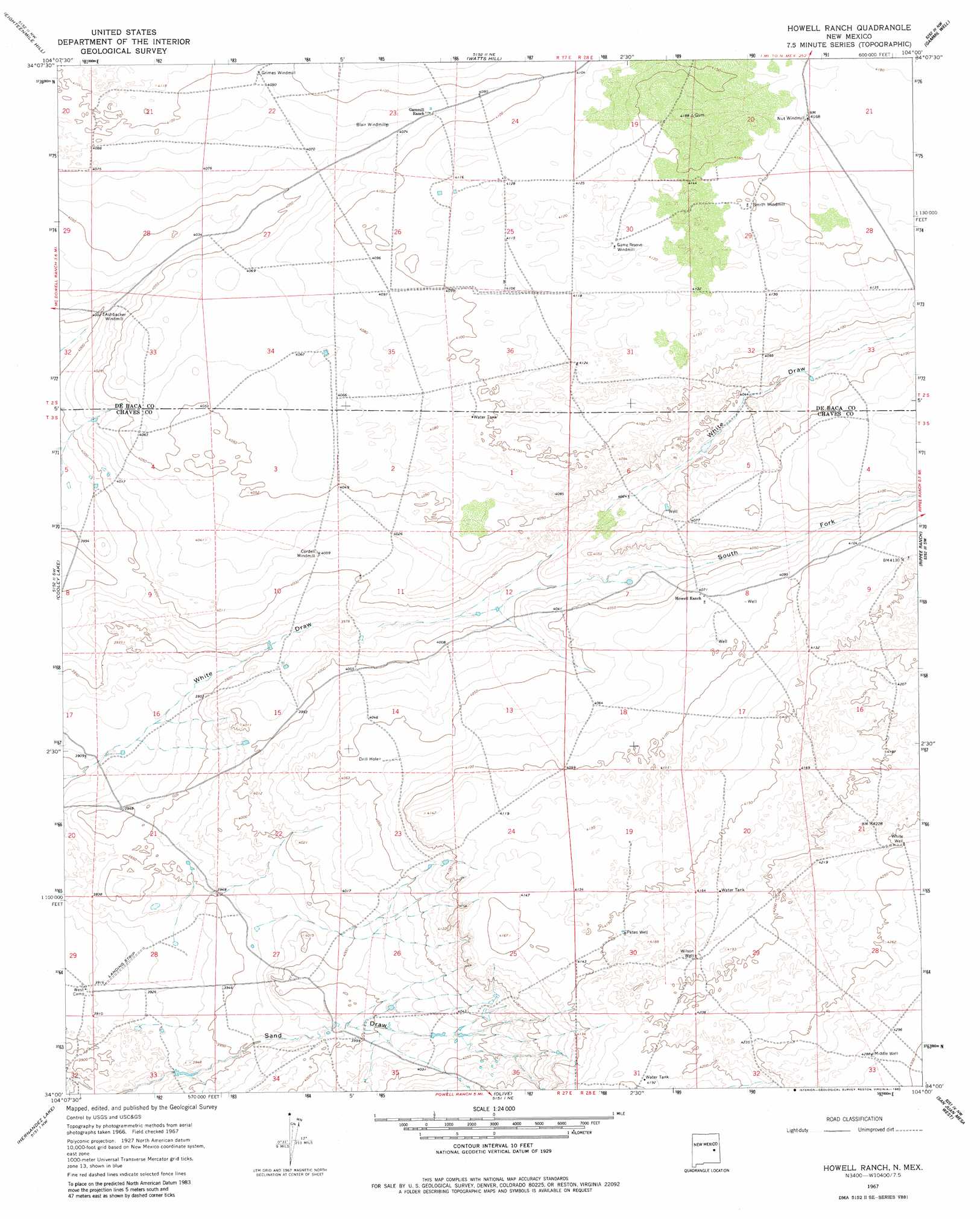
USGS Topo Quad 34104a1 - 1:24,000 scale
| Topo Map Name: | Howell Ranch |
| USGS Topo Quad ID: | 34104a1 |
| Print Size: | ca. 21 1/4" wide x 27" high |
| Southeast Coordinates: | 34° N latitude / 104° W longitude |
| Map Center Coordinates: | 34.0625° N latitude / 104.0625° W longitude |
| U.S. State: | NM |
| Filename: | o34104a1.jpg |
| Download Map JPG Image: | Howell Ranch topo map 1:24,000 scale |
| Map Type: | Topographic |
| Topo Series: | 7.5´ |
| Map Scale: | 1:24,000 |
| Source of Map Images: | United States Geological Survey (USGS) |
| Alternate Map Versions: |
Howell Ranch NM 1967, updated 1971 Download PDF Buy paper map Howell Ranch NM 1967, updated 1980 Download PDF Buy paper map Howell Ranch NM 2010 Download PDF Buy paper map Howell Ranch NM 2013 Download PDF Buy paper map Howell Ranch NM 2017 Download PDF Buy paper map |
1:24,000 Topo Quads surrounding Howell Ranch
Alamo Ranch |
Bonner Lake |
Lomas Gatos |
Tolar Sw |
Tolar Se |
Conejo Creek East |
Eighteenmile Hill |
Watts Hill |
Gammil Well |
Gammil Well Ne |
La Espia Peak |
Cooley Lake |
Howell Ranch |
Rippee Ranch |
Gammil Well Se |
Deering Place |
Hernandez Lake |
Olive |
San Juan Mesa West |
San Juan Mesa East |
Cottonwood Draw |
Haystack Butte |
Denton Camp |
Kenna Sw |
Kenna |
> Back to 34104a1 at 1:100,000 scale
> Back to 34104a1 at 1:250,000 scale
> Back to U.S. Topo Maps home
Howell Ranch topo map: Gazetteer
Howell Ranch: Airports
Bojax Ranch Airport elevation 1196m 3923′Howell Ranch: Valleys
South Fork White Draw elevation 1217m 3992′Howell Ranch: Wells
Middle Well elevation 1307m 4288′Petes Well elevation 1268m 4160′
White Well elevation 1298m 4258′
Wilson Well elevation 1275m 4183′
Howell Ranch digital topo map on disk
Buy this Howell Ranch topo map showing relief, roads, GPS coordinates and other geographical features, as a high-resolution digital map file on DVD: