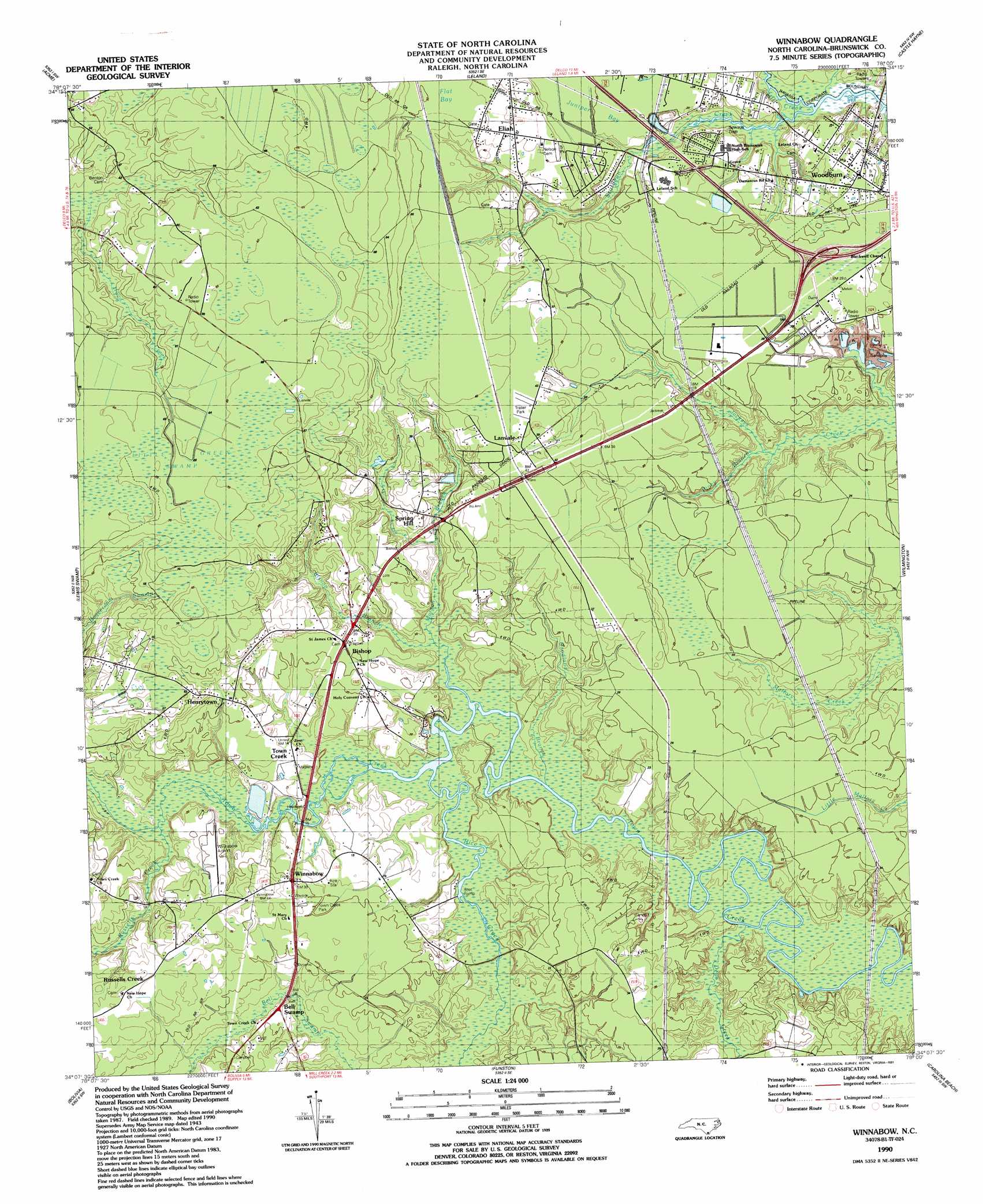
Winnabow Topo Map North Carolina
To zoom in, hover over the map of Winnabow
USGS Topo Quad 34078b1 - 1:24,000 scale
| Topo Map Name: | Winnabow |
| USGS Topo Quad ID: | 34078b1 |
| Print Size: | ca. 21 1/4" wide x 27" high |
| Southeast Coordinates: | 34.125° N latitude / 78° W longitude |
| Map Center Coordinates: | 34.1875° N latitude / 78.0625° W longitude |
| U.S. State: | NC |
| Filename: | o34078b1.jpg |
| Download Map JPG Image: | Winnabow topo map 1:24,000 scale |
| Map Type: | Topographic |
| Topo Series: | 7.5´ |
| Map Scale: | 1:24,000 |
| Source of Map Images: | United States Geological Survey (USGS) |
| Alternate Map Versions: |
Winnabow NC 1943, updated 1962 Download PDF Buy paper map Winnabow NC 1943, updated 1976 Download PDF Buy paper map Winnabow NC 1980, updated 1985 Download PDF Buy paper map Winnabow NC 1990, updated 1991 Download PDF Buy paper map Winnabow NC 1990, updated 1991 Download PDF Buy paper map Winnabow NC 2010 Download PDF Buy paper map Winnabow NC 2013 Download PDF Buy paper map Winnabow NC 2016 Download PDF Buy paper map |
1:24,000 Topo Quads surrounding Winnabow
Kelly |
Point Caswell |
Currie |
Rocky Point |
Mooretown |
Freeman |
Acme |
Leland |
Castle Hayne |
Scotts Hill |
Honey Island |
Lewis Swamp |
Winnabow |
Wilmington |
Wrightsville Beach |
Supply |
Bolivia |
Funston |
Carolina Beach |
|
Holden Beach |
Lockwoods Folly |
Southport |
Kure Beach |
> Back to 34078a1 at 1:100,000 scale
> Back to 34078a1 at 1:250,000 scale
> Back to U.S. Topo Maps home
Winnabow topo map: Gazetteer
Winnabow: Airports
Winnabow Airport elevation 7m 22′Winnabow: Bridges
Rice Creek Bridge elevation 0m 0′Sturgeon Creek Bridge elevation 1m 3′
Winnabow: Parks
Town Creek Park elevation 9m 29′Winnabow: Populated Places
Bell Swamp elevation 6m 19′Bishop elevation 7m 22′
Easy Hill elevation 8m 26′
Eliah elevation 12m 39′
Henrytown elevation 15m 49′
Lanvale elevation 12m 39′
Russells Creek elevation 11m 36′
Spring Hill elevation 6m 19′
Town Creek elevation 6m 19′
Winnabow elevation 8m 26′
Woodburn elevation 6m 19′
Winnabow: Post Offices
Leland Post Office elevation 7m 22′Winnabow: Streams
Bishop Branch elevation 0m 0′Dews Creek elevation 0m 0′
Goodland Branch elevation 1m 3′
Mill Creek elevation 0m 0′
Mill Creek elevation 0m 0′
Morgan Branch elevation 0m 0′
Piney Branch elevation 1m 3′
Rice Creek elevation 0m 0′
Russells Creek elevation 0m 0′
Winnabow digital topo map on disk
Buy this Winnabow topo map showing relief, roads, GPS coordinates and other geographical features, as a high-resolution digital map file on DVD:
South Carolina, Western North Carolina & Northeastern Georgia
Buy digital topo maps: South Carolina, Western North Carolina & Northeastern Georgia