Fairmont Topo Map North Carolina
To zoom in, hover over the map of Fairmont
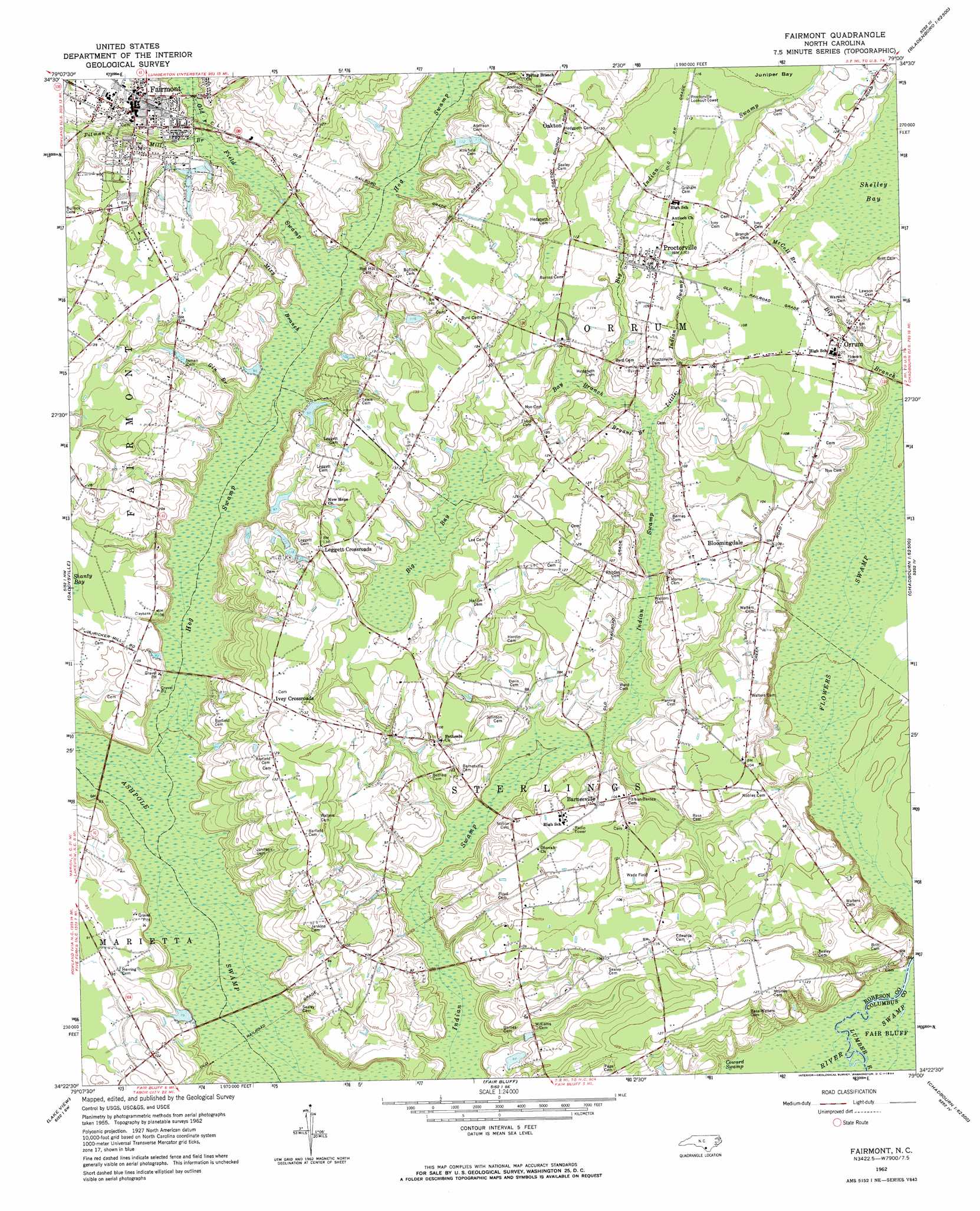
USGS Topo Quad 34079d1 - 1:24,000 scale
| Topo Map Name: | Fairmont |
| USGS Topo Quad ID: | 34079d1 |
| Print Size: | ca. 21 1/4" wide x 27" high |
| Southeast Coordinates: | 34.375° N latitude / 79° W longitude |
| Map Center Coordinates: | 34.4375° N latitude / 79.0625° W longitude |
| U.S. State: | NC |
| Filename: | o34079d1.jpg |
| Download Map JPG Image: | Fairmont topo map 1:24,000 scale |
| Map Type: | Topographic |
| Topo Series: | 7.5´ |
| Map Scale: | 1:24,000 |
| Source of Map Images: | United States Geological Survey (USGS) |
| Alternate Map Versions: |
Fairmont NC 1962, updated 1964 Download PDF Buy paper map Fairmont NC 1976, updated 1978 Download PDF Buy paper map Fairmont NC 2010 Download PDF Buy paper map Fairmont NC 2013 Download PDF Buy paper map Fairmont NC 2016 Download PDF Buy paper map |
1:24,000 Topo Quads surrounding Fairmont
Maxton |
Pembroke |
Northwest Lumberton |
Northeast Lumberton |
Tar Heel |
Rowland |
Mcdonald |
Southwest Lumberton |
Southeast Lumberton |
Bladenboro |
Dillon East |
Gaddysville |
Fairmont |
Evergreen |
Chadbourn Ne |
Fork |
Lake View |
Fair Bluff |
Cerro Gordo |
Chadbourn |
Mullins |
Nichols |
Duford |
Tabor City West |
Tabor City East |
> Back to 34079a1 at 1:100,000 scale
> Back to 34078a1 at 1:250,000 scale
> Back to U.S. Topo Maps home
Fairmont topo map: Gazetteer
Fairmont: Dams
Leggett Lake Dam elevation 27m 88′Fairmont: Populated Places
Barnesville elevation 31m 101′Bloomingdale elevation 32m 104′
Fairmont elevation 38m 124′
Ivey Crossroads elevation 39m 127′
Leggett Crossroads elevation 41m 134′
Oakton elevation 41m 134′
Orrum elevation 31m 101′
Proctorville elevation 35m 114′
Fairmont: Reservoirs
Leggett Lake elevation 27m 88′Fairmont: Streams
Big Branch elevation 24m 78′Big Indian Swamp elevation 28m 91′
Bryant Branch elevation 27m 88′
Gin Branch elevation 27m 88′
Little Indian Swamp elevation 27m 88′
McColl Branch elevation 32m 104′
Miry Branch elevation 25m 82′
Pitman Mill Branch elevation 27m 88′
Red Hill Branch elevation 27m 88′
Fairmont: Swamps
Bay Branch elevation 31m 101′Big Bay elevation 34m 111′
Flowers Swamp elevation 23m 75′
Hog Swamp elevation 27m 88′
Shelley Bay elevation 33m 108′
Fairmont digital topo map on disk
Buy this Fairmont topo map showing relief, roads, GPS coordinates and other geographical features, as a high-resolution digital map file on DVD:
South Carolina, Western North Carolina & Northeastern Georgia
Buy digital topo maps: South Carolina, Western North Carolina & Northeastern Georgia