Humphrey Topo Map Arkansas
To zoom in, hover over the map of Humphrey
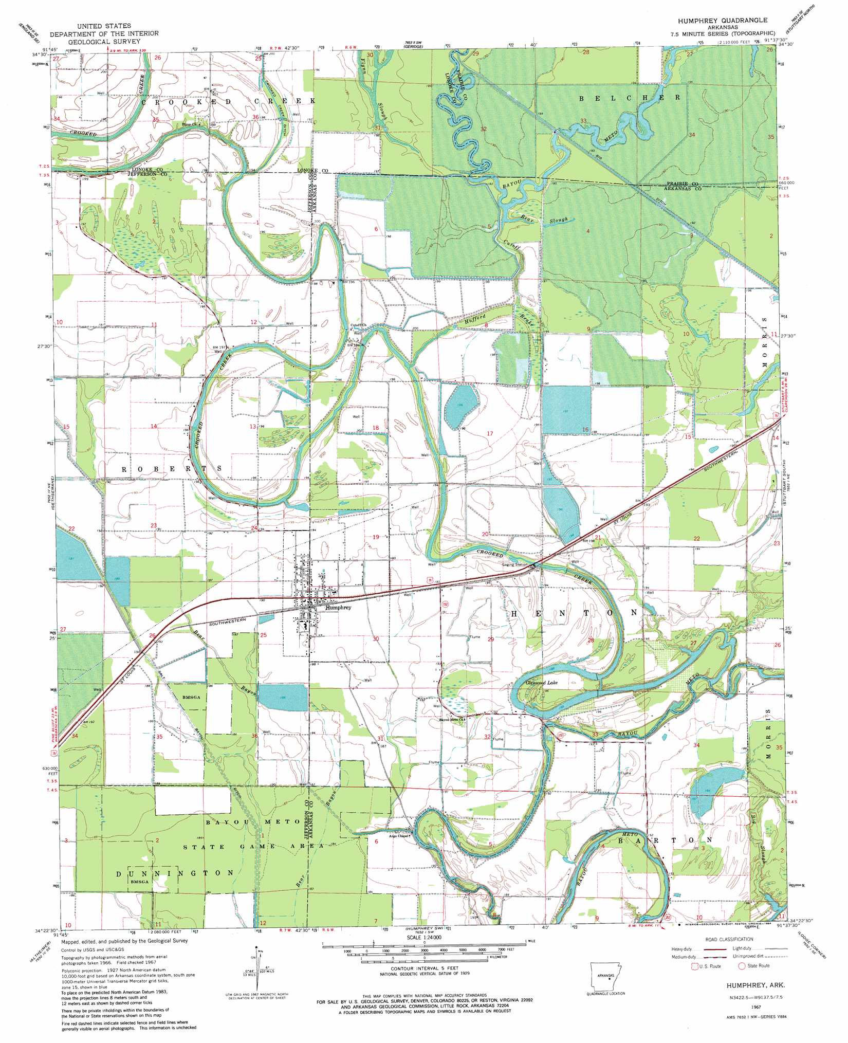
USGS Topo Quad 34091d6 - 1:24,000 scale
| Topo Map Name: | Humphrey |
| USGS Topo Quad ID: | 34091d6 |
| Print Size: | ca. 21 1/4" wide x 27" high |
| Southeast Coordinates: | 34.375° N latitude / 91.625° W longitude |
| Map Center Coordinates: | 34.4375° N latitude / 91.6875° W longitude |
| U.S. State: | AR |
| Filename: | o34091d6.jpg |
| Download Map JPG Image: | Humphrey topo map 1:24,000 scale |
| Map Type: | Topographic |
| Topo Series: | 7.5´ |
| Map Scale: | 1:24,000 |
| Source of Map Images: | United States Geological Survey (USGS) |
| Alternate Map Versions: |
Humphrey AR 1967, updated 1969 Download PDF Buy paper map Humphrey AR 1967, updated 1984 Download PDF Buy paper map Humphrey AR 1967, updated 1984 Download PDF Buy paper map Humphrey AR 2011 Download PDF Buy paper map Humphrey AR 2014 Download PDF Buy paper map |
1:24,000 Topo Quads surrounding Humphrey
Pettus |
Culler |
Parkers Corner |
Slovak |
Roe |
England |
Humnoke |
Geridge |
Stuttgart North |
Ulm |
Sherrill |
Gethsemane |
Humphrey |
Stuttgart South |
Almyra |
Rob Roy |
Altheimer |
Humphrey Sw |
Lodge Corner |
De Witt Sw |
Ladd |
Moscow |
Cornerstone |
Reydell |
One Horse Store |
> Back to 34091a1 at 1:100,000 scale
> Back to 34090a1 at 1:250,000 scale
> Back to U.S. Topo Maps home
Humphrey topo map: Gazetteer
Humphrey: Canals
Lateral Number 3 elevation 57m 187′Lateral Number 5 elevation 59m 193′
Lateral Number 7 elevation 59m 193′
Salt Bayou Drainage Ditch elevation 58m 190′
Humphrey: Dams
Randolph Reservoir Dam elevation 58m 190′Humphrey: Guts
Bear Slough elevation 61m 200′Big Slough elevation 60m 196′
Cutoff elevation 61m 200′
Flynn Slough elevation 60m 196′
Hufford Brake elevation 59m 193′
Humphrey: Lakes
Glenwood Lake elevation 58m 190′Humphrey: Populated Places
Humphrey elevation 59m 193′Kratnek (historical) elevation 60m 196′
Roberts (historical) elevation 61m 200′
Humphrey: Reservoirs
Randolph Reservoir elevation 58m 190′Humphrey: Streams
Crooked Creek elevation 57m 187′Humphrey digital topo map on disk
Buy this Humphrey topo map showing relief, roads, GPS coordinates and other geographical features, as a high-resolution digital map file on DVD: