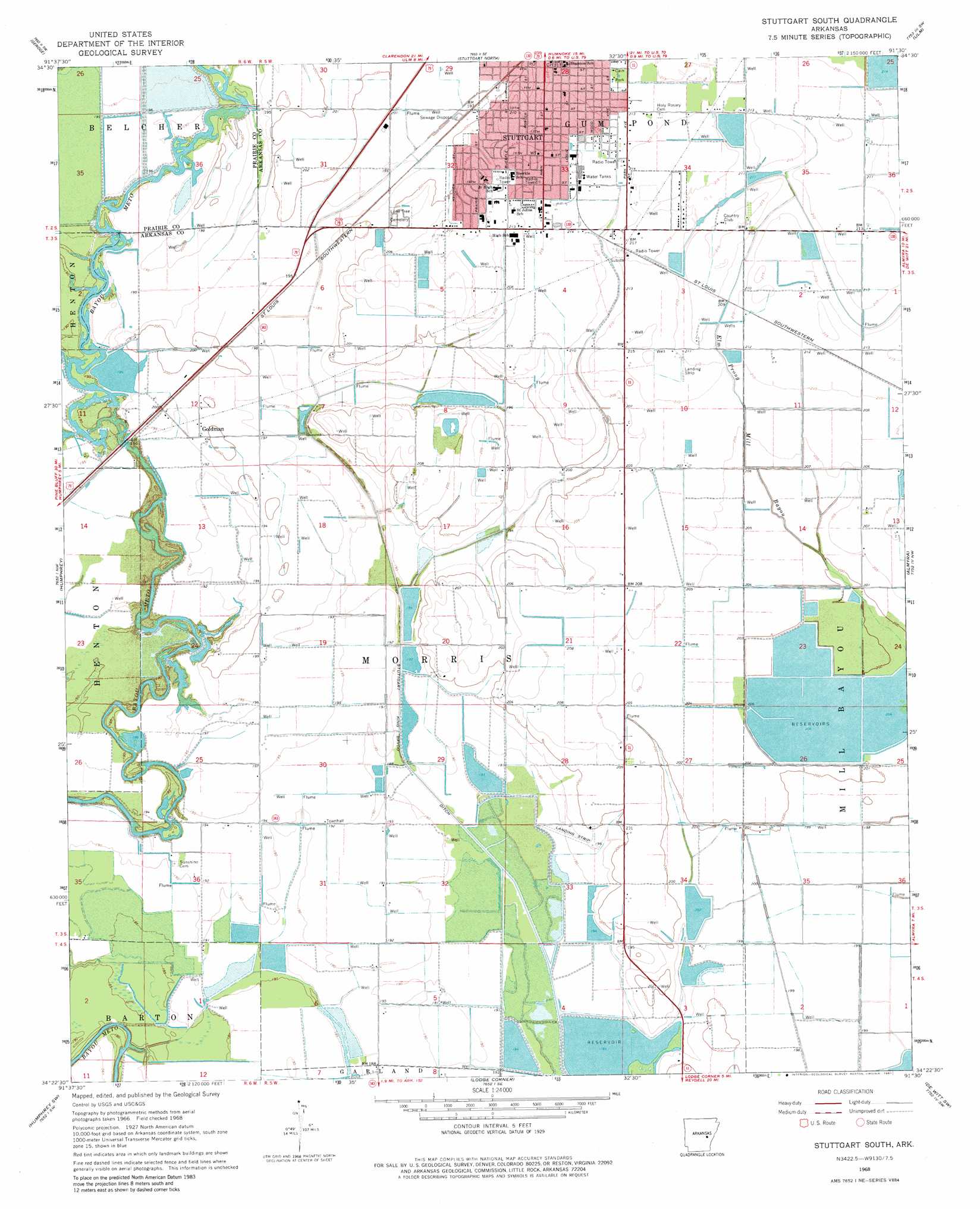
Stuttgart South Topo Map Arkansas
To zoom in, hover over the map of Stuttgart South
USGS Topo Quad 34091d5 - 1:24,000 scale
| Topo Map Name: | Stuttgart South |
| USGS Topo Quad ID: | 34091d5 |
| Print Size: | ca. 21 1/4" wide x 27" high |
| Southeast Coordinates: | 34.375° N latitude / 91.5° W longitude |
| Map Center Coordinates: | 34.4375° N latitude / 91.5625° W longitude |
| U.S. State: | AR |
| Filename: | o34091d5.jpg |
| Download Map JPG Image: | Stuttgart South topo map 1:24,000 scale |
| Map Type: | Topographic |
| Topo Series: | 7.5´ |
| Map Scale: | 1:24,000 |
| Source of Map Images: | United States Geological Survey (USGS) |
| Alternate Map Versions: |
Stuttgart South AR 1968, updated 1969 Download PDF Buy paper map Stuttgart South AR 1968, updated 1981 Download PDF Buy paper map Stuttgart South AR 2011 Download PDF Buy paper map Stuttgart South AR 2014 Download PDF Buy paper map |
1:24,000 Topo Quads surrounding Stuttgart South
Culler |
Parkers Corner |
Slovak |
Roe |
Clarendon |
Humnoke |
Geridge |
Stuttgart North |
Ulm |
Aberdeen |
Gethsemane |
Humphrey |
Stuttgart South |
Almyra |
De Witt Ne |
Altheimer |
Humphrey Sw |
Lodge Corner |
De Witt Sw |
De Witt |
Moscow |
Cornerstone |
Reydell |
One Horse Store |
Tichnor |
> Back to 34091a1 at 1:100,000 scale
> Back to 34090a1 at 1:250,000 scale
> Back to U.S. Topo Maps home
Stuttgart South topo map: Gazetteer
Stuttgart South: Canals
Stuttgart King Bayou elevation 57m 187′Stuttgart South: Parks
Cain Park elevation 65m 213′Stuttgart South: Populated Places
Abeles (historical) elevation 59m 193′Goldman elevation 63m 206′
Ricusky elevation 67m 219′
South Stuttgart elevation 65m 213′
Stuttgart South: Post Offices
Stuttgart Post Office elevation 63m 206′Stuttgart South: Reservoirs
Tindall Reservoir elevation 62m 203′Stuttgart South: Streams
Clearpoint Creek elevation 58m 190′Stuttgart South digital topo map on disk
Buy this Stuttgart South topo map showing relief, roads, GPS coordinates and other geographical features, as a high-resolution digital map file on DVD: