Coalgate Se Topo Map Oklahoma
To zoom in, hover over the map of Coalgate Se
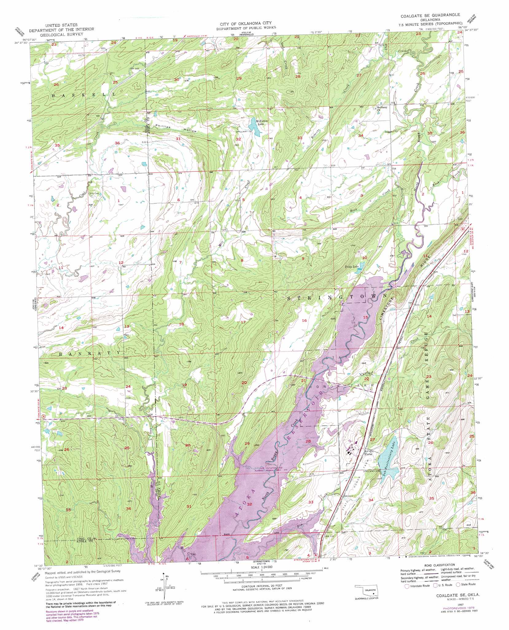
USGS Topo Quad 34096e1 - 1:24,000 scale
| Topo Map Name: | Coalgate Se |
| USGS Topo Quad ID: | 34096e1 |
| Print Size: | ca. 21 1/4" wide x 27" high |
| Southeast Coordinates: | 34.5° N latitude / 96° W longitude |
| Map Center Coordinates: | 34.5625° N latitude / 96.0625° W longitude |
| U.S. State: | OK |
| Filename: | o34096e1.jpg |
| Download Map JPG Image: | Coalgate Se topo map 1:24,000 scale |
| Map Type: | Topographic |
| Topo Series: | 7.5´ |
| Map Scale: | 1:24,000 |
| Source of Map Images: | United States Geological Survey (USGS) |
| Alternate Map Versions: |
Coalgate SE OK 1957, updated 1958 Download PDF Buy paper map Coalgate SE OK 1957, updated 1978 Download PDF Buy paper map Coalgate SE OK 1957, updated 1979 Download PDF Buy paper map Coalgate SE OK 2010 Download PDF Buy paper map Coalgate SE OK 2012 Download PDF Buy paper map Coalgate SE OK 2016 Download PDF Buy paper map |
1:24,000 Topo Quads surrounding Coalgate Se
Gerty |
Non |
Ashland |
Mcalester Sw |
Savanna |
Tupelo Ne |
Parker |
Wardville |
Kiowa |
Pittsburg |
Centrahoma |
Coalgate |
Coalgate Se |
Limestone Gap |
Redden |
Olney |
Lehigh |
Stringtown |
Lane Nw |
Lane Ne |
Boggy Depot |
Tushka |
Bruno |
Lane |
Farris |
> Back to 34096e1 at 1:100,000 scale
> Back to 34096a1 at 1:250,000 scale
> Back to U.S. Topo Maps home
Coalgate Se topo map: Gazetteer
Coalgate Se: Dams
Bluestem Lake Dam elevation 207m 679′Mcentire Lake Dam elevation 225m 738′
Troly Lake Dam elevation 226m 741′
Coalgate Se: Lakes
Troly Lake elevation 186m 610′Coalgate Se: Parks
Atoka State Game Refuge elevation 276m 905′Coalgate Se: Populated Places
Flora elevation 199m 652′Coalgate Se: Reservoirs
Atoka Reservoir elevation 179m 587′Bluestem Lake elevation 207m 679′
McEntire Lake elevation 221m 725′
Sub-Penitentiary Lake elevation 203m 666′
Troly Lake elevation 226m 741′
Coalgate Se: Streams
Beck Creek elevation 181m 593′Buck Creek elevation 181m 593′
Chilly Creek elevation 180m 590′
Elm Creek elevation 180m 590′
Roberts Creek elevation 187m 613′
Coalgate Se: Valleys
Phillips Hollow elevation 189m 620′Coalgate Se digital topo map on disk
Buy this Coalgate Se topo map showing relief, roads, GPS coordinates and other geographical features, as a high-resolution digital map file on DVD: