Irving Topo Map Oklahoma
To zoom in, hover over the map of Irving
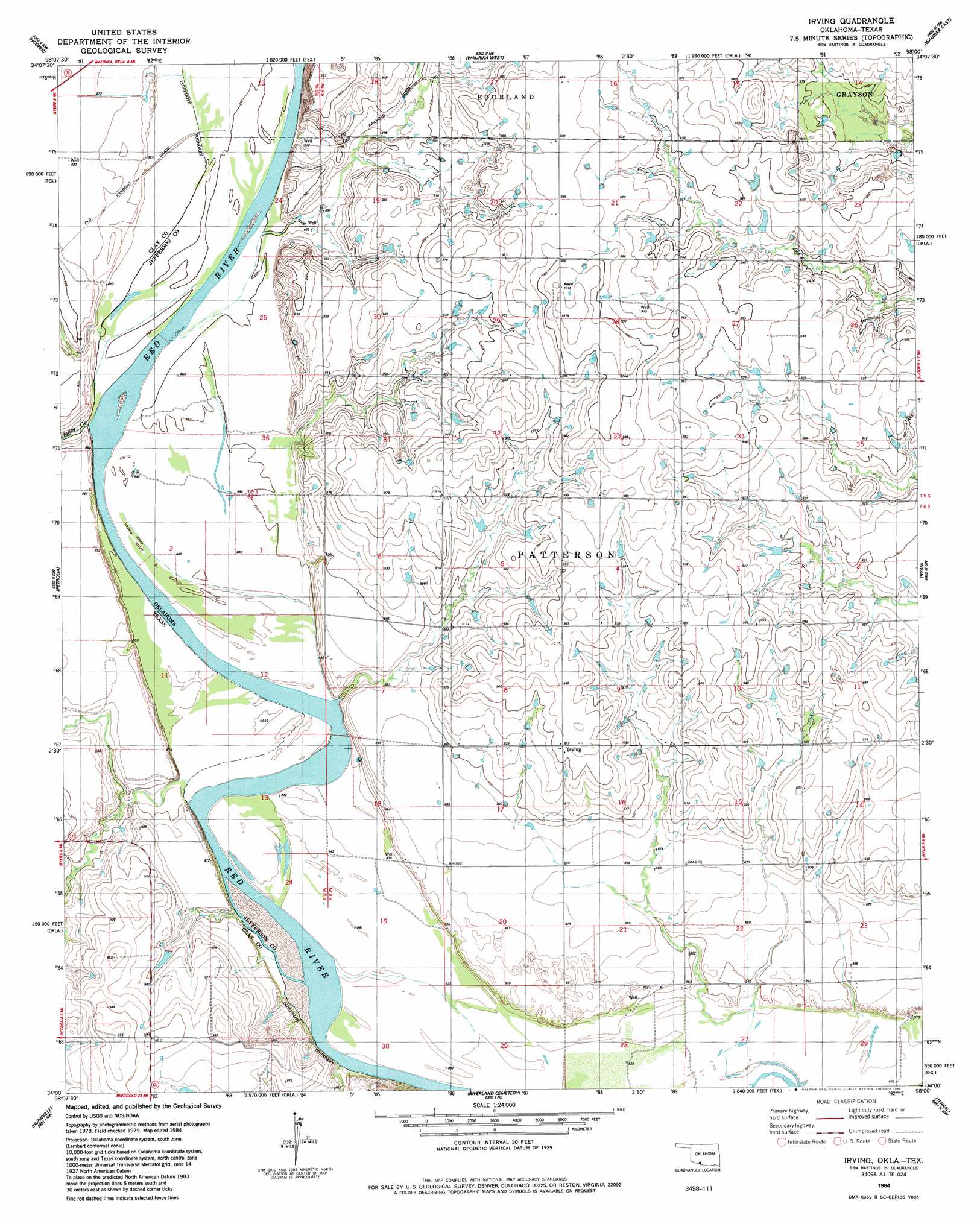
USGS Topo Quad 34098a1 - 1:24,000 scale
| Topo Map Name: | Irving |
| USGS Topo Quad ID: | 34098a1 |
| Print Size: | ca. 21 1/4" wide x 27" high |
| Southeast Coordinates: | 34° N latitude / 98° W longitude |
| Map Center Coordinates: | 34.0625° N latitude / 98.0625° W longitude |
| U.S. States: | OK, TX |
| Filename: | o34098a1.jpg |
| Download Map JPG Image: | Irving topo map 1:24,000 scale |
| Map Type: | Topographic |
| Topo Series: | 7.5´ |
| Map Scale: | 1:24,000 |
| Source of Map Images: | United States Geological Survey (USGS) |
| Alternate Map Versions: |
Irving OK 1984, updated 1985 Download PDF Buy paper map Irving OK 2010 Download PDF Buy paper map Irving OK 2012 Download PDF Buy paper map Irving OK 2016 Download PDF Buy paper map |
1:24,000 Topo Quads surrounding Irving
Walters |
Temple |
Corum |
Comanche |
Comanche Se |
Taylor |
Hooper |
Waurika West |
Waurika East |
Ryan Ne |
Charlie |
Byers |
Irving |
Ryan |
Ryan Se |
Dean |
Hurnville |
Riverland Cemetery |
Terral |
Fleetwood |
Jolly |
Henrietta |
Dickworsham |
Ringgold |
Belcherville |
> Back to 34098a1 at 1:100,000 scale
> Back to 34098a1 at 1:250,000 scale
> Back to U.S. Topo Maps home
Irving topo map: Gazetteer
Irving: Populated Places
Irving elevation 291m 954′Irving: Streams
Bailey Creek elevation 255m 836′Irving digital topo map on disk
Buy this Irving topo map showing relief, roads, GPS coordinates and other geographical features, as a high-resolution digital map file on DVD: