Alamo Ranch Topo Map New Mexico
To zoom in, hover over the map of Alamo Ranch
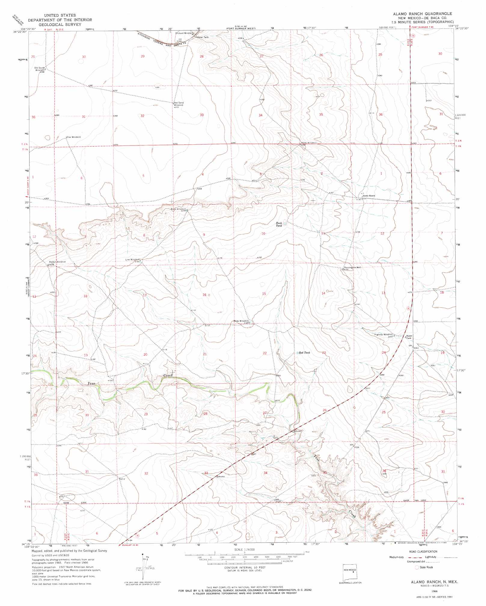
USGS Topo Quad 34104c3 - 1:24,000 scale
| Topo Map Name: | Alamo Ranch |
| USGS Topo Quad ID: | 34104c3 |
| Print Size: | ca. 21 1/4" wide x 27" high |
| Southeast Coordinates: | 34.25° N latitude / 104.25° W longitude |
| Map Center Coordinates: | 34.3125° N latitude / 104.3125° W longitude |
| U.S. State: | NM |
| Filename: | o34104c3.jpg |
| Download Map JPG Image: | Alamo Ranch topo map 1:24,000 scale |
| Map Type: | Topographic |
| Topo Series: | 7.5´ |
| Map Scale: | 1:24,000 |
| Source of Map Images: | United States Geological Survey (USGS) |
| Alternate Map Versions: |
Alamo Ranch NM 1966, updated 1968 Download PDF Buy paper map Alamo Ranch NM 2010 Download PDF Buy paper map Alamo Ranch NM 2013 Download PDF Buy paper map Alamo Ranch NM 2017 Download PDF Buy paper map |
1:24,000 Topo Quads surrounding Alamo Ranch
Cooper Ranch |
Alamogordo Dam |
Windmill Draw |
Twin Mesa |
Candy Mesa |
Yeso |
Ricardo |
Fort Sumner West |
Fort Sumner East |
Taiban |
Horney Ranch |
West Camp |
Alamo Ranch |
Bonner Lake |
Lomas Gatos |
Dunlap Ne |
Conejo Creek West |
Conejo Creek East |
Eighteenmile Hill |
Watts Hill |
Dunlap |
Lovelady Draw |
La Espia Peak |
Cooley Lake |
Howell Ranch |
> Back to 34104a1 at 1:100,000 scale
> Back to 34104a1 at 1:250,000 scale
> Back to U.S. Topo Maps home
Alamo Ranch topo map: Gazetteer
Alamo Ranch: Reservoirs
Red Tank elevation 1242m 4074′Alamo Ranch: Wells
10019 Water Well elevation 1266m 4153′10081 Water Well elevation 1256m 4120′
10082 Water Well elevation 1280m 4199′
10083 Water Well elevation 1296m 4251′
10084 Water Well elevation 1262m 4140′
10085 Water Well elevation 1243m 4078′
10086 Water Well elevation 1279m 4196′
10087 Water Well elevation 1230m 4035′
10089 Water Well elevation 1235m 4051′
10166 Water Well elevation 1333m 4373′
10176 Water Well elevation 1342m 4402′
10177 Water Well elevation 1332m 4370′
10178 Water Well elevation 1284m 4212′
Alamo Ranch digital topo map on disk
Buy this Alamo Ranch topo map showing relief, roads, GPS coordinates and other geographical features, as a high-resolution digital map file on DVD: