Manuel Seep Topo Map Arizona
To zoom in, hover over the map of Manuel Seep
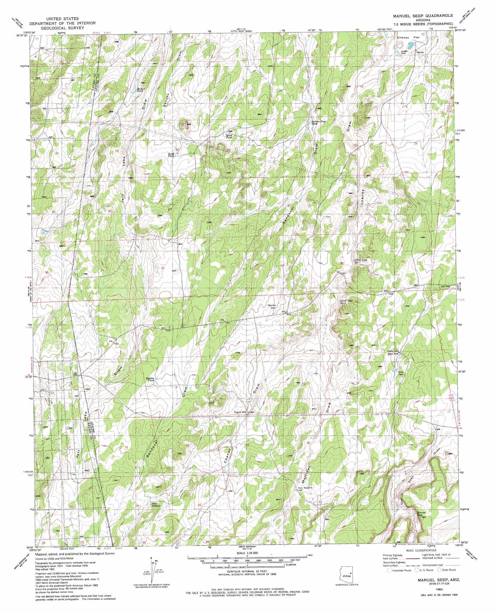
USGS Topo Quad 34109e7 - 1:24,000 scale
| Topo Map Name: | Manuel Seep |
| USGS Topo Quad ID: | 34109e7 |
| Print Size: | ca. 21 1/4" wide x 27" high |
| Southeast Coordinates: | 34.5° N latitude / 109.75° W longitude |
| Map Center Coordinates: | 34.5625° N latitude / 109.8125° W longitude |
| U.S. State: | AZ |
| Filename: | o34109e7.jpg |
| Download Map JPG Image: | Manuel Seep topo map 1:24,000 scale |
| Map Type: | Topographic |
| Topo Series: | 7.5´ |
| Map Scale: | 1:24,000 |
| Source of Map Images: | United States Geological Survey (USGS) |
| Alternate Map Versions: |
Adamana 3 SE AZ 1955, updated 1957 Download PDF Buy paper map Manuel Seep AZ 1982, updated 1982 Download PDF Buy paper map Manuel Seep AZ 1982, updated 1986 Download PDF Buy paper map Manuel Seep AZ 2011 Download PDF Buy paper map Manuel Seep AZ 2014 Download PDF Buy paper map |
1:24,000 Topo Quads surrounding Manuel Seep
Woodruff |
Padilla Tank |
Agate House |
Milky Ranch |
Seven Springs |
Tenmile Cedars |
Hay Hollow |
Little Milky Wash |
Potter Mesa Tank |
Stinking Springs Mountain |
Snowflake |
Point Of The Mountain |
Manuel Seep |
Hunt |
Stinking Springs |
Taylor |
Mesa Redonda Nw |
Mesa Redonda |
Concho Lake |
Concho |
Show Low North |
Silver Springs |
Ortega Mountain |
Vernon |
Cerro Hueco |
> Back to 34109e1 at 1:100,000 scale
> Back to 34108a1 at 1:250,000 scale
> Back to U.S. Topo Maps home
Manuel Seep topo map: Gazetteer
Manuel Seep: Dams
Jungle Dam elevation 1640m 5380′Merrilyn Dam elevation 1721m 5646′
Ward Dam elevation 1723m 5652′
Manuel Seep: Reservoirs
Broken Tank elevation 1656m 5433′Four Section Tank elevation 1660m 5446′
Quema Tank elevation 1754m 5754′
Road Tank elevation 1676m 5498′
Sand Tank elevation 0m 0′
Section Four Tank elevation 1666m 5465′
Manuel Seep: Springs
Manuel Seep elevation 1732m 5682′Stink Seep Number One elevation 1684m 5524′
Stink Seep Number Two elevation 1674m 5492′
Manuel Seep: Valleys
Martinez Draw elevation 1687m 5534′Manuel Seep: Wells
East Windmill elevation 1744m 5721′Rogers Well elevation 1724m 5656′
Ward Well elevation 1718m 5636′
West Windmill elevation 1783m 5849′
Manuel Seep digital topo map on disk
Buy this Manuel Seep topo map showing relief, roads, GPS coordinates and other geographical features, as a high-resolution digital map file on DVD: