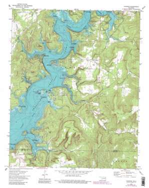
Cookson Topo Map Oklahoma
To zoom in, hover over the map of Cookson
USGS Topo Quad 35094f8 - 1:24,000 scale
| Topo Map Name: | Cookson |
| USGS Topo Quad ID: | 35094f8 |
| Print Size: | ca. 21 1/4" wide x 27" high |
| Southeast Coordinates: | 35.625° N latitude / 94.875° W longitude |
| Map Center Coordinates: | 35.6875° N latitude / 94.9375° W longitude |
| U.S. State: | OK |
| Filename: | o35094f8.jpg |
| Download Map JPG Image: | Cookson topo map 1:24,000 scale |
| Map Type: | Topographic |
| Topo Series: | 7.5´ |
| Map Scale: | 1:24,000 |
| Source of Map Images: | United States Geological Survey (USGS) |
| Alternate Map Versions: |
Cookson OK 1972, updated 1974 Download PDF Buy paper map Cookson OK 1972, updated 1983 Download PDF Buy paper map Cookson OK 2010 Download PDF Buy paper map Cookson OK 2012 Download PDF Buy paper map Cookson OK 2016 Download PDF Buy paper map |
1:24,000 Topo Quads surrounding Cookson
> Back to 35094e1 at 1:100,000 scale
> Back to 35094a1 at 1:250,000 scale
> Back to U.S. Topo Maps home
Cookson topo map: Gazetteer
Cookson: Airports
Tenkiller Lake Airport elevation 258m 846′Cookson: Cliffs
Cookson Bluff elevation 203m 666′Turkey Bluff elevation 206m 675′
Cookson: Islands
Chicken Creek Island elevation 205m 672′Cookson: Parks
Ballew Ridge Public Use Area elevation 212m 695′Blackgum Landing Public Use Area elevation 203m 666′
Carlisle Cove Public Use Area elevation 199m 652′
Carlisle Inlet Public Use Area elevation 205m 672′
Cato Creek Landing Public Use Area elevation 202m 662′
Chicken Creek Point Public Use Area elevation 203m 666′
Cookson Bend Public Use Area elevation 200m 656′
Cookson Bluff Public Use Area elevation 199m 652′
Joliff Inlet Public Use Area elevation 196m 643′
Sisemore Landing Public Use Area elevation 194m 636′
Sixshooter Camp Public Use Area elevation 199m 652′
Snake Creek Cove Public Use Area elevation 196m 643′
Standing Rock Landing Public Use Area elevation 216m 708′
Cookson: Populated Places
Cookson elevation 275m 902′Cookson: Ridges
Ballew Ridge elevation 239m 784′Cookson: Streams
Cato Creek elevation 193m 633′Chicken Creek elevation 193m 633′
Elk Creek elevation 193m 633′
Gum Creek elevation 193m 633′
Sisemore Creek elevation 193m 633′
Sixshooter Branch elevation 193m 633′
Snake Creek elevation 193m 633′
Terrapin Creek elevation 195m 639′
Cookson: Summits
Buckhorn Mountain elevation 378m 1240′Bullet Hill elevation 306m 1003′
Canoe Mountain elevation 300m 984′
Gordon Mountain elevation 281m 921′
Griffin Mountain elevation 260m 853′
Levi Mountain elevation 325m 1066′
Limestone Hill elevation 325m 1066′
Pack Mountain elevation 422m 1384′
Wildhorse Mountain elevation 311m 1020′
Cookson: Valleys
Pine Hollow elevation 193m 633′Cookson digital topo map on disk
Buy this Cookson topo map showing relief, roads, GPS coordinates and other geographical features, as a high-resolution digital map file on DVD:


