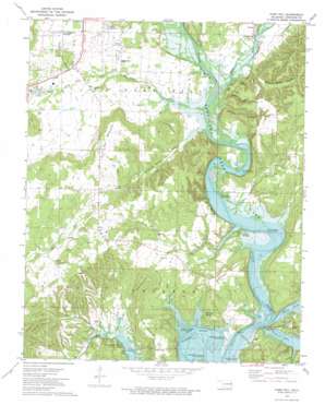
Park Hill Topo Map Oklahoma
To zoom in, hover over the map of Park Hill
USGS Topo Quad 35094g8 - 1:24,000 scale
| Topo Map Name: | Park Hill |
| USGS Topo Quad ID: | 35094g8 |
| Print Size: | ca. 21 1/4" wide x 27" high |
| Southeast Coordinates: | 35.75° N latitude / 94.875° W longitude |
| Map Center Coordinates: | 35.8125° N latitude / 94.9375° W longitude |
| U.S. State: | OK |
| Filename: | o35094g8.jpg |
| Download Map JPG Image: | Park Hill topo map 1:24,000 scale |
| Map Type: | Topographic |
| Topo Series: | 7.5´ |
| Map Scale: | 1:24,000 |
| Source of Map Images: | United States Geological Survey (USGS) |
| Alternate Map Versions: |
Park Hill OK 1973, updated 1974 Download PDF Buy paper map Park Hill OK 2010 Download PDF Buy paper map Park Hill OK 2012 Download PDF Buy paper map Park Hill OK 2016 Download PDF Buy paper map |
1:24,000 Topo Quads surrounding Park Hill
> Back to 35094e1 at 1:100,000 scale
> Back to 35094a1 at 1:250,000 scale
> Back to U.S. Topo Maps home
Park Hill topo map: Gazetteer
Park Hill: Cliffs
Alum Bluff elevation 238m 780′Boy Scout Bluff elevation 225m 738′
Park Hill: Parks
Carters Landing Public Use Area elevation 198m 649′Cherokee Landing State Park elevation 203m 666′
Elk Creek Landing Public Use Area elevation 203m 666′
Etta Bend Public Use Area elevation 205m 672′
Horseshoe Bend Public Use Area elevation 195m 639′
Murrell Home Park elevation 217m 711′
Pettit Bay Public Use Area elevation 206m 675′
Strayhorn Landing Public Use Area elevation 202m 662′
Park Hill: Populated Places
Caney Ridge elevation 215m 705′Carters Landing elevation 212m 695′
Green Country Estates elevation 241m 790′
Indian Meadows elevation 252m 826′
Keys elevation 292m 958′
Park Hill elevation 228m 748′
Pettit elevation 209m 685′
Pettit Bay elevation 224m 734′
Tsa La Gi Indian Village elevation 247m 810′
Wildcat Point elevation 229m 751′
Park Hill: Springs
Blue Spring elevation 258m 846′Keys Spring elevation 209m 685′
Park Hill: Streams
Baron Fork elevation 202m 662′Caney Creek elevation 193m 633′
Dry Creek elevation 193m 633′
Goodman Branch elevation 225m 738′
Park Hill Branch elevation 193m 633′
Pettit Creek elevation 193m 633′
Park Hill: Summits
Bald Hill elevation 289m 948′King Mountain elevation 283m 928′
Mahaney Mountain elevation 287m 941′
Park Hill Mountain elevation 311m 1020′
Pettit Mountain elevation 283m 928′
Short Mountain elevation 325m 1066′
Park Hill: Valleys
Big Hollow elevation 193m 633′Dripping Spring Hollow elevation 195m 639′
Manes Hollow elevation 198m 649′
Minning Camp Hollow elevation 206m 675′
Ross Hollow elevation 200m 656′
Park Hill digital topo map on disk
Buy this Park Hill topo map showing relief, roads, GPS coordinates and other geographical features, as a high-resolution digital map file on DVD:


