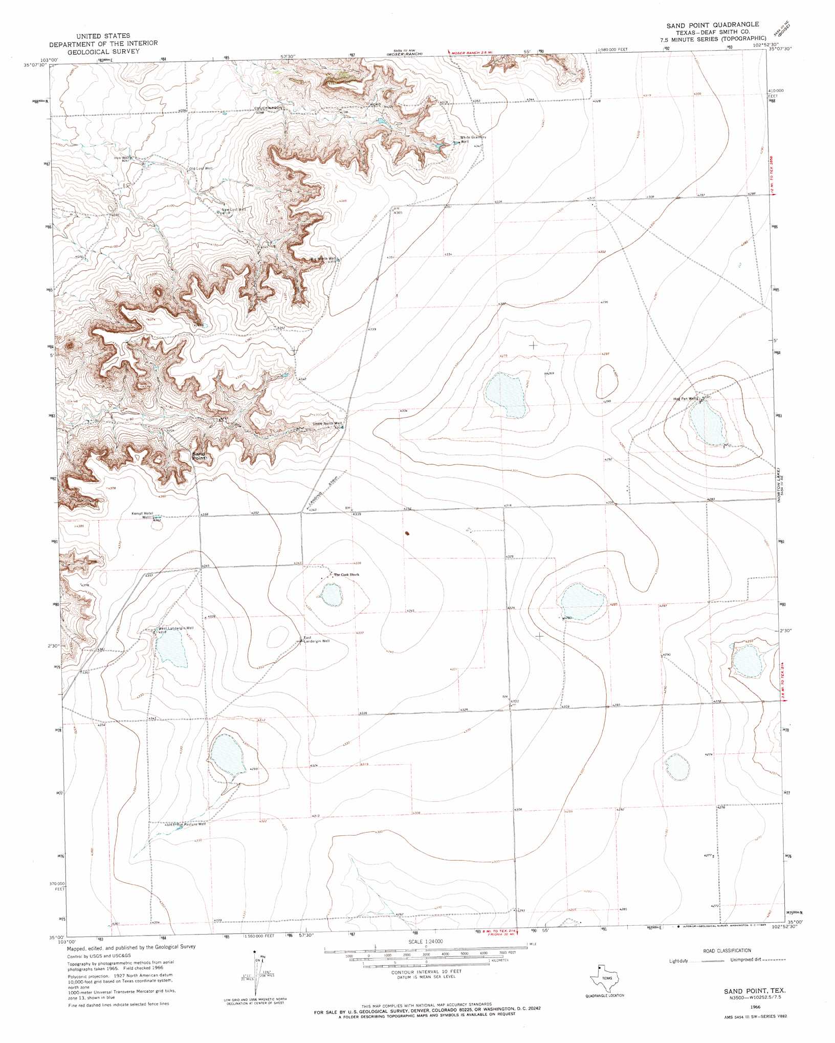
Sand Point Topo Map Texas
To zoom in, hover over the map of Sand Point
USGS Topo Quad 35102a8 - 1:24,000 scale
| Topo Map Name: | Sand Point |
| USGS Topo Quad ID: | 35102a8 |
| Print Size: | ca. 21 1/4" wide x 27" high |
| Southeast Coordinates: | 35° N latitude / 102.875° W longitude |
| Map Center Coordinates: | 35.0625° N latitude / 102.9375° W longitude |
| U.S. State: | TX |
| Filename: | o35102a8.jpg |
| Download Map JPG Image: | Sand Point topo map 1:24,000 scale |
| Map Type: | Topographic |
| Topo Series: | 7.5´ |
| Map Scale: | 1:24,000 |
| Source of Map Images: | United States Geological Survey (USGS) |
| Alternate Map Versions: |
Sand Point TX 1966, updated 1969 Download PDF Buy paper map Sand Point TX 2010 Download PDF Buy paper map Sand Point TX 2012 Download PDF Buy paper map Sand Point TX 2016 Download PDF Buy paper map |
1:24,000 Topo Quads surrounding Sand Point
Blue Hole |
Martin Draw |
Signal Spring |
Signal Spring Se |
Adrian |
Bard |
Glenrio |
Moser Ranch |
Boise |
Simms Nw |
Riley Camp |
Rock Camp |
Sand Point |
Norton Lake |
Simms |
Day Canyon |
Endee Hill |
Mustang Lake |
Walcott |
Westway Nw |
Broadview |
Bellview |
Garcia Lake |
Bootleg |
Chalk Hill |
> Back to 35102a1 at 1:100,000 scale
> Back to 35102a1 at 1:250,000 scale
> Back to U.S. Topo Maps home
Sand Point topo map: Gazetteer
Sand Point: Cliffs
Sand Point elevation 1306m 4284′Sand Point: Wells
Big North Well elevation 1328m 4356′East Landergin Well elevation 1326m 4350′
Hog Pen Wells elevation 1290m 4232′
Iron Well elevation 1232m 4041′
Kempt Hotel Well elevation 1330m 4363′
Little North Well elevation 1313m 4307′
New Lost Well elevation 1255m 4117′
Old Lost Well elevation 1245m 4084′
Rye Pasture Well elevation 1318m 4324′
West Landergin Well elevation 1315m 4314′
White Grainery Well elevation 1316m 4317′
Sand Point digital topo map on disk
Buy this Sand Point topo map showing relief, roads, GPS coordinates and other geographical features, as a high-resolution digital map file on DVD: