Thoreau Topo Map New Mexico
To zoom in, hover over the map of Thoreau
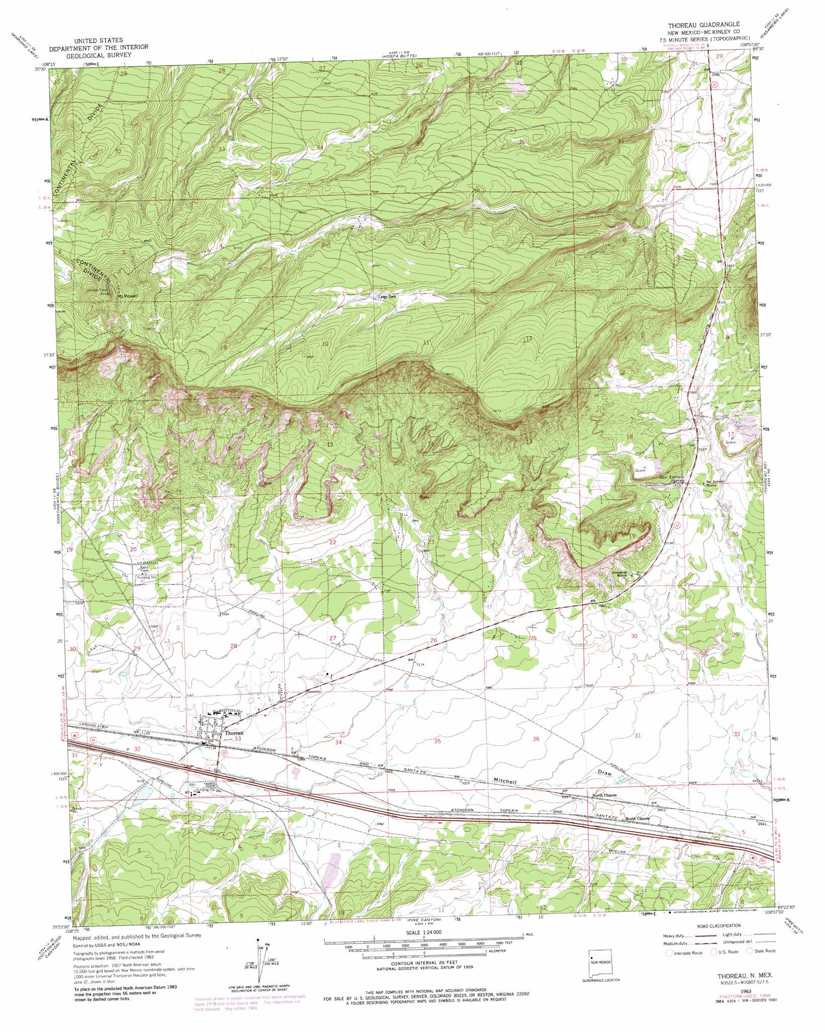
USGS Topo Quad 35108d2 - 1:24,000 scale
| Topo Map Name: | Thoreau |
| USGS Topo Quad ID: | 35108d2 |
| Print Size: | ca. 21 1/4" wide x 27" high |
| Southeast Coordinates: | 35.375° N latitude / 108.125° W longitude |
| Map Center Coordinates: | 35.4375° N latitude / 108.1875° W longitude |
| U.S. State: | NM |
| Filename: | o35108d2.jpg |
| Download Map JPG Image: | Thoreau topo map 1:24,000 scale |
| Map Type: | Topographic |
| Topo Series: | 7.5´ |
| Map Scale: | 1:24,000 |
| Source of Map Images: | United States Geological Survey (USGS) |
| Alternate Map Versions: |
Thoreau NM 1963, updated 1966 Download PDF Buy paper map Thoreau NM 1963, updated 1975 Download PDF Buy paper map Thoreau NM 1963, updated 1981 Download PDF Buy paper map Thoreau NM 2010 Download PDF Buy paper map Thoreau NM 2013 Download PDF Buy paper map Thoreau NM 2017 Download PDF Buy paper map |
| FStopo: | US Forest Service topo Thoreau is available: Download FStopo PDF Download FStopo TIF |
1:24,000 Topo Quads surrounding Thoreau
Oak Spring |
Dalton Pass |
Crownpoint |
Heart Rock |
Laguna Castillo |
Pinedale |
Mariano Lake |
Hosta Butte |
Casamero Lake |
Borrego Pass |
Ciniza |
Continental Divide |
Thoreau |
Thoreau Ne |
Goat Mountain |
Page |
Cottonwood Canyon |
Pine Canyon |
Prewitt |
Bluewater |
Ramah |
Kettner Canyon |
Post Office Flat |
Mount Sedgwick |
Milan |
> Back to 35108a1 at 1:100,000 scale
> Back to 35108a1 at 1:250,000 scale
> Back to U.S. Topo Maps home
Thoreau topo map: Gazetteer
Thoreau: Dams
Henio Dam elevation 2141m 7024′Thoreau: Mines
Eagle Uranium Deposit elevation 2249m 7378′Elkins Lime Pit elevation 2218m 7276′
Largo Uranium Deposit elevation 2277m 7470′
Thoreau: Populated Places
North Chaves elevation 2131m 6991′South Chaves elevation 2135m 7004′
Thoreau elevation 2177m 7142′
Thoreau: Post Offices
Thoreau Post Office elevation 2177m 7142′Thoreau: Springs
San Antonio Spring elevation 2187m 7175′Thoreau: Summits
Mount Powell elevation 2653m 8704′San Antonio Hill elevation 2229m 7312′
Thoreau: Wells
RR2-Baca 15 Water Well elevation 2135m 7004′RR2-Baca 16 Water Well elevation 2135m 7004′
RR3-Baca 17 Water Well elevation 2135m 7004′
Thoreau digital topo map on disk
Buy this Thoreau topo map showing relief, roads, GPS coordinates and other geographical features, as a high-resolution digital map file on DVD: