North Mill Well Topo Map Arizona
To zoom in, hover over the map of North Mill Well
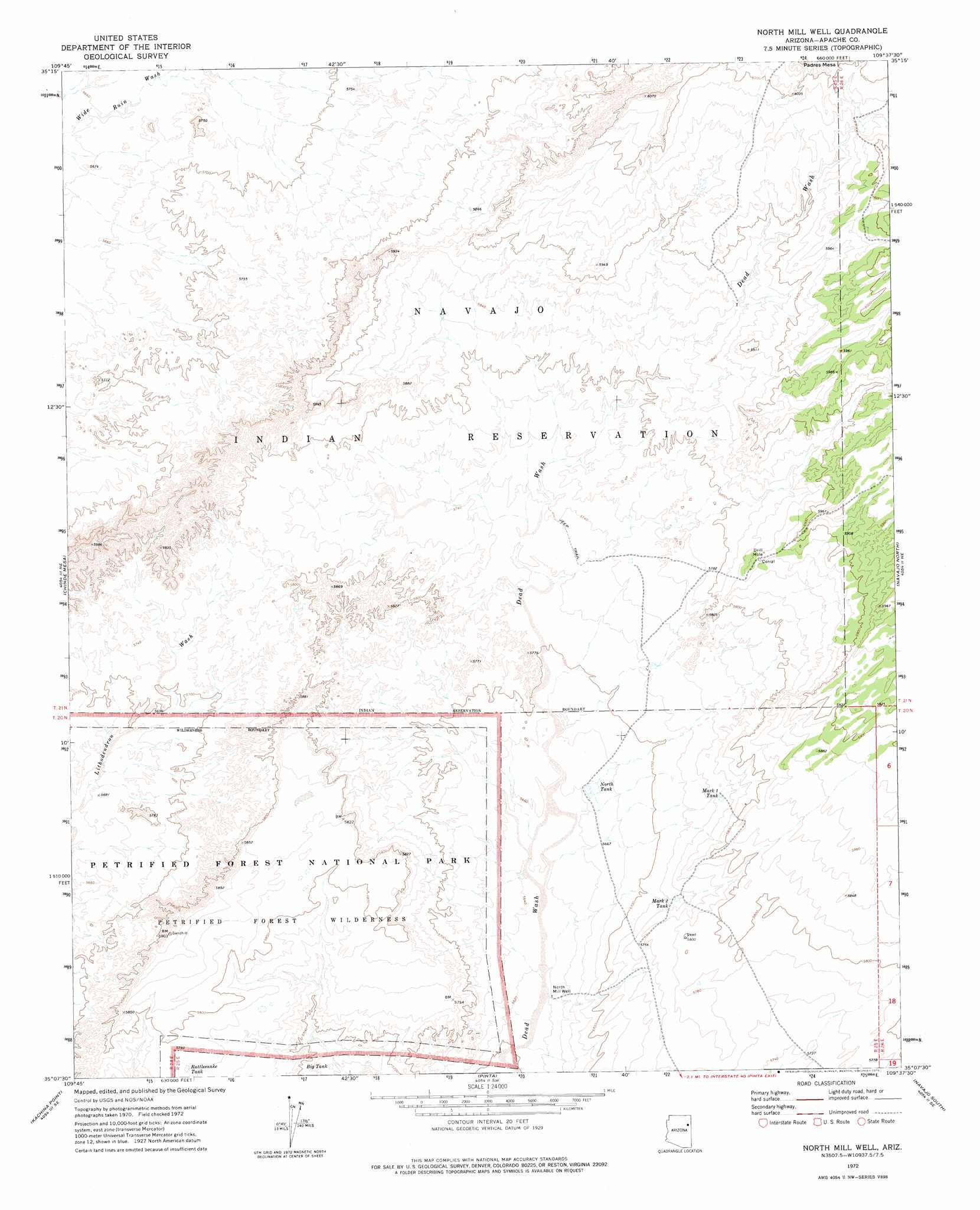
USGS Topo Quad 35109b6 - 1:24,000 scale
| Topo Map Name: | North Mill Well |
| USGS Topo Quad ID: | 35109b6 |
| Print Size: | ca. 21 1/4" wide x 27" high |
| Southeast Coordinates: | 35.125° N latitude / 109.625° W longitude |
| Map Center Coordinates: | 35.1875° N latitude / 109.6875° W longitude |
| U.S. State: | AZ |
| Filename: | o35109b6.jpg |
| Download Map JPG Image: | North Mill Well topo map 1:24,000 scale |
| Map Type: | Topographic |
| Topo Series: | 7.5´ |
| Map Scale: | 1:24,000 |
| Source of Map Images: | United States Geological Survey (USGS) |
| Alternate Map Versions: |
North Mill Well AZ 1972, updated 1975 Download PDF Buy paper map North Mill Well AZ 2011 Download PDF Buy paper map North Mill Well AZ 2014 Download PDF Buy paper map |
1:24,000 Topo Quads surrounding North Mill Well
Greasewood Spring |
Arrowhead Butte Ne |
Boggy Lake Well |
Klagetoh South |
Wide Ruins |
Arrowhead Butte |
Betty Well |
Tanner Springs |
Dipping Water Well |
Wide Ruins Sw |
Pilot Rock |
Chinde Mesa |
North Mill Well |
Navajo North |
Chambers |
Little Lithodendron Tank |
Kachina Point |
Pinta |
Navajo South |
Navajo Springs |
Carrizo Butte |
Adamana |
Sorrel Horse Mesa |
Ninemile Seep |
Hogan Well |
> Back to 35109a1 at 1:100,000 scale
> Back to 35108a1 at 1:250,000 scale
> Back to U.S. Topo Maps home
North Mill Well topo map: Gazetteer
North Mill Well: Reservoirs
Big Tank elevation 1728m 5669′Mark One Tank elevation 1752m 5748′
Mark Two Tank elevation 1748m 5734′
North Tank elevation 1730m 5675′
Rattlesnake Tank elevation 1763m 5784′
North Mill Well: Wells
North Mill Well elevation 1715m 5626′North Mill Well digital topo map on disk
Buy this North Mill Well topo map showing relief, roads, GPS coordinates and other geographical features, as a high-resolution digital map file on DVD: