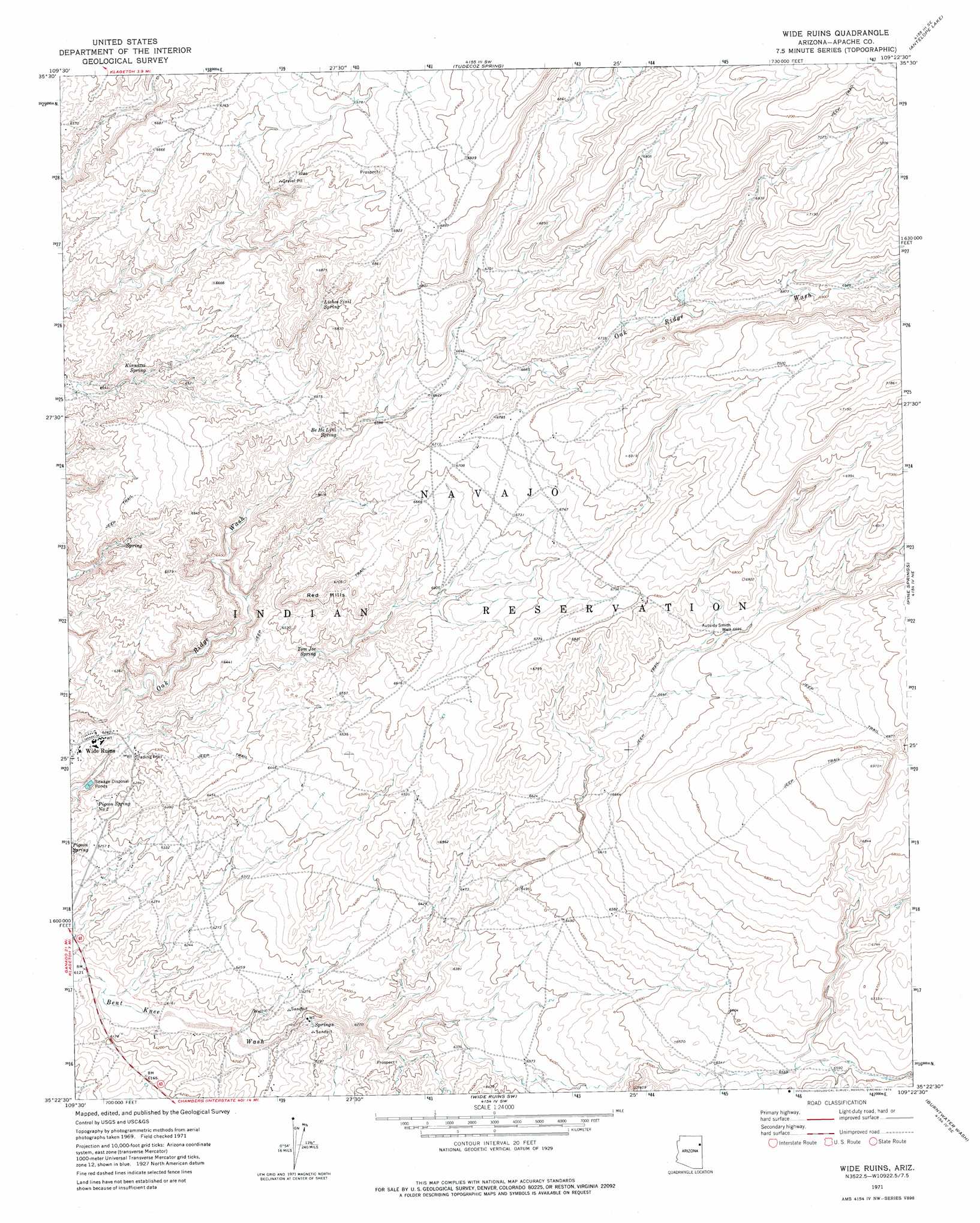
Wide Ruins Topo Map Arizona
To zoom in, hover over the map of Wide Ruins
USGS Topo Quad 35109d4 - 1:24,000 scale
| Topo Map Name: | Wide Ruins |
| USGS Topo Quad ID: | 35109d4 |
| Print Size: | ca. 21 1/4" wide x 27" high |
| Southeast Coordinates: | 35.375° N latitude / 109.375° W longitude |
| Map Center Coordinates: | 35.4375° N latitude / 109.4375° W longitude |
| U.S. State: | AZ |
| Filename: | o35109d4.jpg |
| Download Map JPG Image: | Wide Ruins topo map 1:24,000 scale |
| Map Type: | Topographic |
| Topo Series: | 7.5´ |
| Map Scale: | 1:24,000 |
| Source of Map Images: | United States Geological Survey (USGS) |
| Alternate Map Versions: |
Wide Ruins AZ 1971, updated 1974 Download PDF Buy paper map Wide Ruins AZ 2011 Download PDF Buy paper map Wide Ruins AZ 2014 Download PDF Buy paper map |
1:24,000 Topo Quads surrounding Wide Ruins
Cornfields |
Ganado |
Kinlichee |
East Of Kinlichee |
West Of Window Rock |
Sunrise Springs |
Klagetoh North |
Tudecoz Spring |
Antelope Lake |
Joe Woody Well |
Boggy Lake Well |
Klagetoh South |
Wide Ruins |
Pine Springs |
Uranium Spring |
Tanner Springs |
Dipping Water Well |
Wide Ruins Sw |
Burntwater Wash |
Houck |
North Mill Well |
Navajo North |
Chambers |
Sanders |
Tolapai Spring |
> Back to 35109a1 at 1:100,000 scale
> Back to 35108a1 at 1:250,000 scale
> Back to U.S. Topo Maps home
Wide Ruins topo map: Gazetteer
Wide Ruins: Populated Places
Wide Ruins elevation 1912m 6272′Wide Ruins: Springs
Be He Lini Spring elevation 2005m 6578′Kinnazzi Spring elevation 1965m 6446′
Lichee Sinil Spring elevation 2062m 6765′
Pigeon Spring Number Two elevation 1905m 6250′
Tom Joe Spring elevation 1962m 6437′
Wide Ruins: Summits
Red Hills elevation 2044m 6706′White Top (historical) elevation 1892m 6207′
Wide Ruins: Valleys
Bent Knee Wash elevation 1864m 6115′Wide Ruins: Wells
Autsidy Smith Well elevation 2042m 6699′Wide Ruins digital topo map on disk
Buy this Wide Ruins topo map showing relief, roads, GPS coordinates and other geographical features, as a high-resolution digital map file on DVD: